Situation Summary
Albania remains a low–to–moderate risk environment (global rank #132, composite score 4) with heightened volatility concentrated in Tirana County. Recent 24–48-hour activity shows a mix of civil unrest tied to parliamentary arrests, multiple wildfire incidents, drug enforcement operations, and isolated criminal incidents. The security picture is stable but fragmented—no systemic state failure or widespread violence is evident, though localized civil order challenges and environmental hazards warrant operational attention.
Key Developments
- Tirana – July 30, 2026: Protest outside Police Station No. 3 demanding release of two individuals arrested following July 27 parliamentary clashes; police dispersed crowd with water, one officer injured and station property damaged.
- Fier (Drizë village) – July 30, 2026: Massive wildfire forced evacuation of 11 families and closure of the Qafa e Kosovicës–Cakran road; flames threatened residential structures; strong winds drove rapid spread.
- Fier & Kavajë districts – July 30, 2026: Multiple wildfires reported across both areas; fast-moving flames required active firefighting interventions due to wind-driven conditions and proximity to infrastructure.
- Laç, Kurbin – July 30, 2026: 22-year-old sustained pistol-wound injury; emergency transport to Tirana initiated; police investigation underway into circumstances of discharge.
- Tirana (State Police HQ) – July 30, 2026: Senior police officer suspended following internal investigation into verbal threats issued at headquarters; incident reported by national media.
- Vau i Dejës – July 30, 2026: State Police prevented criminal incident involving remote-controlled mine in vehicle; no casualties reported.
- Tirana International Airport (Rinas) – July 30, 2026: Police anti-drug operation seized approximately 46 kg of suspected narcotics; concurrent prevention of drug smuggling attempt valued at ~€250,000 with one arrest and two persons under investigation.
- Kukës – July 30, 2026: Police arrested suspect for cannabis cultivation; weapons and ammunition seized during operation.
Highest-Risk Areas
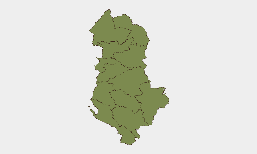
Tirana County dominates the national risk profile (score 31.4), accounting for nearly all tracked threat events and reflecting concentration of civil unrest, law-enforcement activity, and criminal incidents in the capital. Shkodër County shows secondary elevation (8.9), though specifics in the current 24–48-hour window are limited. All remaining 10 counties cluster at 1.4, indicating geographically dispersed but low-intensity baseline risk. Wildfire events in Fier and Kavajë represent localized environmental hazards rather than security threats per se, but they do strain emergency response capacity and may intersect with transportation security for assets or personnel transiting those zones.
How GeoBit Would Assist
Teams managing personnel or assets in Tirana should deploy AOI Monitoring & Early Warning on police stations and protest hotspots, coupled with sentiment & temporal analysis of social-media feeds (X, Telegram) to detect escalation signals ahead of scheduled demonstrations. Multi-language OSINT fusion across Albanian media, police statements, and event feeds enables real-time situational awareness of both civil unrest and criminal enforcement operations. For supply-chain or logistics operations, Routing & Network Analysis and satellite imagery can identify wildfire zones and road closures in Fier and Kavajë, supporting alternative-route planning and duty-of-care compliance.
7-Day Outlook
The immediate outlook (7 days) suggests contained but active civil unrest in Tirana tied to the July 27 parliamentary incident; further protests are plausible if arrested individuals remain detained. Wildfire risk will likely persist through early August given regional weather patterns, with secondary hazards (road closures, air quality, evacuations) affecting mobility. No indication of state-level instability or cross-border escalation is present; risk remains sub-national and episodic.
Highest-Risk Areas — Ranked
| # | State / Region | Risk |
|---|---|---|
| 1 | Tirana County | 31.4 |
| 2 | Shkodër County | 8.9 |
| 3 | Durrës County | 1.4 |
| 4 | Kukës County | 1.4 |
| 5 | Lezhë County | 1.4 |
| 6 | Dibër County | 1.4 |
| 7 | Elbasan County | 1.4 |
| 8 | Fier County | 1.4 |
| 9 | Berat County | 1.4 |
| 10 | Korçë County | 1.4 |
| 11 | Vlorë County | 1.4 |
| 12 | Gjirokastër County | 1.4 |
Sources
Previous Daily Briefs
A new Albania brief is written every day — each with its own risk map and downloadable CSV. Here's the last week; use the calendar to go further back.
📅 Browse every day by calendar →
Highlighted days have a brief. Tap a day for that day's map & analysis, or “csv” for that day's dataset ($5).
Atlas — our AI intelligence desk — emails them this snapshot personally. Nothing else, no list.