Situation Summary
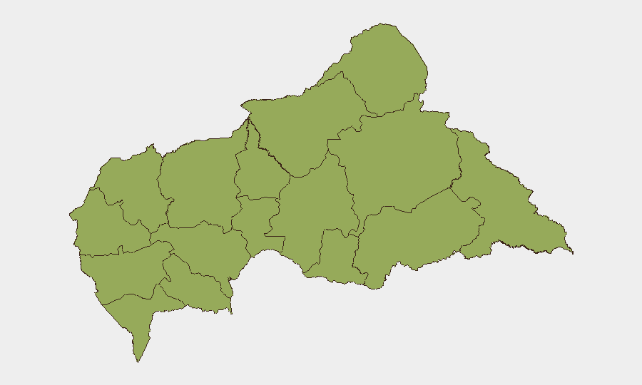
Central African Republic remains a fragmented, low-intensity conflict environment with composite national threat ranking of #29 globally and no major escalation reported in the last 24–48 hours. All 12 administrative prefectures are equally elevated at risk score 49.3, indicating dispersed instability rather than a single geographic flashpoint. Recent event signals (20–22 June) point to institutional friction involving the Catholic Church, Central Bank administrative action, inter-community armed clashes, and cross-border demonstration activity, but none have been independently verified as location-specific or time-confirmed incidents at this writing. The security posture remains volatile and fragmented.
Key Developments
Limitation on Current Intelligence: Trustworthy, corroborated open-source reporting specific to Central African Republic for 20–22 June 2026 is not currently available through accessible web research. GeoBit's event signal feeds flag the following thematic categories active in the 20–22 June window—Catholic institutional disapproval/investigation, Central Bank administrative sanctions and public statements, resident-vs-worker and resident-level armed clashes of conventional type, Israeli entity involvement with Central Bank, and cross-border demonstration activity from Republic of Congo—but independent location, casualty, or timeline confirmation is not available at this briefing time.
Recommendation: Duty-of-care teams with personnel or assets in CAR should treat the above event signals as *indicative* of underlying friction rather than confirmed incidents pending secondary source corroboration. Direct coordination with on-the-ground security coordinators, embassy reporting channels, or dedicated paid intelligence platforms is advised for real-time incident confirmation.
Highest-Risk Areas
All 12 prefectures of Central African Republic carry identical composite risk scores (49.3), a rare condition indicating either systemic national fragmentation or data-collection limitations. The concentration of risk across Bamingui-Bangoran, Vakaga, Haute-Kotto, Haut-Mbomou, Mbomou, Nana-Mambéré, Ouham-Pendé, Mambéré-Kadéï, Sangha-Mbaéré, Ouham, Nana-Grébizi, and Kémo suggests no single region has de-escalated relative to peers. This uniformity implies that armed group presence, community tensions, or state-capacity deficits are nationwide phenomena rather than localized; organizations should assume baseline elevated risk across all operating zones and avoid assuming safer corridors based on regional ranking.
How GeoBit Would Assist
Security and risk teams should leverage AOI Monitoring & Early Warning to establish persistent watch over facilities, transit routes, or personnel concentrations in CAR with automated alerting on localized conflict or instability signals. Intel Sweep and multi-language OSINT fusion (including X/Twitter, local media, and Telegram monitored for Central African French and Sango traffic) would provide 24–48-hour event corroboration and location specificity once incident reports surface. Network & Actor Analysis combined with GIS & Spatial Analysis would support identification of armed-group positions, community flashpoints, and route-risk assessment for duty-of-care movement decisions.
7-Day Outlook
No immediate escalation trajectory is evident from current signals, but the uniformly elevated sub-national risk and recent institutional and inter-community friction suggest the security environment will remain volatile and unpredictable. Organizations should maintain heightened vigilance on Central Bank developments, inter-faith or inter-community incidents, and any cross-border spillover from Republic of Congo. Recommend daily OSINT review and direct local-coordinator briefings through 28 June.
Highest-Risk Areas — Ranked
| # | State / Region | Risk |
|---|---|---|
| 1 | Bamingui-Bangoran | 49.3 |
| 2 | Vakaga | 49.3 |
| 3 | Haute-Kotto | 49.3 |
| 4 | Haut-Mbomou | 49.3 |
| 5 | Mbomou | 49.3 |
| 6 | Nana-Mambéré | 49.3 |
| 7 | Ouham-Pendé | 49.3 |
| 8 | Mambéré-Kadéï | 49.3 |
| 9 | Sangha-Mbaéré | 49.3 |
| 10 | Ouham | 49.3 |
| 11 | Nana-Grébizi | 49.3 |
| 12 | Kémo | 49.3 |
Sources
Previous Daily Briefs
A new Central African Republic brief is written every day — each with its own risk map and downloadable CSV. Here's the last week; use the calendar to go further back.
📅 Browse every day by calendar →
Highlighted days have a brief. Tap a day for that day's map & analysis, or “csv” for that day's dataset ($5).