Situation Summary
Croatia remains a low-threat environment (global rank #176) with composite security risk score 3.0, though concentrated hazards in Zagreb and its adjacent counties merit heightened awareness. Recent 24-hour activity shows a mix of natural disasters, opportunistic financial crime, and routine traffic incidents—none indicating systemic instability or organized threat escalation. Weather emergencies and localized property crime dominate the current threat profile. The trajectory remains stable with no deterioration in underlying political, security, or crime fundamentals.
Key Developments
- Lošinj island, Primorje-Gorski Kotar County (19 July): A strong waterspout (pijavica) struck the Čikat campground area, toppling approximately 50 pine trees onto tents and campers; two people were injured and transported to Rijeka hospital. Risk to outdoor personnel and tourists remains elevated during ongoing unstable weather.
- Borovje neighborhood, Zagreb (night of 19 July, ~03:40): A fatal residential apartment fire killed one occupant; emergency responders were deployed. Indicates potential building-safety and occupancy risks in residential areas.
- Split coastal region, Dalmatia (19 July): Meteorological Service (DHMZ) issued orange-level heat warnings (temperatures to 35°C), increasing wildfire and heat-stress risk across the coast. Wildfire containment operations ongoing in Dubrovnik hinterland with Canadair aerial support reported.
- Zagreb and Karlovac regions (19 July): DHMZ issued orange-level severe thunderstorm alerts; heavy rain and localized flooding possible. Transportation and outdoor operations merit contingency planning.
- Dubrovnik old town, Dubrovnik-Neretva County (19 July): Police arrested a Bulgarian national installing ATM skimmer devices to harvest card data from tourists. Active financial-crime infrastructure targeting visitors; ATM use warrants vigilance.
- Dubrovnik 'Vojnović' road (19 July): Vehicle overturn accident; local police enforcement ongoing against reckless driving and non-compliant e-scooter use. Traffic hazards remain relevant for personnel mobility.
Highest-Risk Areas
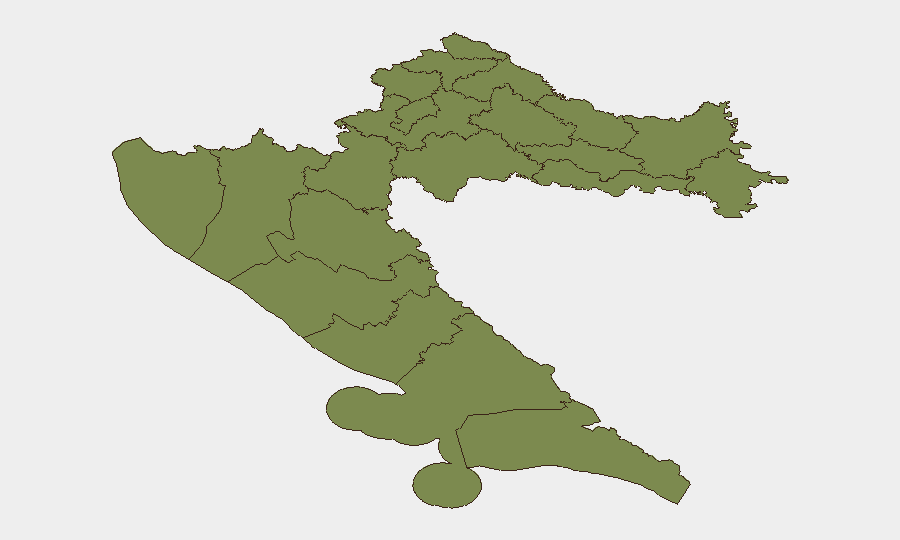
Zagreb city dominates the sub-national risk picture (31.8 composite score), driven by incident density, population concentration, and intersection of crime, infrastructure, and weather hazards. Varaždin and Karlovac counties (24.3 each) show elevated risk from severe weather alerts and ongoing thunderstorm potential. All other tracked counties score substantially lower (1.8–16.8), indicating that risk is geographically concentrated in the north-central and central regions. Coastal counties, despite tourism volumes and isolated incidents (skimming, wildfires), remain lower-ranked, suggesting localized rather than systematic threat patterns.
How GeoBit Would Assist
Intel Sweep and multi-language OSINT fusion would capture emerging threats (crime rings, environmental hazards, labor disputes) across Croatian media, social platforms, and local law enforcement alerts in real time. AOI Monitoring & Early Warning on Zagreb, Karlovac, and Dubrovnik would provide persistent alerting for property crime, weather escalation, and public-order incidents affecting corporate operations and personnel safety. GIS & Spatial Analysis and Routing & Network Analysis enable security teams to map safe travel corridors, identify alternative routes around active wildfires and severe weather zones, and plan duty-of-care evacuations or site access during emergencies.
7-Day Outlook
Severe weather (thunderstorms, heat, wildfire) will persist across central and coastal regions through mid-week; DHMZ advisories will likely remain in effect. Opportunistic financial crime (ATM fraud, petty theft targeting tourists) will continue in high-traffic areas. No indicators suggest political unrest, organized violence, or systemic security degradation; overall threat profile remains benign relative to regional and global comparisons.
Highest-Risk Areas — Ranked
| # | State / Region | Risk |
|---|---|---|
| 1 | City of Zagreb | 31.8 |
| 2 | Varaždin County | 24.3 |
| 3 | Karlovac County | 24.3 |
| 4 | Požega-Slavonia County | 16.8 |
| 5 | Krapina-Zagorje County | 1.8 |
| 6 | Međimurje County | 1.8 |
| 7 | Koprivnica-Križevci County | 1.8 |
| 8 | Zagreb County | 1.8 |
| 9 | Sisak-Moslavina County | 1.8 |
| 10 | Istria | 1.8 |
| 11 | Primorje-Gorski Kotar County | 1.8 |
| 12 | Lika-Senj County | 1.8 |
Sources
Previous Daily Briefs
A new Croatia brief is written every day — each with its own risk map and downloadable CSV. Here's the last week; use the calendar to go further back.
📅 Browse every day by calendar →
Highlighted days have a brief. Tap a day for that day's map & analysis, or “csv” for that day's dataset ($5).
Atlas — our AI intelligence desk — emails them this snapshot personally. Nothing else, no list.