Situation Summary
Eritrea remains a low-frequency threat environment with a composite threat score of 2 and no verified security incidents recorded in the last 24–48 hours. Structural risk remains concentrated in border regions—particularly Gash-Barka (west) and Southern Red Sea (east)—driven by regional tensions and historical conflict dynamics rather than acute domestic instability. The country's overall security posture has not changed materially in the last two days, though ongoing Ethiopia–Eritrea tensions and weapons-trafficking networks continue to create latent risk for corporate operations and travel.
Key Developments
No discrete, location-specific security or civil-unrest incidents have been verified in Eritrea during 26–28 July 2026 across monitored news outlets, social media, or security intelligence feeds.
An unverified "unconventional-violence" signal involving Eritrea and Canada was flagged on 24 July, but remains under review with no corroborated location, casualty, or event details in open sources and falls outside the 24–48-hour window.
Regional Ethiopia–Eritrea tensions persist as a structural driver, including reports of Eritrean support for armed groups and alleged weapons movements across borders, but no new discrete incidents in Eritrea proper have been confirmed in the last 48 hours.
Highest-Risk Areas
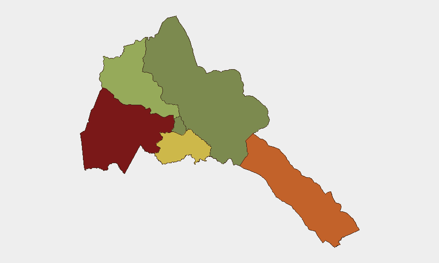
Gash-Barka region (risk score 92) remains Eritrea's highest-risk zone, driven by proximity to the Sudan–Eritrea border, historical cross-border militia activity, and weapons-trafficking routes. Southern Red Sea Region (75) follows, reflecting maritime smuggling networks, piracy risk, and regional conflict spillover from Yemen and the broader Red Sea corridor. Debub Region (68) carries elevated risk from south-ern border dynamics and residual tensions with Ethiopia. By contrast, Maekel Region (central, including the capital) and Northern Red Sea Region maintain minimal acute risk scores (18 and 0 respectively), reflecting greater state control and lower conflict exposure.
How GeoBit Would Assist
Intel Sweep and multi-language OSINT fusion provide continuous monitoring of Eritrean media, regional chatter, and cross-border activity to detect emerging incidents before they escalate. AOI Monitoring & Early Warning with persistent watch on Gash-Barka and Southern Red Sea regions enables real-time alerting when activity spikes, critical for duty-of-care teams managing field operations near borders. Conflict & Military tracking (force structure, weapons flows, and battle mapping) combined with Network & Actor Analysis helps corporate security identify militia activity, arms networks, and actors that may affect supply chains, personnel safety, or asset security.
7-Day Outlook
No acute deterioration is anticipated in the 7-day window; Eritrea is expected to remain a low-event environment domestically. However, escalation in Ethiopia–Tigray dynamics or Red Sea regional tensions could trigger secondary effects on Eritrean borders and transit corridors, warranting continued monitoring of Gash-Barka and Southern Red Sea Region for indirect security impacts on corporate operations.
Highest-Risk Areas — Ranked
| # | State / Region | Risk |
|---|---|---|
| 1 | Gash-Barka | 92 |
| 2 | Southern Red Sea Region | 75 |
| 3 | Debub Region | 68 |
| 4 | Anseba | 55 |
| 5 | Maekel Region | 18 |
| 6 | Northen Red Sea Region | 0 |
Sources
Previous Daily Briefs
A new Eritrea brief is written every day — each with its own risk map and downloadable CSV. Here's the last week; use the calendar to go further back.
📅 Browse every day by calendar →
Highlighted days have a brief. Tap a day for that day's map & analysis, or “csv” for that day's dataset ($5).
Atlas — our AI intelligence desk — emails them this snapshot personally. Nothing else, no list.