Situation Summary
Gabon remains in the lower-risk category globally (rank #104, composite threat score 9) with no discrete security incidents recorded in the current event window. No reliable, independently confirmed acute security, civil unrest, crime, or infrastructure incidents have been identified in open sources over the past 24–48 hours. The security environment reflects gradual stabilization following constitutional restoration and reintegration into the African Union, though localized risks persist in the northern and southeastern regions.
Key Developments
No acute security, conflict, crime, or travel-risk incidents meeting confirmation criteria have been identified in Gabon in the last 24–48 hours across indexed news, major social feeds, or regional open-source channels.
Note: A recently circulated social post references an airport security fee for international passengers, but the post is not clearly time-stamped to the current 24–48-hour window and appears to document a policy change rather than an incident. Without confirmed recency, it cannot be classified as a current development.
Highest-Risk Areas
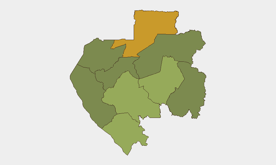
Northern Woleu-Ntem Province (risk score 72) significantly outpaces all other regions and warrants priority monitoring; underlying drivers likely include border permeability, limited state capacity, and historical cross-border movement patterns. Ogooué-Lolo Province (risk 58) and Ngounié Province (risk 48) represent secondary concentration areas, while central and coastal zones (Estuaire, Moyen-Ogooué, Ogooué-Maritime) remain substantially lower-risk. The southern and eastern interior (Ogooué-Ivindo) shows negligible current risk. Disparities reflect geography, population density, governance presence, and proximity to higher-risk neighboring jurisdictions.
How GeoBit Would Assist
Security and duty-of-care teams operating in or transiting Gabon should prioritize AOI Monitoring & Early Warning for Woleu-Ntem and Ogooué-Lolo provinces to detect emerging unrest, cross-border activity, or crime patterns in real time. Routing & Network Analysis would enable alternative journey planning for personnel and assets moving between high-risk northern zones and the capital or ports. OSINT fusion (Intel Sweep, multi-language search, X/Telegram monitoring, radio SIGINT) provides persistent visibility into localized political, criminal, and community-level signals before they escalate to reportable incidents.
7-Day Outlook
No imminent acute threats are forecast over the next seven days based on current open-source signals and baseline risk trajectories. Monitoring should remain routine and geographically targeted to Woleu-Ntem and Ogooué-Lolo; any uptick in cross-border incidents, protest announcements, or security-force mobilization in these zones would warrant rapid escalation and contingency review.
Highest-Risk Areas — Ranked
| # | State / Region | Risk |
|---|---|---|
| 1 | Woleu-Ntem | 72 |
| 2 | Ogooué-Lolo Province | 58 |
| 3 | Ngounié Province | 48 |
| 4 | Nyanga Province | 42 |
| 5 | Haut-Ogooué Province | 35 |
| 6 | Moyen-Ogooué Province | 28 |
| 7 | Ogooué-Maritime Province | 25 |
| 8 | Estuaire Province | 15 |
| 9 | Ogooué-Ivindo | 0 |
Sources
Previous Daily Briefs
A new Gabon brief is written every day — each with its own risk map and downloadable CSV. Here's the last week; use the calendar to go further back.
📅 Browse every day by calendar →
Highlighted days have a brief. Tap a day for that day's map & analysis, or “csv” for that day's dataset ($5).
Atlas — our AI intelligence desk — emails them this snapshot personally. Nothing else, no list.