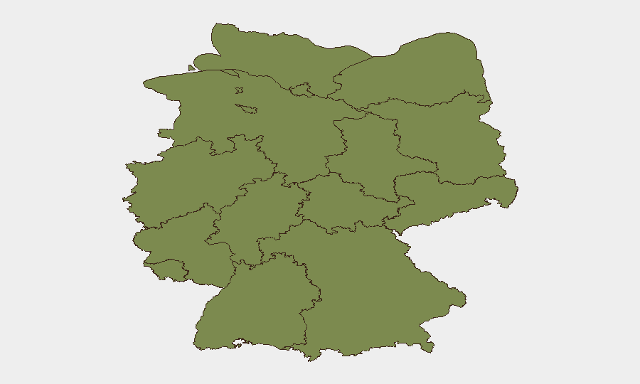
Situation Summary
Germany remains at relatively low composite risk (#138 globally; score 5.0) but faces a sharp, localized spike in Thuringia (risk 31.9)—roughly 6.8× the national average—driven by ongoing political tensions and far-right activism in the eastern state. Recent 24–48 hour activity reflects a mixed threat picture: violent crime (residential shootings, assaults) in Berlin; suspected critical infrastructure sabotage on western rail corridors; and routine law-enforcement successes offsetting some incidents. Concurrent NATO military exercises and upgraded border controls represent operational changes rather than acute threats, but will increase transport congestion and emergency-services demand.
Key Developments
- Berlin (Neukölln), 13 July – Police arrested the final suspect in a residential shooting incident; main perpetrators now in custody, closing an active manhunt with direct implications for neighborhood security.
- Berlin (Friedrichshain-Kreuzberg), 13 July – Suspect identified in violent rail-safety incident where a teenager was thrown onto train tracks; wanted appeal withdrawn following identification.
- Western Germany (Düsseldorf–Cologne rail corridor), 11–12 July – Fire damaged critical signaling infrastructure on a major freight and passenger route; authorities suspect deliberate sabotage, causing multi-day service suspensions and supply-chain risk.
- Berlin, 11 July (charges filed 13 July) – Supermarket hostage siege (11 hours; female employee held at knifepoint) concluded with special-forces intervention; suspect now charged. Underscores armed-violence risk in high-footfall public spaces.
- Berlin-Brandenburg Airport, 13 July – New external border-control facility became operational; part of nationwide upgrade in migration and border-security infrastructure affecting passenger processing and entry/exit timelines.
- Germany (nationwide), 13 July – NATO "Steadfast Dart 26" rapid-reaction exercise began large-scale troop and equipment movements through German ports (Emden), roads, and airports; impacts expected on transport corridors and logistics capacity.
- Berlin, 13 July – Bundeswehr–civilian "Medic Quadriga 2026" large-scale medical readiness exercise launched; involves increased military and emergency-services activity across Berlin medical and military sites.
- Germany/Belgium/Netherlands, 13–14 July – Lidl online-shop data breach notification: customer email addresses and phone numbers exposed via third-party service; no payment data or password compromise confirmed, but current privacy and identity-risk concern.
Highest-Risk Areas
Thuringia dominates the risk landscape (31.9), reflecting persistent far-right political activity, extremist demonstrations, and intelligence investigations documented in recent event signals. Bavaria (4.7) and Berlin (4.4) follow, with Berlin's elevation driven by recent violent crime (shootings, assaults, hostage situations) concentrated in specific districts (Neukölln, Friedrichshain-Kreuzberg) rather than systemic instability. Lower Saxony (4.0) and Hesse (3.0) show elevated but moderate risk; all other states remain below 2.5. The geographic split—eastern risk driven by political/extremist factors, western/urban risk by violent crime and infrastructure vulnerability—suggests different duty-of-care strategies by location.
How GeoBit Would Assist
Security teams would employ OSINT Fusion & Corroboration (cross-checking police, news, and Telegram/X feeds) to track Berlin violent-crime hotspots and suspect networks in real time. AOI Monitoring & Early Warning on Thuringia and key rail corridors (Düsseldorf–Cologne line) would provide persistent, alert-driven watch for extremist activity and infrastructure threats. Routing & Network Analysis supports alternative-route planning for personnel and freight during NATO exercise congestion and rail disruptions.
7-Day Outlook
NATO exercise movements and heightened border operations will persist through mid-late July, maintaining transport friction and emergency-services strain, particularly around Emden and Berlin. Violent crime in Berlin is expected to remain episodic rather than systemic; police momentum on Neukölln and Friedrichshain-Kreuzberg cases may temporarily lower incident frequency. Thuringia's political risk trajectory is unlikely to shift materially absent major national political events.
Highest-Risk Areas — Ranked
| # | State / Region | Risk |
|---|---|---|
| 1 | Thuringia | 31.9 |
| 2 | Bavaria | 4.7 |
| 3 | Berlin | 4.4 |
| 4 | Lower Saxony | 4 |
| 5 | Hesse | 3 |
| 6 | Baden-Württemberg | 2.5 |
| 7 | Brandenburg | 2.5 |
| 8 | North Rhine-Westphalia | 2.3 |
| 9 | Rhineland-Palatinate | 2.1 |
| 10 | Hamburg | 2.1 |
| 11 | Schleswig-Holstein | 1.9 |
| 12 | Mecklenburg-Vorpommern | 1.9 |
Sources
Previous Daily Briefs
A new Germany brief is written every day — each with its own risk map and downloadable CSV. Here's the last week; use the calendar to go further back.
📅 Browse every day by calendar →
Highlighted days have a brief. Tap a day for that day's map & analysis, or “csv” for that day's dataset ($5).
Atlas — our AI intelligence desk — emails them this snapshot personally. Nothing else, no list.