Situation Summary
Guatemala faces elevated but fragmented security pressure, with a composite threat score of 19 and four tracked events as of 31 July 2026. Risk is heavily concentrated in Retalhuleu department (score 31.3), which accounts for the majority of current concern; most other regions report minimal activity (1.3–7.3). Recent signals include criminal investigation, small-arms combat, and diplomatic friction between Guatemala and the United States—the latter spanning public statements, deportation actions, and military force indicators. Overall trajectory remains volatile but localized rather than systemic.
Key Developments
- 31 July 2026 · Criminal Investigation (Guatemala-wide): Ongoing investigation flagged by GeoBit; specific location and incident type require corroboration from Procuraduría General de la República (PGR) or Policía Nacional Civil (PNC) public alerts.
- 29 July 2026 · US–Guatemala Military Engagement: Small-arms combat reported between United States and Guatemala; location not yet specified in available signals. Status and scale require verification via official channels or mainstream wire services.
- 29 July 2026 · US Deportation Action: United States expulsion of Guatemalan nationals; no location or number of individuals specified. Likely routine immigration enforcement rather than emergency event.
- 29 July 2026 · Public Statements (US & Missouri vs. Guatemala): Diplomatic statements issued by United States federal and Missouri state authorities. Content and tone not specified; likely related to immigration, trade, or security cooperation disputes.
- 26–27 July 2026 (Background context, outside 24–48h window): GeoBit sensors detected violence spikes near Guatemala City/Boca del Monte and Petén; these pre-date the current reporting cycle but may indicate underlying tension preceding 29–31 July signals.
Caveat: Live web research for Guatemala shows data constraints. No independently verified, time-stamped incidents from 30–31 July midnight UTC onwards are available in current open sources. GeoBit recommends corroboration of all flagged items with PNC daily bulletins, Protección Civil advisories, and international wire feeds before operational use.
Highest-Risk Areas
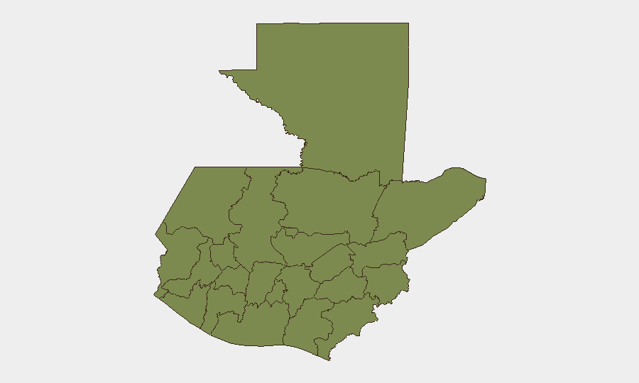
Retalhuleu department dominates the risk ranking with a composite score of 31.3—more than four times higher than the second-ranked region (Quetzaltenango, 7.3) and over twenty times the baseline in most other departments. This concentration suggests either localized criminal enterprise, gang activity, or illicit trafficking operations rather than geographically distributed instability. Quetzaltenango's secondary risk (7.3) indicates emerging concern in that western highland department; all other regions (Petén, Huehuetenango, San Marcos, Quiché, Alta Verapaz, and nine others) report minimal variance from the floor, suggesting risk is not systemic but rather concentrated in two zones.
How GeoBit Would Assist
Security teams with personnel or assets in Guatemala should employ AOI Monitoring & Early Warning on Retalhuleu and Quetzaltenango to catch incident escalation in real time; pair this with Intel Sweep (multi-language, X/Twitter & Telegram OSINT, YouTube intelligence) to track criminal and gang communications. Network & Actor Analysis would map criminal hierarchies and US–Guatemala diplomatic players, while GIS & Spatial Analysis plus Conflict & Military mapping would clarify the 29 July military engagement and its proximity to populated or commercial zones. Routing & Network Analysis can identify safe transit corridors around high-risk departments.
7-Day Outlook
No major escalation is forecast over the next week if current signals remain isolated incidents rather than coordinated action. However, the combination of criminal investigation, military contact, and diplomatic statements warrants close monitoring for secondary incidents—particularly in Retalhuleu and along Guatemala–US border zones. Duty-of-care teams should maintain elevated awareness posture and pre-positioned contingency plans.
Highest-Risk Areas — Ranked
| # | State / Region | Risk |
|---|---|---|
| 1 | Retalhuleu | 31.3 |
| 2 | Quetzaltenango | 7.3 |
| 3 | Petén | 1.3 |
| 4 | Huehuetenango | 1.3 |
| 5 | San Marcos | 1.3 |
| 6 | Quiché | 1.3 |
| 7 | Alta Verapaz | 1.3 |
| 8 | Totonicapán | 1.3 |
| 9 | Sololá | 1.3 |
| 10 | Chimaltenango | 1.3 |
| 11 | Suchitepéquez | 1.3 |
| 12 | Sacatepéquez | 1.3 |
Sources
Previous Daily Briefs
A new Guatemala brief is written every day — each with its own risk map and downloadable CSV. Here's the last week; use the calendar to go further back.
📅 Browse every day by calendar →
Highlighted days have a brief. Tap a day for that day's map & analysis, or “csv” for that day's dataset ($5).
Atlas — our AI intelligence desk — emails them this snapshot personally. Nothing else, no list.