Situation Summary
Honduras faces a complex, multi-layered security environment marked by simultaneous political institutional strain, organized-crime financial operations, and street-level violent crime. Over the past 24–48 hours, the country has experienced a presidential arrest, judicial sanctions, armed robbery resulting in fatality, infrastructure disruptions, and a major anti-money laundering operation—indicating active pressure across governance, criminal finances, and public safety. Francisco Morazán department, home to the capital Tegucigalpa, remains the dominant risk driver, while secondary concerns span the northern and western zones.
Key Developments
- San Pedro Sula, Cortés – daylight armed robbery and fatal shooting (July 28, 2026). Three masked assailants with assault rifles conducted a commercial-district robbery; a private security guard was fatally shot when attempting to draw his weapon. Suspects fled on motorcycles with cash boxes, signaling persistent street-level lethality and organized robbery activity in Honduras's second-largest city.
- Presidential arrest and institutional upheaval (July 27, 2026). High-level signals indicate detention of the sitting president, coupled with Supreme Court administrative sanctions and territorial occupation events linked to the presidency and Tegucigalpa. These point to acute political-institutional crisis with unclear trajectory.
- Operación Jaguar anti-money laundering strikes (last 48 hours). National Police dismantled the "Los Domínguez" criminal structure, executing multi-site raids, making six arrests, and seizing 228 assets valued at over 420 million lempiras. This reflects significant recent enforcement action against organized-crime financial networks.
- Bus rollover near El Durazno, Francisco Morazán (recent Sunday, within 48 hours). A public transport bus overturned on the highway north of Tegucigalpa, injuring seven people including three minors. This signals elevated transport-corridor risk and emergency-services strain in the highest-risk department.
- Electricity outages, Choloma, Cortés (July 28, 2026). The National Electric Energy Company announced scheduled power cuts from 8:45 a.m. to 2:45 p.m. in specific Choloma sectors, affecting business operations, traffic management, and security infrastructure during the maintenance window.
- Weather and hydrology alerts (current week). COPECO issued Yellow Alert for Gracias a Dios due to persistent rain and upper-level trough; five Olancho municipalities remain under Green Alert. Additionally, main reservoirs supplying Tegucigalpa remain critically low despite forecast rains, presenting flood and water-supply risks.
Highest-Risk Areas
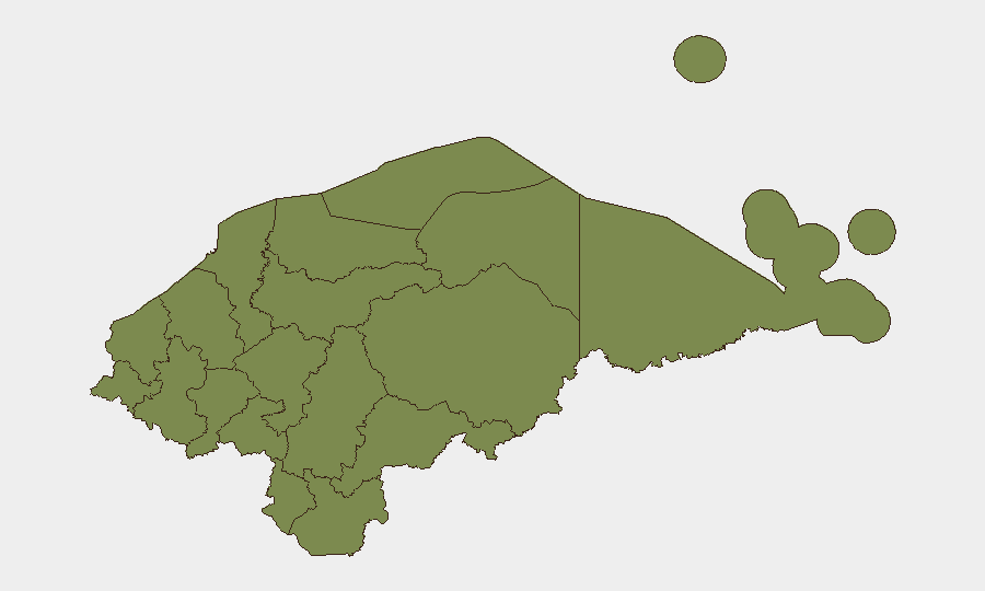
Francisco Morazán dominates the sub-national risk profile (score 31.3), driven primarily by the capital region's concentration of political institutions, transport corridors, and organized-crime activity—currently exacerbated by presidential detention and institutional crisis. Santa Bárbara (6.6) represents a secondary concentration; all remaining departments fall to minimal baseline (1.3), reflecting either lower activity reporting or stable conditions. The northern and western departments (Cortés, Yoro, Ocotepeque) remain operationally significant due to trafficking networks, street crime, and proximity to borders, but are not currently flagged in the highest-risk tier.
How GeoBit Would Assist
Organizations operating in Honduras should employ AOI Monitoring & Early Warning on Francisco Morazán (especially Tegucigalpa and San Pedro Sula) to detect further institutional disruptions or security escalations in real time. Intel Sweep and multi-language OSINT (X, Telegram, local media feeds) provide early detection of protest mobilization, transport disruptions, and organized-crime enforcement actions. Routing & Network Analysis enables security teams to identify and pre-position alternative transport corridors and supply routes around active risk zones.
7-Day Outlook
The immediate horizon is shaped by political uncertainty—the presidential arrest and institutional sanctions signal potential for further governance instability, protests, or security-force repositioning over the next week. Water scarcity and weather alerts in the capital will likely compound infrastructure stress, affecting utilities, transport, and emergency response capacity. Street-level armed robbery and organized-crime enforcement activity are expected to persist at current elevated levels absent major policy or operational shifts.
Highest-Risk Areas — Ranked
| # | State / Region | Risk |
|---|---|---|
| 1 | Francisco Morazán | 31.3 |
| 2 | Santa Bárbara | 6.6 |
| 3 | El Paraíso | 1.3 |
| 4 | Copán | 1.3 |
| 5 | Ocotepeque | 1.3 |
| 6 | Cortés | 1.3 |
| 7 | Yoro | 1.3 |
| 8 | Lempira | 1.3 |
| 9 | Intibucá | 1.3 |
| 10 | Comayagua | 1.3 |
| 11 | La Paz | 1.3 |
| 12 | Valle | 1.3 |
Sources
Previous Daily Briefs
A new Honduras brief is written every day — each with its own risk map and downloadable CSV. Here's the last week; use the calendar to go further back.
📅 Browse every day by calendar →
Highlighted days have a brief. Tap a day for that day's map & analysis, or “csv” for that day's dataset ($5).
Atlas — our AI intelligence desk — emails them this snapshot personally. Nothing else, no list.