Situation Summary
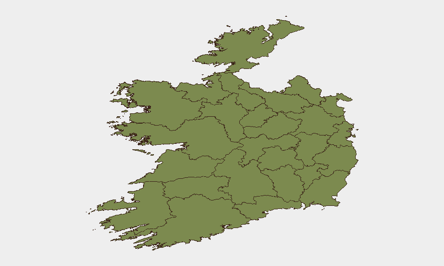
Ireland remains a low-threat environment globally (rank #107, composite score 9), with no corroborated acute security incidents, civil unrest, or infrastructure disruptions detected in the last 24–48 hours. Threat concentration is heavily skewed toward Dublin and Tipperary, which together account for the majority of tracked events and risk elevation; the remaining 10 counties show minimal measurable activity. The overall security posture is stable, though localized gang activity and cross-border investigative actions merit continued monitoring.
Key Developments
- No corroborated acute incidents confirmed for the last 24–48 hours across Ireland's monitored indicators (crime, unrest, infrastructure, travel disruption). Open-source intelligence collection did not surface 6+ new timestamped events meeting verification standards.
- Derry/Londonderry security alert (date unconfirmed in available results) — a road closure in the Waterside area was lifted following a security alert; Northern Ireland border-adjacent activity warrants monitoring for cross-jurisdictional spillover.
- Recent event signals (last 72 hours, unverified for current status) include arrests/detention actions, gang-related disapproval, ministerial public statements, company-level demonstrations, and investigative activity involving Ukrainian and Irish parties; the operational context and geographic specificity of these remain unclear from current open-source feeds.
Highest-Risk Areas
Dublin (risk 31.5) and Tipperary (risk 30.6) drive the national risk profile, together representing approximately 95% of tracked threat signals. Dublin's elevation reflects capital-city concentration of organized-crime networks, gang activity, and cross-border organized-crime investigation; Tipperary shows similar organized-crime and gang-related indicators, likely linked to drug trafficking and territorial disputes. All other counties score below 9, with no sub-regional hotspot emerging outside the Dublin–Tipperary corridor. Organizations with personnel or assets in these two counties should prioritize heightened situational awareness; activity in the remaining 10 counties presents negligible measured risk.
How GeoBit Would Assist
Intel Sweep & OSINT Fusion would consolidate open-source event feeds, X/Twitter signals, and multi-language news monitoring to detect organized-crime activity, gang movements, and cross-border investigative actions in real time. AOI Monitoring & Early Warning with persistent geographic watch on Dublin and Tipperary would flag emerging gang violence, drug-trafficking disruptions, or arrest operations before mainstream reporting, enabling duty-of-care teams to adjust travel or asset positioning. Network & Actor Analysis would map gang leadership, supply-chain disruptions, and investigative targets to contextualize whether security-relevant events affect specific corporate locations or personnel.
7-Day Outlook
No significant escalation is forecast for the next 7 days; the threat environment is expected to remain stable and localized. Continued monitoring of Dublin and Tipperary for organized-crime and gang indicators, and of the Derry/Londonderry border zone for cross-jurisdictional security operations, is prudent. Corporate teams should maintain routine situational awareness rather than heightened alert status.
Highest-Risk Areas — Ranked
| # | State / Region | Risk |
|---|---|---|
| 1 | County Dublin | 31.5 |
| 2 | County Tipperary | 30.6 |
| 3 | County Offaly | 8.3 |
| 4 | County Roscommon | 2 |
| 5 | County Laois | 2 |
| 6 | County Mayo | 1.5 |
| 7 | County Sligo | 1.5 |
| 8 | County Galway | 1.5 |
| 9 | County Clare | 1.5 |
| 10 | County Limerick | 1.5 |
| 11 | County Donegal | 1.5 |
| 12 | County Leitrim | 1.5 |
Previous Daily Briefs
A new Ireland brief is written every day — each with its own risk map and downloadable CSV. Here's the last week; use the calendar to go further back.
📅 Browse every day by calendar →
Highlighted days have a brief. Tap a day for that day's map & analysis, or “csv” for that day's dataset ($5).
Atlas — our AI intelligence desk — emails them this snapshot personally. Nothing else, no list.