Situation Summary
Kenya's composite threat score remains moderate at 67 (rank #21 globally), but recent events concentrate acute risk in northeastern border regions. A coordinated Al-Shabaab ambush in Mandera County on 29 July killed five Kenyan security personnel and deployed sophisticated tactics including roadside IEDs, signaling a tactical escalation by militant actors. The national threat environment is stable outside the Mandera border belt, though broader sub-national variation—particularly in Migori and Nairobi counties—reflects persistent organized crime and civil tensions.
Key Developments
- Mandera County, Lafey–Wantey Dam area, 29 July 2026 (midday to afternoon)
A Special Operations Group patrol from Alungu was ambushed by suspected Al-Shabaab militants near Lafey town (~10 km from Somalia border), resulting in five fatalities (four SOG officers and one National Police Reservist). The attack combined direct-fire engagement with a secondary IED strike on a reinforcement vehicle; no further casualties were reported in the follow-up blast.
- Mandera County, El-Raamo/Alungu route, 29 July 2026
Security forces on the Somali border patrol route struck or were targeted near an IED at El-Raamo, triggering gunfire exchange with militants. Cross-referenced reporting (AFP, Reuters, Al Jazeera) confirms the same incident resulted in five officer deaths.
- Mandera County, broader border belt (Fino, Arabia, Asharaf), recent days through 29 July
Police and county security reporting document a sustained surge in militant probing and contact across Mandera's southern frontier, including attacks near Fino and Arabia and heavy gunfire in Asharaf. This pattern frames the 29 July ambush as part of an elevated operational tempo rather than an isolated event.
- Mandera County, security response, 29 July evening onward
Kenyan authorities initiated pursuit and clearing operations targeting the responsible Al-Shabaab cell, with heightened checkpoints and patrols near Lafey and surrounding border localities expected to persist. Travelers and logistics operations should anticipate temporary movement restrictions and delays.
- National travel advisory alignment, late July 2026
Foreign governments (e.g., Australian Smartraveller) maintain "exercise high degree of caution" ratings for Kenya overall, with explicit elevation for border regions including Mandera, reflecting current threat perception.
Highest-Risk Areas
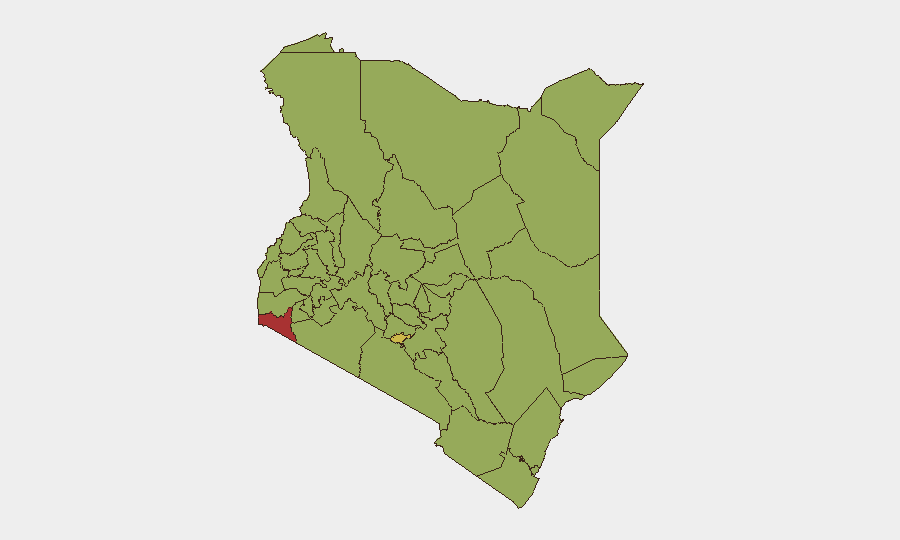
Migori County (77.2) and Nairobi County (62.2) drive the national risk composite, reflecting persistent organized crime, cross-border trafficking, and concentrated violent crime in urban centers. However, the 29 July Mandera events underscore that northeastern border counties—though not in the top five by overall composite score—host acute, episodic terrorism risk with potential for rapid escalation. Isiolo, Kiambu, Kajiado, and Turkana counties (48–49 range) remain moderately elevated, partly reflecting banditry and resource-conflict vectors. Corporate and field teams should segregate strategic concern: Migori and Nairobi warrant standard urban crime/civil-unrest mitigation; Mandera requires active terrorism threat protocols and real-time border monitoring.
How GeoBit Would Assist
Teams operating in Kenya should employ AOI Monitoring & Early Warning on Mandera County and adjacent border corridors to track patrol incidents, checkpoint activity, and militant statements in real time. Routing & Network Analysis enables alternative route planning around confirmed ambush zones and checkpoints. OSINT fusion (X/Telegram, local radio SIGINT, YouTube militant channels) and entity extraction on Al-Shabaab communications provide early indication of planned operations or territorial shifts, allowing duty-of-care teams to adjust movement and deployment schedules ahead of incidents.
7-Day Outlook
Al-Shabaab's demonstrated coordination and IED capability in Mandera suggest sustained operational intent over the near term; security force pursuit may temporarily suppress but is unlikely to eliminate the threat within days. Organizations with personnel or assets in Mandera should maintain heightened alert posture, restrict non-essential border-area travel, and increase reporting frequency to GeoBit's platform for pattern detection. Nairobi and Migori threat levels are expected to remain stable but elevated.
Highest-Risk Areas — Ranked
| # | State / Region | Risk |
|---|---|---|
| 1 | Migori County | 77.2 |
| 2 | Nairobi County | 62.2 |
| 3 | Isiolo | 48.9 |
| 4 | Kiambu | 48.9 |
| 5 | Kajiado County | 48.3 |
| 6 | Turkana County | 48.3 |
| 7 | Homa Bay County | 47.8 |
| 8 | Busia County | 47.2 |
| 9 | Kakamega County | 47.2 |
| 10 | Vihiga County | 47.2 |
| 11 | Nandi County | 47.2 |
| 12 | Elgeyo-Marakwet County | 47.2 |
Sources
Previous Daily Briefs
A new Kenya brief is written every day — each with its own risk map and downloadable CSV. Here's the last week; use the calendar to go further back.
📅 Browse every day by calendar →
Highlighted days have a brief. Tap a day for that day's map & analysis, or “csv” for that day's dataset ($5).
Atlas — our AI intelligence desk — emails them this snapshot personally. Nothing else, no list.