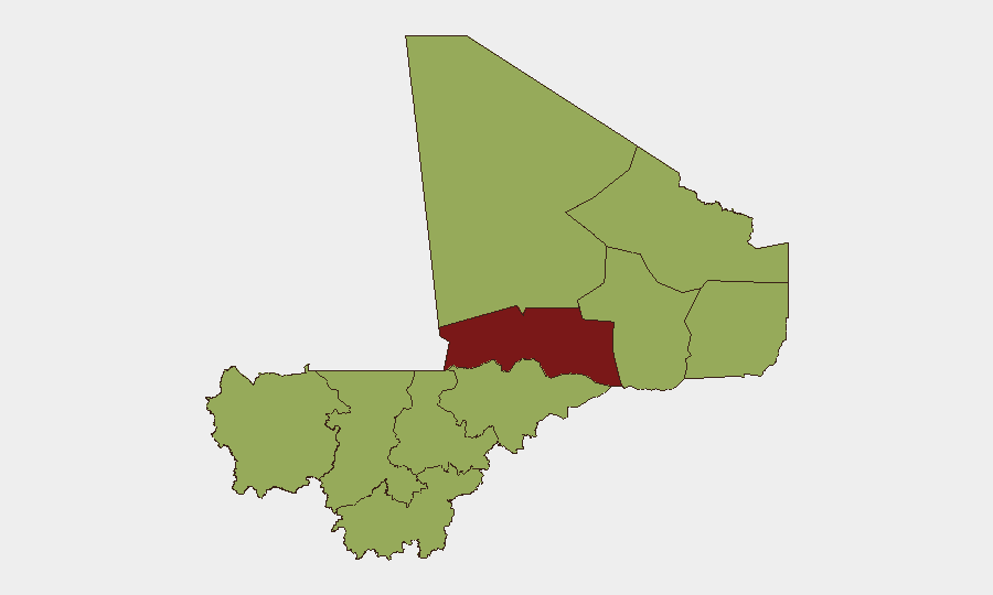
Situation Summary
Mali remains a high-risk operating environment (composite threat score 74; #15 globally) with persistent jihadist activity, military instability, and infrastructure constraints. The security landscape is characterized by sporadic conventional and unconventional violence, competing state and non-state actors, and ongoing tensions between the junta administration and international actors. Open-source reporting for the past 24–48 hours is sparse and weakly corroborated across independent sources, reflecting both operational opacity and data gaps in the intelligence environment.
Key Developments
Data Gap Notice: Specialist monitoring platforms and open-source feeds explicitly flag insufficient corroborated incident reporting for Mali during 17–19 June 2026. No Mali-specific incidents meeting multi-source verification standards have been confirmed for the last 24–48 hours.
Ongoing Background (not strictly last 48h):
- Mid-June jihadist threat (aggregated reporting): MedAire's June 2026 aviation security update cites continued jihadist threat and reports of Russian-backed Africa Corps withdrawals from positions near gold mining sites, exacerbating jet fuel shortages and constraining flight operations outside Bamako.
- Alleged bounty on junta leadership (undated, weakly sourced): Social-media posts reference claims by al-Qaeda-linked JNIM of a multimillion-euro bounty on Col. Assimi Goïta, but lack clear time-stamping and corroboration by independent outlets within the last 48 hours.
Assessment: The absence of high-confidence incident reporting in this window does not indicate calm; rather, it reflects operational security, reporting delays, and gaps in open-source coverage typical of the Sahel conflict zone.
Highest-Risk Areas
Timbuktu (81.7) and Bamako (72.1) drive the composite country risk, with Timbuktu facing the highest sub-national threat score. The northern regions—Timbuktu, Ménaka, Taoudénit, Kidal, and Gao—remain zones of active jihadist presence, intercommunal tension, and military operations. Bamako, despite its capital status and relative infrastructure, sustains elevated risk from political volatility, police-criminal tensions, and administration-media friction, as reflected in recent public statements and investigative activity. The remaining eight regions cluster at 51.7, indicating geographically distributed, moderate-to-high risk across the center and south, likely driven by resource competition, criminal networks, and spillover effects from the north.
How GeoBit Would Assist
Security teams operating in Mali should employ AOI Monitoring & Early Warning on Timbuktu, Bamako, Mopti, and Gao to track militant movement and checkpoint activity in near real-time. Network & Actor Analysis and multi-language OSINT fusion (Intel Sweep, Telegram/X feeds, and regional media monitoring) would contextualize weak or delayed open-source reporting and flag emerging tensions before they escalate. Routing & Network Analysis and alternative journey planning are essential for logistics teams navigating fuel shortages, military checkpoints, and zones of active armed groups; integration with Maritime & Aviation tracking supports real-time flight-path adjustment as operational constraints evolve.
7-Day Outlook
Jihadist and intercommunal violence will likely persist at baseline levels across the north and center, with continued strain on civilian aviation and fuel supply chains. The junta administration's diplomatic posture and media relations remain a secondary friction point; monitor official statements and ministerial activity for signals of policy shifts or international pressure. Travel and asset-movement risk will remain elevated in Timbuktu and northern corridors; operations in Bamako should assume continued police and administrative friction.
Highest-Risk Areas — Ranked
| # | State / Region | Risk |
|---|---|---|
| 1 | Timbuktu | 81.7 |
| 2 | Bamako | 72.1 |
| 3 | Ménaka | 51.7 |
| 4 | Kayes | 51.7 |
| 5 | Taoudénit Region | 51.7 |
| 6 | Kidal | 51.7 |
| 7 | Gao | 51.7 |
| 8 | Koulikoro | 51.7 |
| 9 | Ségou Region | 51.7 |
| 10 | Sikasso Region | 51.7 |
| 11 | Mopti | 51.7 |
Sources
Previous Daily Briefs
A new Mali brief is written every day — each with its own risk map and downloadable CSV. Here's the last week; use the calendar to go further back.
📅 Browse every day by calendar →
Highlighted days have a brief. Tap a day for that day's map & analysis, or “csv” for that day's dataset ($5).