Situation Summary
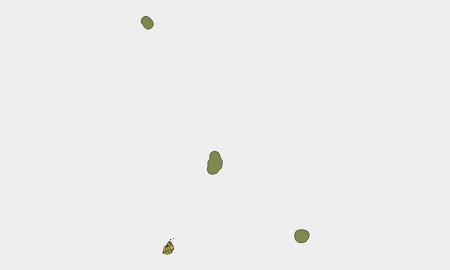
Mauritius maintains a low and stable security environment with no major incidents, civil unrest, or infrastructure disruptions reported in the last 24–48 hours. The composite national threat score remains at 11, reflecting routine petty crime and theft as the primary concerns rather than systemic instability or organized violence. Port Louis, the capital and economic hub, carries elevated risk (score 92) relative to other districts, driven by urban crime concentration and transient population flows; the remaining 10 districts range from moderate (Plaines Wilhems, Black River, Flacq) to minimal (Agaléga, Saint Brandon) risk. Current trajectory is stable, with no indicators of imminent escalation.
Key Developments
- Port Louis – Maritime Security Policy Meetings – late July 2026: Government of Mauritius officials participated in EU Regional Maritime Security Week discussions focused on Western Indian Ocean surveillance and cyber resilience cooperation; these are policy-coordination events with no accompanying civil unrest or security incidents reported.
- Nationwide – Legislative Reform – July 22, 2026: Parliament enacted legislation criminalizing marital rape, marking a significant legal reform for women's protection; no protests, demonstrations, or security disruptions linked to this measure have been reported in the last 24–48 hours.
- Moka (Réduit Triangle) – Vehicle Theft from FCC Car Park – reported July 23 (incident July 17–20): Local press documented theft of audio equipment and batteries from six vehicles held at the Financial Crimes Commission compound; classified as routine property crime with no broader security implications.
- National Border/Air Entry – Health Screening Protocols – ongoing: German Foreign Office advisory confirms continued entry health screening and online travel documentation for passengers from designated Ebola-affected countries; no disruptions or security incidents at Mauritius' main airport or seaports reported in the last 24–48 hours.
- General Crime Environment – July 2026: Open-source travel advisories and local reporting indicate theft and robbery remain the primary petty-crime concerns, particularly in Port Louis and tourist areas; no organized crime operations, gang violence, or coordinated criminal networks have been flagged in current-window reporting.
Highest-Risk Areas
Port Louis dominates the sub-national risk profile (score 92), reflecting its role as the capital, primary commercial center, and main point of entry—factors that concentrate both opportunity for petty crime and transient population exposure. Plaines Wilhems (68), Black River (65), and Flacq (62) show moderate elevation, likely driven by secondary urban centers and tourism corridors; Moka (52) and Savanne (48) reflect lower-density but persistent background crime. Outer islands and territories (Rodrigues, Saint Brandon, Agaléga) register minimal risk (5–22), consistent with lower population density and less formal crime reporting. Risk correlates strongly with urbanization and tourism intensity rather than political instability or organized threats.
How GeoBit Would Assist
Security teams in Mauritius would deploy Intel Sweep and multi-language OSINT fusion to ingest government advisories, social media sentiment, and local press in French and English, enabling early detection of emerging civil unrest or crime spikes. AOI Monitoring & Early Warning on Port Louis, the airport, and key commercial districts would provide persistent watch with automated alerting for protests, infrastructure disruptions, or unusual activity patterns. GIS & Spatial Analysis overlaying crime data, tourism flows, and event calendars would support duty-of-care planning and personnel routing away from high-risk micro-zones in real time.
7-Day Outlook
No indicators point to significant security deterioration in the next seven days. Mauritius is expected to remain in its current low-threat posture, with petty crime and routine policing as the main operational concern. Continued monitoring of the tourism and maritime sectors, combined with standard travel-advisory tracking, should suffice for most corporate risk teams.
Highest-Risk Areas — Ranked
| # | State / Region | Risk |
|---|---|---|
| 1 | Port Louis | 92 |
| 2 | Plaines Wilhems | 68 |
| 3 | Black River | 65 |
| 4 | Flacq | 62 |
| 5 | Grand Port | 58 |
| 6 | Moka | 52 |
| 7 | Savanne | 48 |
| 8 | Pamplemousses | 45 |
| 9 | Rivière du Rempart District | 38 |
| 10 | Rodrigues | 22 |
| 11 | Saint Brandon | 8 |
| 12 | Agaléga | 5 |
Sources
Previous Daily Briefs
A new Mauritius brief is written every day — each with its own risk map and downloadable CSV. Here's the last week; use the calendar to go further back.
📅 Browse every day by calendar →
Highlighted days have a brief. Tap a day for that day's map & analysis, or “csv” for that day's dataset ($5).
Atlas — our AI intelligence desk — emails them this snapshot personally. Nothing else, no list.