Situation Summary
Nepal remains a low-to-moderate global security risk (rank #73, score 18) but faces mounting political and institutional friction centered on border disputes with India and domestic unemployment grievances. The past 48 hours have seen coordinated public messaging by political actors on the Susta border issue, youth-led demonstrations in Kathmandu, and heightened police deployments around government infrastructure. Monsoon-season travel disruptions compound short-term operational risk; the trajectory suggests sustained civil tension around sovereignty and governance without imminent large-scale violence.
Key Developments
- Kathmandu, 1 July 2026 – Youth-led demonstration in New Baneshwor near Federal Parliament protesting unemployment and corruption; police deployed; traffic briefly disrupted; no major violence reported.
- Susta area, Nawalparasi (Nepal–India border), 1 July 2026 – Foreign Minister Shisir Khanal stated to National Assembly that institutional mechanisms are actively addressing cross-border occupation concerns and missing border markers with India, signalling managed but elevated border tensions.
- Kathmandu (Singha Durbar and surroundings), 1 July 2026 – Parliamentary discussion of Nepal–India border disputes and missing markers drew protest messages and critical posts from opposition activists on X, with warnings of possible nationalist mobilisations if talks stall.
- Major highways, Kathmandu Valley, 1 July 2026 – Temporary traffic disruptions linked to fuel-transport delays and ad-hoc roadblocks by transport workers; no major clashes reported.
- Terai districts, 1 July 2026 – Heightened political activity and small gatherings in southern plains relating to land and border grievances; authorities monitoring for civil unrest but no large-scale violence documented.
- Nationwide civil aviation and road travel, 1 July 2026 – Scattered flight delays and road-transport disruptions due to heavy monsoon rains; landslide and flooding risk elevated on hill roads and domestic routes; emergency services on alert.
- Online space (X/Twitter, Instagram), 1 July 2026 – Viral posts on "1,325 missing border markers" and Susta dispute fuelling online anger and calls for street protests; social tension elevated but mostly contained online to date.
- Kathmandu, 1 July 2026 – Visible police presence maintained around government compounds and major intersections following recent small protests; protective posture in effect.
Highest-Risk Areas
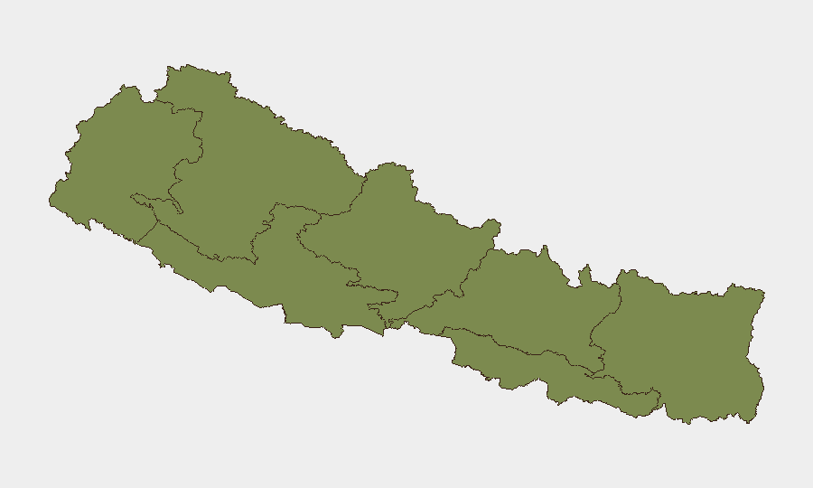
Bagamati Province (risk 31.5)—which includes Kathmandu and Singha Durbar—dominates the national risk profile due to concentration of political institutions, demonstrations, and police activity. Gandaki Province (26) and Sudurpashchim Province (23.3) follow, with Koshi Province (12.4) elevated by its proximity to border tensions and the Susta dispute. The southern Terai districts show localized grievance-driven activity. Madhesh Province (1.5) remains lowest-risk; Karnali and Lumbini (both 6.9) remain comparatively stable.
How GeoBit Would Assist
Security teams should deploy AOI Monitoring & Early Warning on Kathmandu Valley (Parliament, Singha Durbar, major transport corridors) and the Susta border zone to detect escalation in protest frequency or police response. OSINT Fusion & Corroboration on X/Twitter, local news, and official statements will track political messaging and opposition framing around border and sovereignty issues. Routing & Network Analysis can identify alternative transport corridors in Bagamati and Gandaki provinces to mitigate monsoon-driven travel delays and roadblock risk.
7-Day Outlook
Political tension around the border dispute and unemployment will likely sustain small-scale demonstrations and heightened police visibility in Kathmandu through early July. Monsoon disruptions to travel and supply chains will persist. Escalation to coordinated or large-scale civil unrest remains low probability absent a major political statement or border incident; online activism may translate to additional street gatherings if institutional talks with India appear to stall.
Highest-Risk Areas — Ranked
| # | State / Region | Risk |
|---|---|---|
| 1 | Bagamati Province | 31.5 |
| 2 | Gandaki Province | 26 |
| 3 | Sudurpashchim Province | 23.3 |
| 4 | Koshi Province | 12.4 |
| 5 | Karnali Province | 6.9 |
| 6 | Lumbini Province | 6.9 |
| 7 | Madhesh Province | 1.5 |
Sources
Previous Daily Briefs
A new Nepal brief is written every day — each with its own risk map and downloadable CSV. Here's the last week; use the calendar to go further back.
📅 Browse every day by calendar →
Highlighted days have a brief. Tap a day for that day's map & analysis, or “csv” for that day's dataset ($5).