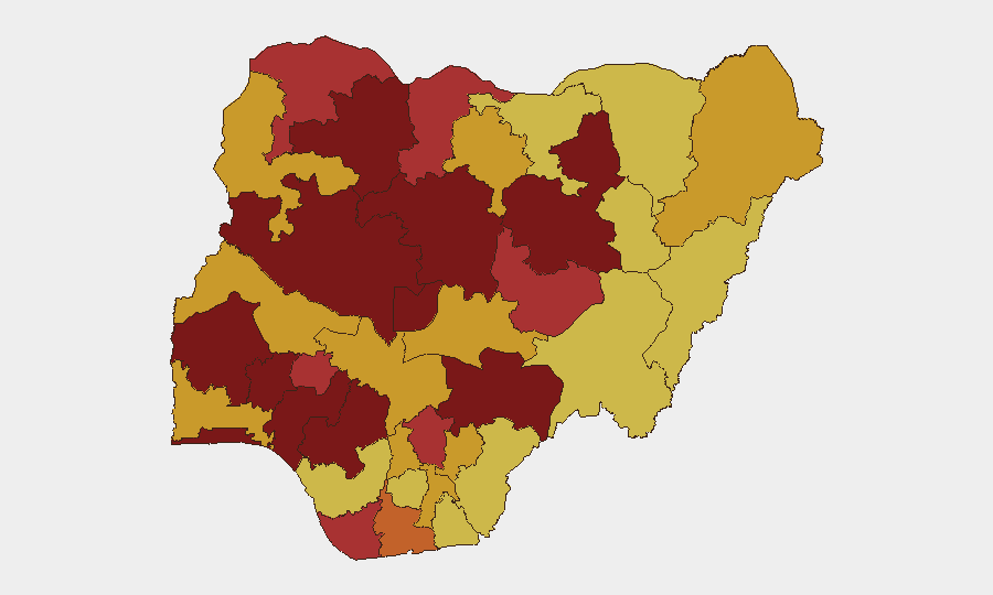
Situation Summary
Nigeria remains the third-highest-threat country globally, driven primarily by ongoing insurgency, banditry, and communal violence across multiple regions. The past 48 hours have seen a sharp spike in reported incidents—including mass abductions, community attacks with high casualty counts, and armed group combat—concentrated in the north and north-central zones. The pattern reflects sustained operational tempo by non-state armed groups and a deteriorating security posture in rural and semi-urban areas despite government security operations. Risk trajectory remains elevated with no immediate de-escalation signals.
Key Developments
- Bokkos LGA, Plateau State (June 22): Gunmen attacked a rural community, killing at least 20 people according to police confirmation; attack occurred Saturday with investigations ongoing.
- Near NIPSS, Kuru, Jos South LGA, Plateau State (June 22): Security incident confirmed at/near the National Institute for Policy and Strategic Studies campus; security agencies responded and contained the situation; formal investigation opened.
- Kebbi State (June 22, reported within 48h): Armed bandits attacked a girls' school, killed a vice principal, and abducted approximately 24 schoolgirls; two reportedly escaped. Limited official detail available to date.
- Kwara State (June 22, reported within 48h): Separate violent incident with confirmed casualties; precise locality and casualty figures not yet officially detailed in open reporting.
- Rigasa, Igabi LGA, Kaduna State (June 22): State authorities announced large-scale resident relocation and 34-billion-naira remediation project due to severe gully erosion; represents significant infrastructure and forced-displacement risk with secondary security implications.
- Armed group small-arms combat (June 21–22, location unconfirmed): Small-arms engagement involving an armed group tracked in event signals; geolocation and full context pending clarification.
- Agrarian grievance statements (June 21–22, national level): Public statements by farmers citing land-use and agrarian grievances flagged as potential localised unrest driver; precise locations not yet identified.
Highest-Risk Areas
Oyo, Lagos, Niger, Kaduna, and Zamfara states are driving the composite threat score, with Oyo (100) and Lagos (98.7) at the apex despite being relatively urbanized—indicating that threat extends beyond traditional insurgency zones into economic and administrative hubs. The concentration of incidents in the past 48 hours in Plateau, Kebbi, and Kaduna states reflects active operational footprints by bandit networks and armed groups in the north-central and northwest corridors. The Rigasa displacement event in Kaduna compounds human-security risk in an already volatile state. FCT (80.3) rounds the top tier, signaling that security concerns now span the capital territory.
How GeoBit Would Assist
Security teams should activate AOI (Area of Interest) Monitoring & Early Warning on Plateau, Kebbi, Kaduna, and Niger states to track the current incident clusters and receive real-time alerts on follow-on activity. Intel Sweep, multi-language OSINT, and entity extraction on Telegram, X, and local broadcast channels will surface emerging bandit/armed-group statements, abductee negotiations, or regional government response messaging within hours of posting. GIS & Spatial Analysis combined with Routing & Network Analysis enables duty-of-care teams to model safe corridors, identify alternative logistics routes, and pre-identify secure transit zones away from incident hotspots.
7-Day Outlook
Expect continued bandit and armed-group operations in the northwest and north-central belt, with schools and rural communities remaining high-risk targets given the pattern of abductions and mass-casualty attacks. Government security responses and investigations into the Plateau and Kebbi incidents may trigger secondary displacement or retaliatory activity. The agrarian grievance signal suggests potential for localized communal clashes independent of organized insurgency, complicating the threat picture.
Highest-Risk Areas — Ranked
| # | State / Region | Risk |
|---|---|---|
| 1 | Oyo State | 100 |
| 2 | Lagos State | 98.7 |
| 3 | Niger State | 98.2 |
| 4 | Kaduna State | 94.4 |
| 5 | Zamfara State | 89.4 |
| 6 | Edo State | 85.4 |
| 7 | Osun State | 83.1 |
| 8 | Benue State | 81.5 |
| 9 | Bauchi State | 80.3 |
| 10 | Ondo State | 80.3 |
| 11 | Federal Capital Territory | 80.3 |
| 12 | Ekiti State | 79.4 |
Sources
Previous Daily Briefs
A new Nigeria brief is written every day — each with its own risk map and downloadable CSV. Here's the last week; use the calendar to go further back.
📅 Browse every day by calendar →
Highlighted days have a brief. Tap a day for that day's map & analysis, or “csv” for that day's dataset ($5).