Situation Summary
Oman faces an acute security escalation following Iranian military strikes on July 12–13, 2026, targeting U.S.-linked facilities and resulting in civilian maritime casualties. Al Wusta Governorate (particularly Duqm) and Musandam have been designated highest-risk zones, with official shelter-in-place guidance issued by the U.S. Embassy. The attacks represent a sharp departure from Oman's historical stability and reflect the country's exposure to broader Gulf regional tensions, especially around the Strait of Hormuz.
Key Developments
- July 12–13, Duqm (Al Wusta) & Musandam: Iran's Islamic Revolutionary Guard Corps (IRGC) announced strikes on U.S. naval logistics facilities and refueling platforms at Port Duqm, and on drone targets in Musandam and Al Batinah, as part of coordinated retaliation across the Gulf.
- July 12–13, Off Omani Coast (maritime): Container vessel MV GFS Galaxy (Cyprus-flagged) was struck by a projectile, igniting an engine-room fire and rendering it immobile; one Indian national remains missing following rescue of ten crew members; Omani authorities and Royal Navy Oman SAR operations ongoing.
- July 12–13, Muscat (national): Oman's government formally protested Iranian strikes via its Foreign Ministry and state media, condemning violations of its territory only hours after hosting Iran's foreign minister for regional security talks.
- July 12, U.S. Embassy Guidance (Duqm & Musandam): Official shelter-in-place alert issued for Duqm and Musandam Governorate, instructing personnel to remain indoors and avoid windows pending clarification of immediate threat.
Highest-Risk Areas
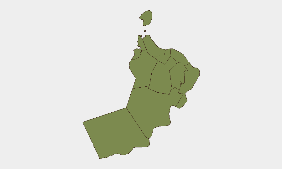
Al Wusta Governorate dominates the risk profile (score 31.5), driven by the July 12–13 strikes on Port Duqm and adjacent U.S. logistics infrastructure; ongoing military activity and potential for follow-on strikes make this zone the country's primary concern. Musandam Governorate (8.2) ranks second, reflecting drone strikes and proximity to the Strait of Hormuz shipping lanes, which carry global energy and commercial traffic. Muscat Governorate (5.8) faces elevated risk from potential secondary strikes or maritime incidents in its waters and port approaches, though the capital itself has not been directly targeted. Ash Sharqiyah South (4.9) rounds out the highest-risk tier due to its coastal and maritime exposure. All other governorates remain at baseline threat levels (1.5), indicating risk is geographically concentrated.
How GeoBit Would Assist
Organizations with personnel or assets in Oman should deploy AOI Monitoring & Early Warning on Duqm, Musandam, and Al Batinah ports and military facilities to detect follow-on strike activity or positioning of Iranian or allied assets. Maritime & Aviation tracking would provide real-time vessel and air activity surveillance in Omani territorial waters and the Strait of Hormuz, critical for supply-chain and personnel-movement planning. Multi-source OSINT fusion (intel sweeps, X/Telegram monitoring, radio SIGINT) combined with conflict and event feed integration will enable 24/7 tracking of official statements, military announcements, and incident reports to support duty-of-care decision-making on shelter-in-place compliance, evacuation, or restricted-area avoidance.
7-Day Outlook
Risk remains elevated through mid-week as diplomatic de-escalation efforts (if any) unfold and damage assessments and search-and-rescue operations conclude. The presence of U.S. logistics infrastructure and Oman's historical role as a regional mediator create unpredictable secondary risks if broader U.S.–Iran escalation materializes. Organizations should assume persistent heightened threat in Al Wusta and Musandam for at least 7 days and monitor official Omani and U.S. Embassy guidance for updates.
Highest-Risk Areas — Ranked
| # | State / Region | Risk |
|---|---|---|
| 1 | Al Wusta Governorate | 31.5 |
| 2 | Musandam Governorate | 8.2 |
| 3 | Muscat Governorate | 5.8 |
| 4 | Ash Sharqiyah South Governorate | 4.9 |
| 5 | Al Buraymi Governorate | 1.5 |
| 6 | Ad Dhahirah Governorate | 1.5 |
| 7 | Al Batinah North Governorate | 1.5 |
| 8 | Al Batinah South Governorate | 1.5 |
| 9 | Ad Dakhiliyah Governorate | 1.5 |
| 10 | Ash Sharqiyah North Governorate | 1.5 |
| 11 | Dhofar Governorate | 1.5 |
Sources
Previous Daily Briefs
A new Oman brief is written every day — each with its own risk map and downloadable CSV. Here's the last week; use the calendar to go further back.
📅 Browse every day by calendar →
Highlighted days have a brief. Tap a day for that day's map & analysis, or “csv” for that day's dataset ($5).
Atlas — our AI intelligence desk — emails them this snapshot personally. Nothing else, no list.