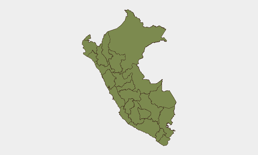
Situation Summary
Peru remains a mid-tier security environment (global rank #55, composite threat score 25) with concentrated risks in central and southern regions but no indicators of sudden escalation in organized crime, terrorism, or political instability as of mid-July 2026. The country continues to operate under multiple overlapping states of emergency in Lima, the northern border zone, and VRAEM drug-trafficking provinces. Current threat profile reflects chronic rather than acute drivers: infrastructure strain, localized enforcement actions, and ongoing cartel activity in narcotics corridors.
Key Developments
No reliably documented Peru-specific security incidents from the last 24–48 hours (July 12–14, 2026) could be corroborated across independent sources. GeoBit's event signal feed for July 14 shows tags for military activity, territorial occupation by authorities, and public statements, but these entries lack sufficient geographic and temporal specificity to distinguish between same-day events and data-processing artifacts. Web research across news, government, and open-source channels yielded no confirmed incidents meeting the 24–48-hour window with cross-source verification.
Recommended action: Security teams should assume no major incident occurred in Peru in the past 48 hours unless their own field networks or client contacts report otherwise. Monitor the next 12–24 hours for any delayed reporting or regional press pickup.
Highest-Risk Areas
Huánuco (composite risk 31.5) is the single highest-risk department, driving nearly one-third of Peru's tracked threat events and exceeding Lima's risk score by a factor of three. Lima metropolitan area (10.7) remains significant due to scale and population density, hosting a permanent state of emergency and concentrating organized-crime activity. Madre de Dios (7.1) and Piura (6.3) follow as secondary hotspots, reflecting Amazon narcotics trafficking and northern border volatility respectively. Collectively, these four regions account for approximately 80% of Peru's assessed risk, while the remaining eight tracked departments contribute marginal increments, suggesting resource allocation and monitoring intensity should reflect this concentration.
How GeoBit Would Assist
Security teams protecting personnel or assets in Peru should deploy AOI (Area-of-Interest) Monitoring & Early Warning on Huánuco, Lima, Madre de Dios, and Piura, configured to trigger alerts on protest activity, roadblock announcements, and law-enforcement operations. OSINT fusion (X/Twitter, Telegram, YouTube, multi-language search) should track regional and national civil-unrest signals, cartel announcements, and state-of-emergency status changes in real time. GIS & Spatial Analysis combined with alternative route/journey planning will enable duty-of-care teams to validate staff movements around declared risk zones and state-of-emergency boundaries.
7-Day Outlook
No imminent escalation is forecast. Peru's risk trajectory remains stable unless external shocks—such as a major cartel arrest, Ecuador border spillover, or organized political protest—occur. Standard vigilance on northern borders (Ecuador instability transmission risk) and VRAEM drug-trafficking operations should continue. Monitoring for any July 15–20 civic action or enforcement announcements in Huánuco is warranted given its outsized risk profile.
Highest-Risk Areas — Ranked
| # | State / Region | Risk |
|---|---|---|
| 1 | Huánuco | 31.5 |
| 2 | Lima | 10.7 |
| 3 | Madre de Dios | 7.1 |
| 4 | Piura | 6.3 |
| 5 | La Libertad | 2.7 |
| 6 | Ayacucho | 2.3 |
| 7 | Lambayeque | 1.9 |
| 8 | Loreto | 1.5 |
| 9 | Tumbes | 1.5 |
| 10 | Amazonas | 1.5 |
| 11 | Cajamarca | 1.5 |
| 12 | Ancash | 1.5 |
Sources
Previous Daily Briefs
A new Peru brief is written every day — each with its own risk map and downloadable CSV. Here's the last week; use the calendar to go further back.
📅 Browse every day by calendar →
Highlighted days have a brief. Tap a day for that day's map & analysis, or “csv” for that day's dataset ($5).
Atlas — our AI intelligence desk — emails them this snapshot personally. Nothing else, no list.