Situation Summary
Rwanda maintains a stable security environment with no acute incidents—protests, armed clashes, terrorism, or infrastructure disruption—recorded in the past 24–48 hours. The country's composite threat score of 20 places it at rank 65 globally, reflecting manageable baseline risks driven primarily by routine crime, road safety, and the ongoing Marburg virus outbreak. Kigali City concentrates the majority of documented risk (32.5), while provincial areas remain substantially lower-risk; diplomatic friction over FDLR disarmament protocols in eastern DR Congo presents a medium-term indicator of potential regional tension but has not yet translated into cross-border incidents affecting Rwandan territory.
Key Developments
- Gasabo District, Kigali – 26 July 2026 – Rwanda National Police Anti-Narcotics Unit arrested two men (Dushimimana Gad, 24, and Mayira Eric, 27) in Remera Sector, Rukiri II Cell for transporting cannabis via motorcycle. The operation reflects targeted crime enforcement; no broader public disorder resulted.
- Kigali City – 30 July 2026 – Student demonstration/rally documented; routine protest activity with no reports of violence, disruption, or security force escalation.
- Rwanda – 29 July 2026 – Diplomatic development: Congo's government announced FDLR disarmament protocols; Rwanda publicly rejected the step as inconsistent with existing agreements. No cross-border clashes or incursions into Rwandan territory confirmed, but signals potential for future regional friction.
- Rwanda – Nationwide – 18–31 July 2026 window – Consolidated OSINT (news feeds, social media, specialist monitoring) records no acute security incidents, armed confrontation, or infrastructure disruption. Security posture assessed as stable.
- Marburg virus outbreak – Rwanda, nationwide – Ongoing as of 31 July 2026 – Public-health emergency remains active with no new confirmed cases or significant spread in the last 24–48 hours, but continues to constrain movement and medical contingency planning.
- Eastern DR Congo border – 26–27 July 2026 – OSINT scan found no discrete, multi-source-verified incidents despite ongoing M23/ADF conflict near Rwanda; no verified spillover violence into Rwandan border areas detected.
Highest-Risk Areas
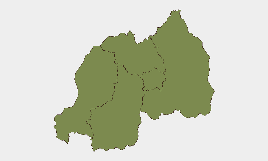
Kigali City dominates the threat landscape (risk score 32.5), driven by population density, transit concentration, and documented routine crime. The four provincial areas (Western, Northern, Southern, Eastern) cluster at 2.4 each, indicating substantially lower risk profiles. Southern Province carries the highest provincial baseline, likely reflecting historical and structural factors, but no new discrete incidents have been recorded there in the last 24–48 hours; the elevation reflects background risk rather than active escalation. For corporate operations, Kigali remains the primary focus for duty-of-care, crime prevention, and health-protocol enforcement; provincial sites warrant standard precautions but face lower operational constraint.
How GeoBit Would Assist
Security teams would deploy AOI Monitoring & Early Warning on Kigali and the eastern border zones to detect protest escalation, crime clusters, or cross-border spillover in real time. Intel Sweep and OSINT fusion (combining news feeds, X/Twitter, and specialist intelligence) provide 24-hour corroboration of incidents and rule out false alarms—critical for duty-of-care decisions. Routing & Network Analysis supports alternative-route planning for staff and assets to avoid Kigali congestion or emerging crime hotspots, while Environmental & Health monitoring tracks Marburg case progression and movement restrictions.
7-Day Outlook
No acute security deterioration is anticipated over the next seven days; the stable posture is likely to persist absent new cross-border escalation. Marburg outbreak trajectory and diplomatic FDLR negotiations warrant continued monitoring as potential inflection points. Standard crime, road-safety, and health-protocol vigilance remains the primary operational focus.
Highest-Risk Areas — Ranked
| # | State / Region | Risk |
|---|---|---|
| 1 | Kigali City | 32.5 |
| 2 | Western Province | 2.4 |
| 3 | Northern Province | 2.4 |
| 4 | Southern Province | 2.4 |
| 5 | Eastern Province | 2.4 |
Sources
Previous Daily Briefs
A new Rwanda brief is written every day — each with its own risk map and downloadable CSV. Here's the last week; use the calendar to go further back.
📅 Browse every day by calendar →
Highlighted days have a brief. Tap a day for that day's map & analysis, or “csv” for that day's dataset ($5).
Atlas — our AI intelligence desk — emails them this snapshot personally. Nothing else, no list.