Situation Summary
Syria remains in acute civil conflict with composite threat ranking #8 globally (score 100), driven by overlapping state fragmentation, ISIS insurgency, Israeli military incursions, and sectarian tensions. The past 48 hours have seen ISIS attacks on government security infrastructure, Israeli ground operations in the south, agricultural fires in the northeast, and civil unrest in Damascus—indicating simultaneous pressure across multiple domains and regions. The 16 fatalities reported on 21 June across various security incidents reflect baseline operational tempo rather than a sharp escalation, but concentration of high-risk events in Raqqa, Daraa, Quneitra, and Damascus suggests no near-term stability.
Key Developments
- Raqqa Governorate, Raqqa city (20 June 2026): ISIS operatives mounted coordinated attack on Syrian Interior Ministry Internal Security Forces command headquarters; both attackers killed, but one security personnel confirmed dead. ISIS claimed responsibility on 21 June. Indicates ISIS capacity for direct strikes on hardened government targets in regime-held territory.
- Daraa & Quneitra Governorates, Yarmouk Basin area and broader south-west zone (21 June 2026): Israeli ground incursions and residential searches reported by SANA across four separate operations in Yarmouk Basin, Daraa, and Quneitra within 24-hour window. Signals renewed Israeli kinetic activity in demilitarized/contested zones adjacent to Golan.
- Hasakah Governorate, Tal Tamr countryside & al‑Tawiliyah village (21 June 2026): Large-scale agricultural fires reported burning harvested farmland and causing heavy damage; local civil defense responded but full containment unclear. Cause unspecified; potential arson, ISIS activity, or accident remains open.
- Raqqa Governorate, Suluk area (21 June 2026): General Security raid resulted in two personnel wounded; no casualty count or perpetrator detail provided in source material.
- Damascus Governorate, Mezzeh 86 neighborhood (overnight 16–17 June, reported within 48h): Overnight street protests in predominantly Alawite quarter; vandalism of shops and vehicles reported; anti-resident chants noted; Grand Mufti issued warning against sectarian escalation. Suggests underlying social/sectarian friction in capital despite regime control.
- Multi-location Syria (21 June 2026): 16 fatalities across Syria reported over 24-hour period, including one suicide attack (one ISIS militant, two members of Syrian Interim Government security forces killed). Distributed incidents indicate ongoing low-level conflict across theater.
Highest-Risk Areas
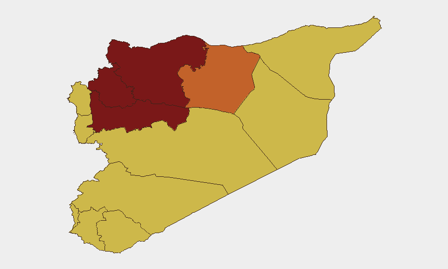
Hama Governorate (risk 100) and Aleppo Governorate (risk 94.9) head the sub-national ranking, reflecting ongoing conventional military and sectarian contestation in Syria's north-central and northern zones. Idleb and Damascus follow (80.1 and 79.4), driven by opposition-held/contested terrain and capital-city civil unrest respectively. South-western zones (Daraa, Quneitra, Rif Dimashq, and UNDOF area) cluster at risk 70, primarily due to Israeli cross-border activity and residual rebel presence. Raqqa's risk score (74.7) reflects ISIS capability and recurring attack patterns on government installations in the east.
How GeoBit Would Assist
Security teams should employ AOI Monitoring & Early Warning on Raqqa, Daraa, Quneitra, and Damascus to detect attack precursors and incursion patterns; Conflict & Military battle mapping and force-structure tracking to correlate Israeli operations with Syrian repositioning; and OSINT fusion (Telegram/Twitter monitoring, entity extraction, sentiment analysis) to identify sectarian rhetoric escalation and ISIS claim-of-responsibility timing. GIS & Spatial Analysis applied to fire incidents and Israeli incursion footprints enables pattern inference and route-risk modeling for personnel movement.
7-Day Outlook
ISIS attack tempo and Israeli ground incursion frequency are likely to persist at current levels absent major tactical shift; sectarian tensions in Damascus may produce additional localized civil unrest but are unlikely to destabilize regime security apparatus in the near term. Monitor Raqqa and Daraa for follow-on activity; watch Damascus Alawite and Sunni-mixed neighborhoods for further flashpoints.
Highest-Risk Areas — Ranked
| # | State / Region | Risk |
|---|---|---|
| 1 | Hama Governorate | 100 |
| 2 | Aleppo Governorate | 94.9 |
| 3 | Idleb Governorate | 80.1 |
| 4 | Damascus Governorate | 79.4 |
| 5 | Ar-Raqqa Governorate | 74.7 |
| 6 | Lattakia Governorate | 70 |
| 7 | Tartus Governorate | 70 |
| 8 | UNDOF | 70 |
| 9 | Al-Quneitra Governorate | 70 |
| 10 | Dar'a Governorate | 70 |
| 11 | Homs Governorate | 70 |
| 12 | Rif Dimashq Governorate | 70 |
Sources
Previous Daily Briefs
A new Syria brief is written every day — each with its own risk map and downloadable CSV. Here's the last week; use the calendar to go further back.
📅 Browse every day by calendar →
Highlighted days have a brief. Tap a day for that day's map & analysis, or “csv” for that day's dataset ($5).