Situation Summary
Tonga remains a low-threat environment (global rank #191, composite score 2) with no verified security incidents in the last 24–48 hours. Seismic activity continues in the region, with moderate earthquakes recorded in recent days, though no immediate damage or tsunami warnings have been reported. The security posture is stable across all island groups, with routine governance and law-enforcement operations ongoing.
Key Developments
- No discrete security, civil-unrest, crime, or political-instability incidents verified in the last 24–48 hours across Tonga.
- Seismic activity ongoing: Four moderate earthquakes recorded in recent days across the Tonga region; no confirmed damage, disruption, or tsunami warnings reported in the current window.
- Routine law-enforcement operations continue (anti-drug taskforce activity, ongoing investigations), but no new incidents or escalations reported in the last 48 hours.
Highest-Risk Areas
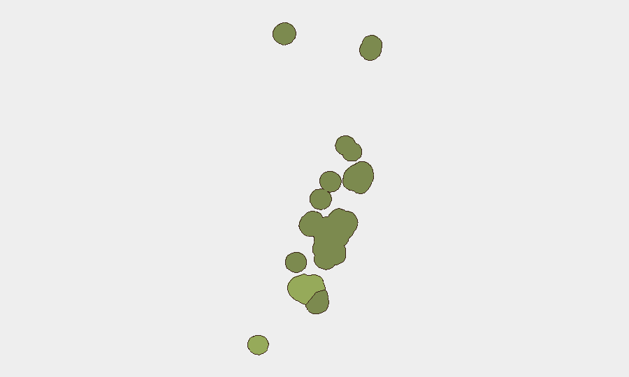
Tongatapu (composite risk 45) carries the highest sub-national risk score and should remain the focus of duty-of-care monitoring; as the capital region and economic center, it concentrates population, government facilities, and foreign personnel. Vavaʻu (risk 28) and Haʻapai (risk 22) present secondary risk levels, likely driven by geographic isolation, limited emergency infrastructure, and seismic vulnerability. ʻEua and Ongo Niua carry minimal scores. The risk gradient reflects infrastructure resilience and service-delivery capacity rather than active conflict or unrest.
How GeoBit Would Assist
Security teams should deploy AOI Monitoring & Early Warning on Tongatapu and secondary islands to detect emerging civil unrest, labor disputes, or political friction in real time. Multi-language OSINT and social-media monitoring (X, Telegram, local news) will provide early signals of supply-chain disruption, healthcare incidents, or maritime hazards. Environmental & Health intelligence and seismic/hazard monitoring will track ongoing earthquake activity and potential secondary risks (flooding, infrastructure damage) that could affect expatriate safety or business continuity.
7-Day Outlook
Tonga is expected to remain in a stable, low-incident posture over the next seven days. Seismic monitoring should continue, as regional earthquake activity may persist; however, no escalation to major civil, economic, or political crisis is anticipated. Routine governance and law-enforcement operations will continue; duty-of-care focus should remain on infrastructure resilience and expatriate communication protocols in the event of a significant seismic event.
Report Date: 2026-08-07
Data Cutoff: Last 24–48 hours (OSINT, news, social media)
Next Update: 2026-08-08
Highest-Risk Areas — Ranked
| # | State / Region | Risk |
|---|---|---|
| 1 | Tongatapu | 45 |
| 2 | Vavaʻu | 28 |
| 3 | Haʻapai | 22 |
| 4 | ʻEua | 18 |
| 5 | Ongo Niua | 12 |
Sources
Previous Daily Briefs
A new Tonga brief is written every day — each with its own risk map and downloadable CSV. Here's the last week; use the calendar to go further back.
📅 Browse every day by calendar →
Highlighted days have a brief. Tap a day for that day's map & analysis, or “csv” for that day's dataset ($5).
Atlas — our AI intelligence desk — emails them this snapshot personally. Nothing else, no list.