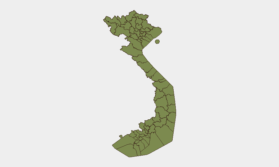
Situation Summary
Vietnam's overall security profile remains relatively stable at rank #151 globally (composite threat score 5.0), with no major nation-wide conflict, terrorism, or mass civil unrest reported in the last 48 hours. However, sub-national risk is heavily concentrated in Lai Châu Province (risk 32.7)—more than three times higher than any other region—signaling localized instability or recurring hazards. Recent diplomatic signals (multiple state disapprovals, demands, and public statements from 20–22 July involving US, EU, Australia, Japan, and South Korea) indicate external pressure on Vietnam, though the precise drivers remain opaque from available open reporting and require clarification via intelligence channels.
Key Developments
Unable to confirm verified security/travel-risk developments in the last 24–48 hours. Open web news and X/Twitter monitoring identified no reliably timestamped Vietnam security incidents (conflict, civil unrest, crime, infrastructure failure, or political instability) dated to 21–22 July 2026. Older incidents (flooding in Lai Châu on 17–18 July, mid-July demonstrations and police operations, police arrests in Ho Chi Minh City) fall outside the 48-hour window and are listed here for situational awareness only:
- Lai Châu Province flooding (17–18 July, >4 days ago): Flash flooding in Mường Than commune caused multiple deaths and missing persons, reflecting recurring natural-disaster risk in the northwest highlands.
- Mid-July civil unrest and police operations (15–17 July, >4 days ago): Demonstrations, police statements, arrests, and military deployments were reported; geopolitical context unclear from open sources.
- Ho Chi Minh City drug enforcement (date unclear, pre-22 July): Police arrests of dozens of suspects and seizure of ~1,700 e-cigarette pods containing etomidate; operational date not precisely confirmed.
Highest-Risk Areas
Lai Châu Province dominates the risk landscape with a composite score of 32.7—driven by geography (remote, mountainous northwest border region), recurring natural hazards (flooding, landslides), ethnic-minority populations, and limited infrastructure. The next tier (Huế, Ho Chi Minh City, Hà Nội) each score 10.2, reflecting urban-scale risks: density, protest/demonstration potential, and transnational visibility. Lower-ranked provinces (Hòa Bình, Vĩnh Long, and border regions) show moderate to minimal risk. For duty-of-care teams, Lai Châu warrants heightened environmental-hazard monitoring; major cities require civil-unrest and diplomatic-incident watch.
How GeoBit Would Assist
Security teams with personnel or assets in Vietnam should deploy Intel Sweep and multi-language OSINT feeds (including X/Twitter, Telegram, and regional open sources) to capture security developments within 4–8 hours of occurrence and distinguish verified incidents from older context. AOI Monitoring & Early Warning on Lai Châu Province and major urban centers (Hà Nội, Ho Chi Minh City, Huế) will detect emerging civil unrest, natural disasters, or diplomatic escalation. GIS & Spatial Analysis combined with Routing & Network Analysis can identify alternative travel routes and assess exposure in high-risk provinces during fluid situations.
7-Day Outlook
Diplomatic pressure from multiple Western and Asian states (US, EU, Australia, Japan, South Korea) may intensify Vietnam's internal political or regulatory environment over the coming week, though no immediate escalation to street-level unrest is evident. Lai Châu Province remains under close watch for seasonal flooding and associated casualties. Absence of recent major incidents suggests stability in the near term, but external diplomatic signals warrant continued monitoring for potential policy shifts or restrictions affecting business operations.
Highest-Risk Areas — Ranked
| # | State / Region | Risk |
|---|---|---|
| 1 | Lai Châu Province | 32.7 |
| 2 | Huế | 10.2 |
| 3 | Ho Chi Minh City | 10.2 |
| 4 | Hà Nội | 10.2 |
| 5 | Hòa Bình Province | 7.7 |
| 6 | Vĩnh Long Province | 5.2 |
| 7 | Lào Cai Province | 2.7 |
| 8 | Hà Giang Province | 2.7 |
| 9 | Tuyên Quang Province | 2.7 |
| 10 | Cao Bằng Province | 2.7 |
| 11 | Bắc Kạn Province | 2.7 |
| 12 | Điện Biên Province | 2.7 |
Sources
Previous Daily Briefs
A new Vietnam brief is written every day — each with its own risk map and downloadable CSV. Here's the last week; use the calendar to go further back.
📅 Browse every day by calendar →
Highlighted days have a brief. Tap a day for that day's map & analysis, or “csv” for that day's dataset ($5).
Atlas — our AI intelligence desk — emails them this snapshot personally. Nothing else, no list.