Situation Summary
Yemen remains at composite threat rank #14 globally with a score of 84, driven primarily by ongoing civil war and 22 tracked threat events. The past 48 hours have seen a sharp escalation in Houthi–Saudi tensions following an alleged Saudi attempt to intercept an Iranian civilian aircraft over Sanaa airspace on 3 July, with the Houthis issuing public threats to strike Saudi airports and vital infrastructure and the Saudi-led Coalition responding with warnings of "decisive and unprecedented" counteraction. This escalatory cycle—combined with reported airstrikes, arms interdictions, and heightened maritime security posture in adjacent waters—signals increased operational tempo and reduced diplomatic buffer across the conflict zone.
Key Developments
- Sanaa International Airport airspace, 3 July 2026: Houthi military spokesman Yahya Saree claimed air defenses thwarted a Saudi warplane incursion at 05:20 local time aimed at preventing an Iranian civilian aircraft landing; the claim was widely reported by Times of Israel and Al Jazeera and followed by explicit Houthi threats of retaliation.
- Houthi threat escalation, 3–4 July 2026 (nationwide): The Houthis publicly threatened to target Saudi airports and vital infrastructure on land and sea in response to the alleged airspace violation, framing the threat as defensive retaliation and distributing it across multiple media channels.
- Northern Yemen airstrikes, 4 July 2026: Houthi-aligned sources reported at least 27 Saudi airstrikes against targets in northern governorates within a 24-hour window, labeling the campaign a "dangerous escalation" linked to the Iranian aircraft dispute.
- Saudi-led Coalition statement, 4 July 2026: The Coalition to Restore Legitimacy issued a formal warning of a "decisive and unprecedented" response to any Houthi threat against Saudi territory, signaling intent to escalate if rhetoric translates to action.
- Bab el-Mandeb Strait interdiction, 4 July 2026: Security sources reported seizure of drone-manufacturing equipment destined for Houthi-controlled areas near the strait, indicating ongoing supply-chain targeting and potential enhancement of Houthi unmanned aerial capabilities.
- Gulf of Aden maritime security posture, 3–4 July 2026: Regional maritime reporting noted heightened armed security presence on commercial vessels, with foiled piracy attempts and normalized on-board armed guard deployment affecting shipping lanes adjacent to Yemen.
Highest-Risk Areas
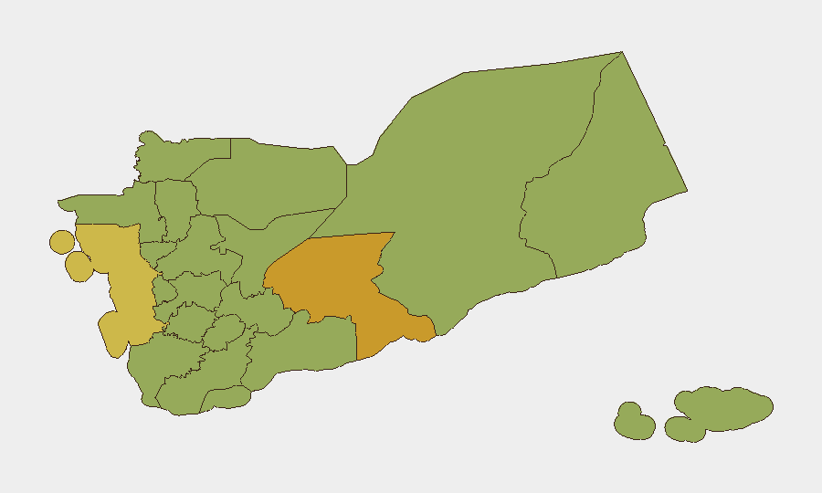
Amanat Al Asimah (Sanaa city and environs, risk 89.1) remains the critical flashpoint, hosting the international airport, seat of Houthi de facto administration, and the center of the current airspace dispute. Shabwah Governorate (71.6) is the second-highest-risk state, reflecting both Saudi-coalition military pressure and ongoing inter-faction conflict. The northern corridor—Sa'dah, Hajjah, Al Hudaydah, and 'Amran governorates (all 59.1–61.6)—forms a contiguous high-risk belt of Houthi-controlled territory subject to sustained coalition air operations. Personnel and assets in or transiting these areas face compounded risks from military action, weapons transfers, and humanitarian disruption.
How GeoBit Would Assist
Security teams should deploy AOI Monitoring & Early Warning on Amanat Al Asimah, Sanaa airport, and key Saudi border crossing points to detect escalation signals in real time. Conflict & Military battle mapping and Force Structure tracking will clarify coalition and Houthi disposition changes. Maritime & Aviation tracking combined with Routing & Network Analysis enables real-time avoidance of airspace incursions, shipping lane closures, and interdiction hotspots around Bab el-Mandeb.
7-Day Outlook
Escalation risk is elevated over the next week. If either the Houthis or Saudi-led Coalition translate public threats into new strikes or incursions, tit-for-tat strikes will likely accelerate, particularly targeting Sanaa airspace, airport infrastructure, and Saudi border facilities. Commercial aviation and maritime traffic face increased delays, interdictions, and security restrictions. De-escalation would require diplomatic intervention or demonstrated restraint by one party; absent either, operational tempo is forecast to remain high through mid-July.
Highest-Risk Areas — Ranked
| # | State / Region | Risk |
|---|---|---|
| 1 | Amanat Al Asimah | 89.1 |
| 2 | Shabwah Governorate | 71.6 |
| 3 | Al Hudaydah Governorate | 61.6 |
| 4 | Sa'dah Governorate | 59.1 |
| 5 | Hajjah Governorate | 59.1 |
| 6 | Al Mahwit Governorate | 59.1 |
| 7 | 'Amran Governorate | 59.1 |
| 8 | Sana'a Governorate | 59.1 |
| 9 | Raymah Governorate | 59.1 |
| 10 | Dhamar Governorate | 59.1 |
| 11 | Ibb Governorate | 59.1 |
| 12 | Ta'izz Governorate | 59.1 |
Sources
Previous Daily Briefs
A new Yemen brief is written every day — each with its own risk map and downloadable CSV. Here's the last week; use the calendar to go further back.
📅 Browse every day by calendar →
Highlighted days have a brief. Tap a day for that day's map & analysis, or “csv” for that day's dataset ($5).
Atlas — our AI intelligence desk — emails them this snapshot personally. Nothing else, no list.