Situation Summary
Central African Republic remains a complex operating environment with elevated security fragmentation. The country ranks #28 globally on GeoBit's composite threat index (score 62), with Bangui significantly outpacing all other administrative divisions in risk concentration (73.6 vs. 43.6 baseline across remaining regions). Signal activity on 2026-06-23 indicates cross-border military engagement involving Congo and rebel elements, alongside domestic banking/financial sector friction and isolated civil friction. The security trajectory remains volatile and localized rather than systematically deteriorating at the national level.
Key Developments
- 2026-06-23 | Bangui vicinity | Military engagement: Bi-directional conventional military force activity recorded between Congo-aligned forces and rebel actors; exact location and casualty figures require confirmation.
- 2026-06-23 | Status unclear | Small arms combat: Armed activity involving Congo reported; geographic specificity and scale unconfirmed by secondary sources.
- 2026-06-23 | Banking sector | Administrative friction: Central African Republic Senate imposed sanctions against the Central Bank; Central Bank subsequently rejected a banking institution's request. Operational and liquidity implications for corporate accounts require monitoring.
- 2026-06-23 | Domestic | Civil/religious friction: Catholic institutional actors rejected an aid group's assistance; motivation and scope indicate localized grievance but low immediate security impact.
Data integrity note: GeoBit's web research and external corroboration capability did not return verifiable incident reports in the last 24–48 hours beyond the signal feed listed above. Bangui's elevated risk score (73.6) reflects cumulative instability patterns since earlier in 2026 rather than acute escalation in the past 48 hours. Secondary confirmation of the military and armed activity signals is recommended before operational decisions.
Highest-Risk Areas
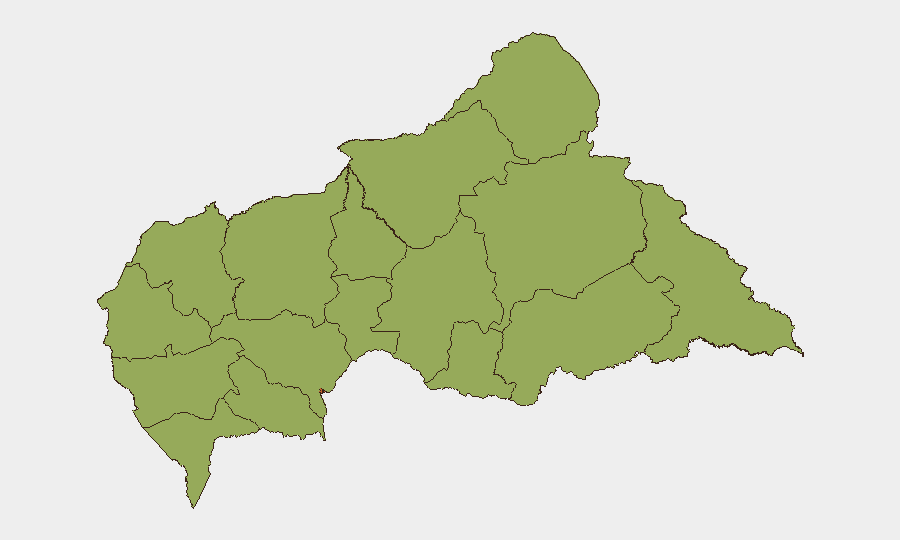
Bangui dominates the risk landscape by a factor of 1.7, driven by its role as the capital, primary commercial hub, and historical locus of factional friction and administrative volatility. All remaining 11 administrative divisions cluster at equivalent moderate-to-high baseline risk (43.6), suggesting either data aggregation of dispersed, lower-intensity instability or incomplete sub-national resolution. The eastern and northern border regions (Vakaga, Haute-Kotto, Mbomou, Haut-Mbomou) warrant elevated operational attention due to cross-border armed-group presence and mineral-extraction activity, though current signaling does not indicate acute flare-up outside Bangui.
How GeoBit Would Assist
Corporate security and duty-of-care teams operating in or transiting Central African Republic should prioritize: (1) AOI Monitoring & Early Warning with persistent watch on Bangui, border crossing points, and supply-route corridors to detect rapid escalation; (2) Intel Sweep and multi-language OSINT (X/Twitter, Telegram, local radio) to fill the 24-hour verification gap and corroborate military and banking-sector signals in real time; (3) Network & Actor Analysis to map armed-group and factional movements and forecast flashpoint timing; and (4) Routing & Network Analysis to identify and update safe transit corridors and alternative supply chains ahead of deterioration.
7-Day Outlook
No intelligence suggests imminent nationwide escalation. Bangui will remain the primary focus of risk; military and armed activity along Congo border will likely persist at current or incrementally lower levels unless diplomatic intervention occurs. Banking-sector friction may introduce operational delays or account-access restrictions; advance liquidity and vendor-payment planning is prudent. Persistent monitoring rather than immediate evacuation posture is warranted unless localized Bangui conditions degrade sharply.
Highest-Risk Areas — Ranked
| # | State / Region | Risk |
|---|---|---|
| 1 | Bangui | 73.6 |
| 2 | Bamingui-Bangoran | 43.6 |
| 3 | Vakaga | 43.6 |
| 4 | Haute-Kotto | 43.6 |
| 5 | Haut-Mbomou | 43.6 |
| 6 | Mbomou | 43.6 |
| 7 | Nana-Mambéré | 43.6 |
| 8 | Ouham-Pendé | 43.6 |
| 9 | Mambéré-Kadéï | 43.6 |
| 10 | Sangha-Mbaéré | 43.6 |
| 11 | Ouham | 43.6 |
| 12 | Nana-Grébizi | 43.6 |
Sources
Previous Daily Briefs
A new Central African Republic brief is written every day — each with its own risk map and downloadable CSV. Here's the last week; use the calendar to go further back.
📅 Browse every day by calendar →
Highlighted days have a brief. Tap a day for that day's map & analysis, or “csv” for that day's dataset ($5).