Situation Summary
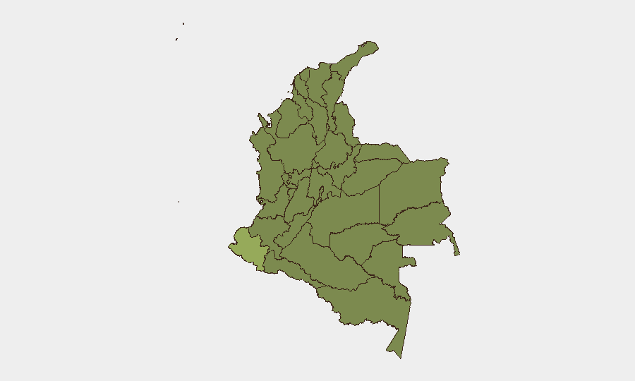
Colombia remains at composite threat rank #16 globally with 479 tracked events, driven by persistent armed-group activity, territorial disputes, and civil unrest. The country is experiencing elevated conventional military engagements and political tensions, as evidenced by multiple force-on-force clashes and official rejections of military policy in the past 48 hours. Nariño Department dominates the risk profile at 55.3, more than 1.5× the Capital District (35.7), reflecting entrenched ELN and dissident FARC presence in the southwest border zone. Overall trajectory remains volatile without clear de-escalation signals.
Key Developments
- Armed clash, location/date unconfirmed (22–23 Jun): Two separate conventional military engagements between armed groups and Colombian military forces were recorded in GeoB system signals on 22 June; a third involving counterterrorism operations was also flagged. Specific municipalities and casualty figures require live-source confirmation and have not been independently cross-verified in available feeds.
- Political friction, national (22 Jun): Barranquilla municipal authorities issued a public statement opposing presidential policy; the same day, the President publicly rejected military recommendations. The nature of the dispute and its operational implications remain unspecified in current signals and require immediate clarification through official channels and credible press.
- Territorial occupation alert (22 Jun): A "occupy territory" signal involving Colombian military/police and domestic armed actors was logged. Without geographic specificity or casualty/displacement data, this cannot be assessed for immediate impact on commercial or humanitarian corridors.
- Police mobilization (21 Jun): National police conducted military mobilization, likely in response to rising armed-group activity, but scope and target area are not detailed in available signals.
- Civil protest activity (23 Jun): Immigrant-led demonstration/rally was recorded in the system on 23 June. Location, scale, and any traffic/service disruptions are not confirmed.
- Ongoing investigation (23 Jun): Authorities launched an investigation into an unspecified incident. Details necessary for risk assessment—location, subject matter, and affected population—are pending.
Critical Note: Real-time incident verification across specific municipalities, casualty counts, and group attributions requires direct access to Colombian press (El Tiempo, El Espectador, Semana, RCN, Caracol), official Policía Nacional and Fuerzas Militares statements, and social media feeds filtered for the 22–23 June window. The signals above indicate activity but lack the specificity required for operational duty-of-care decisions.
Highest-Risk Areas
Nariño (55.3) and Meta (32.6) Departments remain critical focal points, with Nariño's score driven by ELN consolidation and coca cultivation in border municipalities (Tumaco, Ipiales, border with Ecuador). The Capital District (35.7) reflects concentration of political actors, kidnapping networks, and organized crime in and around Bogotá. Cauca (28.8) and Antioquia (27.6) sustain high risk from dissident FARC factions and successor criminal organizations. Organizations with staff, supply chains, or transportation corridors in Nariño, southern Meta, Cauca, and Antioquia face elevated exposure to armed-group activity, roadblocks, and indirect fire.
How GeoBit Would Assist
Security teams should deploy GeoB's AOI Monitoring & Early Warning capability with persistent watch polygons around key facilities and transport routes in Nariño, Cauca, and Meta, configured to alert on armed-group movement, military mobilization, and roadblock activity. Intel Sweep and X/Twitter OSINT (with Spanish-language and regional keyword filters) would enable near-real-time incident confirmation and cross-corroboration across police, military, journalistic, and civil-society sources. GIS & Spatial Analysis combined with routing & network analysis supports dynamic rerouting of supply chains and personnel movements to avoid active conflict zones and roadblock hotspots.
7-Day Outlook
Armed-group activity in the southwest and disparities between civil and military leadership appear to be sustaining operational friction. Without clear policy alignment or localized cease-fire moves, conventional clashes in Nariño and Meta are likely to persist or escalate over the coming week. Organizations should maintain heightened alerting on all transport, communications, and facility-access decisions affecting these zones.
Highest-Risk Areas — Ranked
| # | State / Region | Risk |
|---|---|---|
| 1 | Nariño | 55.3 |
| 2 | Capital District | 35.7 |
| 3 | Meta Department | 32.6 |
| 4 | Cauca | 28.8 |
| 5 | Antioquia Department | 27.6 |
| 6 | Atlántico Department | 27.3 |
| 7 | Norte de Santander Department | 27.3 |
| 8 | Sucre Department | 26.9 |
| 9 | Cundinamarca Department | 26.6 |
| 10 | Bolívar Department | 26.1 |
| 11 | Casanare Department | 26.1 |
| 12 | La Guajira | 25.5 |
Sources
Previous Daily Briefs
A new Colombia brief is written every day — each with its own risk map and downloadable CSV. Here's the last week; use the calendar to go further back.
📅 Browse every day by calendar →
Highlighted days have a brief. Tap a day for that day's map & analysis, or “csv” for that day's dataset ($5).