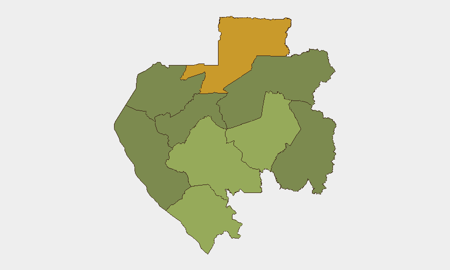
Situation Summary
Gabon remains a low-frequency, moderate-risk environment at the national level (global rank #102, composite score 9). No significant security incidents or unrest have been detected in the past 24–48 hours. Risk is concentrated in the northeastern and southeastern interior regions; the capital Libreville and coastal zones remain comparatively stable. Current trajectory reflects routine governance and economic activity with no indicators of acute destabilization.
Key Developments
- No confirmed security incidents, civil unrest, conflict, or crime events have been verified in Gabon during the past 24–48 hours. Recent web signals include routine government and corporate announcements (data center inauguration on 2026-07-03, ministerial field visits on 2026-07-05–06, and police/prison ceremonial events on 2026-07-07–08), none of which constitute security incidents or risk escalation.
Highest-Risk Areas
Woleu-Ntem Province (risk score 72) and Ogooué-Lolo Province (risk score 58) present Gabon's most acute sub-national risks and together account for a significant share of tracked events. Both regions border Cameroon and Equatorial Guinea and are subject to cross-border trafficking, smuggling, and limited state capacity. Ngounié Province (risk 48), Nyanga Province (risk 42), and Haut-Ogooué Province (risk 35) represent secondary risk zones, likely driven by remoteness, mining activity, and lower security infrastructure. Libreville and the coastal Estuaire Province (risk 15) remain substantially lower-risk, reflecting concentrated government presence and economic activity. Interior regions, particularly Ogooué-Ivindo (risk 0), show minimal tracked activity.
How GeoBit Would Assist
Security teams operating in Gabon should employ Intel Sweep and multi-language OSINT (X/Twitter, Telegram, local media) to monitor Woleu-Ntem and Ogooué-Lolo provinces for cross-border trafficking, smuggling, and instability signals. AOI Monitoring & Early Warning on high-risk provinces would provide persistent watch and automated alerting on emerging incidents, reducing response lag. GIS & Spatial Analysis paired with Routing & Network Analysis enables security teams to map safe corridors, identify choke points, and plan alternative evacuation/supply routes in remote mining or exploration areas. Quarterly Risk & Threat Assessment updates maintain current baseline awareness as conditions evolve.
7-Day Outlook
No acute triggers or escalation indicators are evident for the coming week. Routine governance, mining operations, and regional trade are expected to continue. Monitor Woleu-Ntem and Ogooué-Lolo for any emergence of cross-border incidents or localized unrest; the absence of events in the past 48 hours does not diminish the inherent structural risks in these regions.
Highest-Risk Areas — Ranked
| # | State / Region | Risk |
|---|---|---|
| 1 | Woleu-Ntem | 72 |
| 2 | Ogooué-Lolo Province | 58 |
| 3 | Ngounié Province | 48 |
| 4 | Nyanga Province | 42 |
| 5 | Haut-Ogooué Province | 35 |
| 6 | Moyen-Ogooué Province | 28 |
| 7 | Ogooué-Maritime Province | 25 |
| 8 | Estuaire Province | 15 |
| 9 | Ogooué-Ivindo | 0 |
Sources
Previous Daily Briefs
A new Gabon brief is written every day — each with its own risk map and downloadable CSV. Here's the last week; use the calendar to go further back.
📅 Browse every day by calendar →
Highlighted days have a brief. Tap a day for that day's map & analysis, or “csv” for that day's dataset ($5).
Atlas — our AI intelligence desk — emails them this snapshot personally. Nothing else, no list.