Situation Summary
Ghana remains a relatively stable operating environment in sub-Saharan Africa (global rank #108) but faces concentrated security challenges in its northern and central regions. Bono East Region dominates the threat profile with a composite risk score of 33.2—more than 50% higher than Greater Accra—driven by ongoing communal and resource-based conflicts. Recent event signals suggest elevated political and administrative tensions at the national level, compounded by infrastructure vulnerabilities exposed during recent flood events and ongoing concern over Ghanaian nationals' safety in xenophobic incidents abroad.
Key Developments
- National-level political and administrative tensions (2026-07-07 to 07-08): Multiple government, ministerial, and civil-society actors have issued public statements and disputes, including contested positions between government and opposition figures and between Ghana's leadership and international entities (EU). Specific operational impacts remain unclear from available reporting but warrant monitoring for labor, commercial, or administrative disruptions.
- Interior Ministry security messaging (date unclear, recent): Ghana's Interior Minister and National Security officials have publicly discussed firearms regulations and warned against civilian acquisition of weapons, framed as response to perceived insecurity concerns. The messaging suggests authorities perceive sufficient public anxiety to warrant reassurance campaigns, though the precise triggering incident(s) are not clearly dated in available sources.
- Ongoing flood recovery and infrastructure risk (weeks prior to 2026-07-08): At least 13 deaths and significant displacement have occurred in recent weeks, with Accra and other areas still in recovery. Flood-related disruptions to supply chains, utilities, and movement corridors remain active risk factors for corporate operations and personnel safety.
- Ghanaian evacuation planning from South Africa (reported recently, exact date unclear): Ghana has reportedly postponed bilateral meetings with South Africa and is preparing to evacuate approximately 300 Ghanaian nationals due to xenophobic violence. This signals concern for diaspora safety and potential reputational/diplomatic consequences for Ghana-South Africa commercial ties.
- Bawku communal violence (background context, not current): Upper East Region has experienced protracted clashes between Mamprusi and Kusasi groups since at least 2022–2023, with approximately 200 deaths recorded by 2023 and recurring cycles. This remains a structural risk in the region but does not represent a new incident within the last 24–48 hours.
*Note: Additional reports of armed attacks in Odomi (Oti Region) and police-civilian clashes circulated on social media within the review window but lack verifiable timestamps and corroborating coverage, so are not included as confirmed current developments.*
Highest-Risk Areas
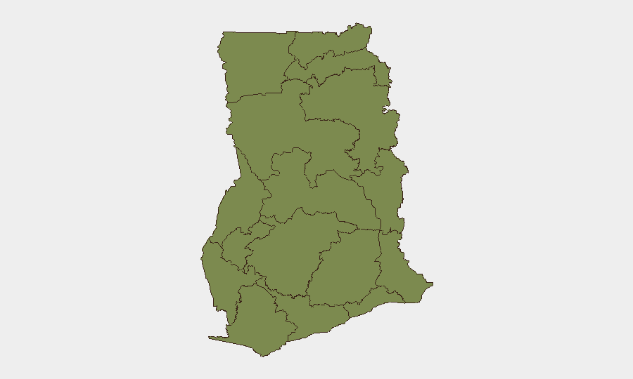
Bono East Region's threat score of 33.2 reflects resource competition, communal tensions, and limited state security capacity in a relatively remote zone. Greater Accra (21.2) carries risk from urban crime, infrastructure vulnerability (as evidenced by flood exposure), and concentration of government/commercial targets. Volta Region (15.2) shows elevated risk linked to border dynamics and communal disputes. The gap between the top three regions and the remainder suggests risk is geographically concentrated; organizations with staff or assets outside these three areas face materially lower event probability, though baseline vigilance remains warranted.
How GeoBit Would Assist
Security teams should deploy AOI Monitoring & Early Warning on Bono East and Greater Accra to detect emerging incidents in real time. OSINT fusion (X/Twitter, Telegram, local news) combined with sentiment & temporal analysis can clarify the intent and scale of current political tensions before they affect operations. GIS & Spatial Analysis linked to flood recovery data will help prioritize supply-chain and personnel routing away from vulnerable infrastructure corridors.
7-Day Outlook
Political and administrative tensions are likely to persist or clarify over the next week as government and civil-society actors continue public discourse. No imminent nationwide security collapse is indicated, but localized risks in Bono East and communal hotspots (Upper East, Oti) will remain elevated. Personnel and asset movements should factor regional risk variation and monitor official Ghana security advisories for any changes to travel or operations guidance.
Highest-Risk Areas — Ranked
| # | State / Region | Risk |
|---|---|---|
| 1 | Bono East Region | 33.2 |
| 2 | Greater Accra Region | 21.2 |
| 3 | Volta Region | 15.2 |
| 4 | Eastern Region | 9.2 |
| 5 | Upper East Region | 6.2 |
| 6 | Upper West Region | 3.2 |
| 7 | Savannah Region | 3.2 |
| 8 | North East Region | 3.2 |
| 9 | Northern Region | 3.2 |
| 10 | Oti Region | 3.2 |
| 11 | Bono Region | 3.2 |
| 12 | Ahafo Region | 3.2 |
Sources
Previous Daily Briefs
A new Ghana brief is written every day — each with its own risk map and downloadable CSV. Here's the last week; use the calendar to go further back.
📅 Browse every day by calendar →
Highlighted days have a brief. Tap a day for that day's map & analysis, or “csv” for that day's dataset ($5).
Atlas — our AI intelligence desk — emails them this snapshot personally. Nothing else, no list.