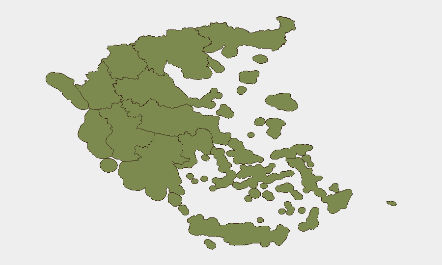
Situation Summary
Greece remains at moderate composite threat level (rank #141 globally, score 5/10) but faces elevated near-term risk from concurrent environmental and public-safety pressures. Wildfires, extreme heat, and mass holiday travel are the primary drivers of operational disruption and infrastructure strain over the next 72 hours. Criminal enforcement against wildfire-related offenses has intensified, and several geopolitical signal events (Iran–UAE military activity, Greece–Russia relations, UN statements) are being tracked but show no direct operational nexus to Greece-based incidents at this time.
Key Developments
- Attica, Crete, Northern Aegean – 18 July 2026
Extreme wildfire risk warnings issued; 35 wildfires reported nationwide in 24 hours with fires near populated areas in Evia and Boeotia. Authorities warn of potential evacuations, smoke impact, and road/transport closures.
- Nationwide – 18 July 2026
First major heat wave forecast to begin 21 July, with inland temperatures reaching 42°C. Compounding effect on wildfire spread, power-grid stability, and health-system capacity expected.
- Multiple sites (Northern Greece) – 18 July 2026
Police arrested 197 individuals this wildfire season for negligent burning and suspected arson, with a record number of arrests in the past 48 hours. Ongoing criminal investigations active in affected regions.
- Mouries station, Thessaloniki–Serres rail line (Central Macedonia) – 18 July 2026
Train breakdown with 61 passengers; replacement bus service deployed. Reflects regional rail infrastructure vulnerability during peak-travel period.
- Port of Piraeus and Athens ports (Attica) – 18 July 2026
Over 100,000 travelers departing for islands as July holiday exodus peaks. High crowding and exposure risk coinciding with elevated fire and heat conditions on island routes.
- Vrilissia, Athens suburbs (Attica) – 18 July 2026
Dog attack resulting in injury to 66-year-old; owner arrested on bodily-harm charges. Routine public-safety incident but illustrative of underlying low-level crime activity in metropolitan Attica.
Highest-Risk Areas
Central Greece dominates the risk landscape (score 31.8), primarily driven by active wildfire and heat exposure in Attica, Evia, and surrounding regions. Attica (score 11) is the second-highest-risk zone due to urban population density, critical port infrastructure, and concurrent wildfire threat during peak tourist season. The Peloponnese, South Aegean, and Thessaly carry secondary but material risk linked to wildfire, heat stress, and transport fragility. Island destinations and ferry routes face compounded risk from simultaneous heat, fire, and mass passenger movement.
How GeoBit Would Assist
AOI Monitoring & Early Warning would track wildfire progression, evacuation zones, and infrastructure outages in Central Greece and Attica in near real-time, with automated alerts on crossing thresholds (fire approach to ports, airport, or major roads). GIS & Spatial Analysis combined with Routing & Network Analysis would enable security teams to model alternative travel routes, port-access corridors, and evacuation scenarios for personnel and assets during heat-wave and fire conditions. Environmental & Health data feeds would provide authoritative temperature, air-quality, and infrastructure-stress forecasts to inform duty-of-care decisions on personnel movement and site operations.
7-Day Outlook
Heat-wave onset (21 July) will elevate wildfire risk and infrastructure strain through at least 24 July; transport delays and crowding on ferries and regional rail are highly probable. Holiday-season mass movement will persist through month-end, maintaining elevated exposure for corporate personnel in transit to/from islands and tourism zones. Risk is expected to plateau or gradually decline after 25 July if heat subsides and wildfire containment improves; continued monitoring of Central Greece and Attica remains essential.
Highest-Risk Areas — Ranked
| # | State / Region | Risk |
|---|---|---|
| 1 | Central Greece | 31.8 |
| 2 | Attica | 11 |
| 3 | Peloponnese Region | 4.4 |
| 4 | South Aegean | 3.8 |
| 5 | Thessaly | 3 |
| 6 | Eastern Macedonia and Thrace | 2.5 |
| 7 | Epirus | 2.5 |
| 8 | Ioanian Islands | 2.2 |
| 9 | Western Macedonia | 2 |
| 10 | Northern Aegean | 2 |
| 11 | Central Macedonia | 1.8 |
| 12 | Western Greece | 1.8 |
Previous Daily Briefs
A new Greece brief is written every day — each with its own risk map and downloadable CSV. Here's the last week; use the calendar to go further back.
📅 Browse every day by calendar →
Highlighted days have a brief. Tap a day for that day's map & analysis, or “csv” for that day's dataset ($5).
Atlas — our AI intelligence desk — emails them this snapshot personally. Nothing else, no list.