Situation Summary
Guatemala faces elevated but fragmented security pressures, with violent crime concentrated in specific departments while nationwide infrastructure disruptions remain episodic. A targeted homicide in rural Escuintla, ongoing road blockades in Izabal, and heightened police presence at financial institutions reflect concurrent but disconnected threats: criminal violence, protest-driven infrastructure disruption, and petty crime opportunity during bonus-payment season. The active state of prevention across six departments provides security forces expanded authority but also increases friction points for civilians and transiting personnel.
Key Developments
- La Democracia, Escuintla – 31 July 2026. Four individuals found shot dead in a pickup truck on a rural road near aldea Las Delicias; a two-year-old passenger was unharmed. Classified as a targeted armed attack; indicates elevated lethality on secondary routes in Escuintla.
- RN-7E, Izabal – 31 July–1 August 2026. Civil roadblock ongoing on RN-7E affecting vehicle circulation; cause linked to local protest or community action under the active state of prevention. Franja Transversal del Norte at km 366.7 was cleared and traffic resumed, but dynamic conditions persist on this critical freight corridor.
- Nationwide banking corridors – 31 July–1 August 2026. PNC intensified security deployments at banks, ATMs, and commercial centers under operation "Bono 14 Seguro" to prevent cash-related robberies and assaults during the annual labor bonus payment cycle. Deployments concentrated in Guatemala City and departmental capitals.
- 24 Calle, Zona 4, Guatemala City – 1 August 2026. Six-vehicle traffic accident caused by a truck failing to climb a slope; resulted in short-term congestion and emergency response activity but no criminal element indicated.
- Statewide enforcement environment – ongoing. State of prevention remains active in Guatemala, Petén, Escuintla, Izabal, San Marcos, and Huehuetenango, expanding checkpoint authority and enabling rapid dispersal of gatherings; directly correlates with roadblock and protest incidents.
Highest-Risk Areas
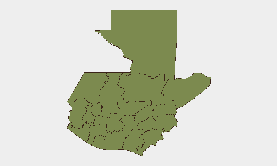
Quetzaltenango dominates the sub-national risk ranking with a composite score of 31.3—approximately 24 times higher than all other monitored departments, which cluster near 1.3. This disparity suggests concentrated criminal activity, likely linked to trafficking networks or organized gang presence, rather than distributed risk across the country. The remaining high-risk departments (Petén, Huehuetenango, San Marcos, and the western highlands) show baseline elevation but warrant monitoring for secondary shifts. Recent homicide and blockade incidents in Escuintla and Izabal, while serious, do not yet register equivalent to Quetzaltenango's persistent threat level, indicating those events may reflect localized rather than systemic departmental risk.
How GeoBit Would Assist
Corporate security teams should deploy AOI (Area-of-Interest) Monitoring & Early Warning on Quetzaltenango, Escuintla, and Izabal to capture emerging roadblocks, checkpoints, and violent incidents in near-real time. Routing & Network Analysis capabilities enable identification of alternative travel corridors away from RN-7E and secondary rural routes subject to sudden closure or armed activity. Integration of Intel Sweep (multi-language local news feeds, X/Twitter OSINT, and entity extraction) with Risk & Threat Assessment maintains daily updates on the state of prevention's enforcement tempo and protest-linked infrastructure disruptions.
7-Day Outlook
The state of prevention is expected to remain in effect through early August, sustaining elevated checkpoints and roadblock risk, particularly in Izabal and the western departments. Criminal violence in Quetzaltenango and isolated homicides in Escuintla are unlikely to abate without targeted law-enforcement escalation; personnel transiting secondary routes should assume heightened armed-attack risk. Bono 14 payment operations conclude within days, after which police deployments at financial institutions will likely normalize.
Highest-Risk Areas — Ranked
| # | State / Region | Risk |
|---|---|---|
| 1 | Quetzaltenango | 31.3 |
| 2 | Petén | 1.3 |
| 3 | Huehuetenango | 1.3 |
| 4 | San Marcos | 1.3 |
| 5 | Retalhuleu | 1.3 |
| 6 | Quiché | 1.3 |
| 7 | Alta Verapaz | 1.3 |
| 8 | Totonicapán | 1.3 |
| 9 | Sololá | 1.3 |
| 10 | Chimaltenango | 1.3 |
| 11 | Suchitepéquez | 1.3 |
| 12 | Sacatepéquez | 1.3 |
Sources
Previous Daily Briefs
A new Guatemala brief is written every day — each with its own risk map and downloadable CSV. Here's the last week; use the calendar to go further back.
📅 Browse every day by calendar →
Highlighted days have a brief. Tap a day for that day's map & analysis, or “csv” for that day's dataset ($5).
Atlas — our AI intelligence desk — emails them this snapshot personally. Nothing else, no list.