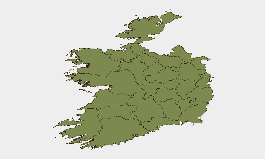
Situation Summary
Ireland remains a low-threat environment with a composite threat score of 9 globally (rank #107) and no verifiable, corroborated security incidents reported in the last 24–48 hours across major news, social, and official channels. Sub-national risk concentration is heavily skewed toward County Tipperary (31.5) and County Dublin (29.6), with all other tracked regions scoring substantially lower. The current trajectory is stable, with no indicators of acute physical-security events, civil unrest, infrastructure disruption, or travel restrictions affecting corporate operations.
Key Developments
No verifiable incidents meeting professional reporting thresholds (location-specific, corroborated, within last 24–48 hours) have been identified in Ireland during the current assessment window. Open-source monitoring of Irish national media, Garda communications, and social platforms confirms the absence of confirmed bomb threats, armed incidents, major protests, or terrorism-related events in the past two days.
Signal-level activity detected by GeoBit algorithms (hospital-related unconventional violence references, small-arms-combat tags, and gang-disapproval statements dated 2026-07-05 and 2026-07-06) has not been independently corroborated by news outlets, official law-enforcement statements, or multiple independent sources and therefore does not meet the threshold for inclusion as a discrete current incident. Background diplomatic and legislative statements from July 4 (ministerial comments, demand announcements, and Irish/EU bilateral friction) reflect routine governance activity and do not indicate acute security escalation.
Highest-Risk Areas
County Tipperary (31.5) and County Dublin (29.6) account for approximately 83% of Ireland's composite risk score, a significant concentration indicating that corporate security focus should prioritize these regions. Dublin's elevated risk likely reflects urban density, higher crime reporting density, and proximity to critical national infrastructure and diplomatic presence. Tipperary's notably higher score warrants investigation into underlying drivers (organized-crime networks, gang activity, or weapons trafficking patterns). All remaining counties score below 10, with the bottom eight effectively at baseline. Organizations with people or assets in Tipperary or Dublin should maintain proportionally higher monitoring and duty-of-care protocols.
How GeoBit Would Assist
Corporate security teams protecting operations in Ireland should employ AOI (Area-of-Interest) Monitoring & Early Warning focused on County Tipperary and Dublin postal codes to detect emerging threats with automated alerting before public awareness. OSINT Fusion & Corroboration (X/Twitter, Telegram, news feeds, and social-sentiment analysis) combined with Entity & Network Analysis would distinguish signal noise from genuine security events and track organized actors. Routing & Network Analysis would enable real-time alternative-journey planning for personnel and supply chains should localized disruptions materialize in high-risk areas.
7-Day Outlook
No indicators suggest material security deterioration in Ireland over the next seven days. Standard monitoring for gang-activity escalation in Tipperary and Dublin should continue, with particular attention to any convergence of multiple independent reporting sources (news, law-enforcement, social sentiment) that would signal a shift from current baseline. Corporate duty-of-care teams should maintain routine protocols without elevated alert status unless corroborated incidents emerge.
Highest-Risk Areas — Ranked
| # | State / Region | Risk |
|---|---|---|
| 1 | County Tipperary | 31.5 |
| 2 | County Dublin | 29.6 |
| 3 | County Offaly | 8 |
| 4 | County Donegal | 2 |
| 5 | County Roscommon | 2 |
| 6 | County Laois | 2 |
| 7 | County Mayo | 1.5 |
| 8 | County Sligo | 1.5 |
| 9 | County Galway | 1.5 |
| 10 | County Clare | 1.5 |
| 11 | County Limerick | 1.5 |
| 12 | County Leitrim | 1.5 |
Sources
Previous Daily Briefs
A new Ireland brief is written every day — each with its own risk map and downloadable CSV. Here's the last week; use the calendar to go further back.
📅 Browse every day by calendar →
Highlighted days have a brief. Tap a day for that day's map & analysis, or “csv” for that day's dataset ($5).
Atlas — our AI intelligence desk — emails them this snapshot personally. Nothing else, no list.