Situation Summary
Kenya's composite threat score of 67 places it at #25 globally, with 52 tracked security events. The security environment is characterized by persistent terrorist activity in the north and northeast, civil unrest risk in urban centres, and logistical disruption from transport strikes. Nairobi County dominates sub-national risk (77.2), while Mandera and the border belt remain zones of active militant engagement and heightened counterterrorism operations.
Key Developments
- Mandera County, Wantey Dam / Lafey area – 28 July 2026: Suspected al-Shabaab militants ambushed a Special Operations Group patrol near Wantey Dam, killing five Kenyan security personnel and destroying an armoured vehicle with an IED during a reinforcement response. This represents a significant tactical success for militant actors and signals continued capacity for coordinated multi-phase attacks in the border corridor.
- Mandera County, Fino / Arabia / Asharaf border belt – 24 July 2026, operations ongoing: Kenyan police repelled coordinated al-Shabaab attacks on the Fino security camp and Arabia area; one student was injured. Active security operations continue through end-July, with elevated military/police presence and movement restrictions.
- Nairobi CBD – 30 July 2026: Heavy police presence and roadblocks established at Nairobi West roundabout (Lang'ata Road) and Jogoo Road in anticipation of Saba Saba-related protests. Traffic disruption and risk of crowd control operations and confrontations in the city centre remain elevated.
- National travel advisories – 29–30 July 2026: Germany, Canada and other foreign ministries reiterated or updated "avoid all travel" guidance for Mandera, Wajir, Garissa, Lamu and parts of Baringo, West Pokot, Turkana and Tana River, citing terrorist attacks, kidnapping and armed banditry risks.
- Marsabit County – late July 2026: Interior Cabinet Secretary Kipchumba Murkomen extended the designation of 13 areas as "dangerous and security-disturbed" for a further 30 days due to banditry, inter-communal violence and cross-border insecurity. This signals intensified security operations, roadblocks and movement restrictions.
- Nationwide public transport – late July 2026: A matatu strike over fuel prices has disrupted urban and inter-city transport, increasing crowd congestion, spontaneous protest risk and opportunistic crime at major bus termini.
- Kenya cyber incident – mid-July, mitigation ongoing: The Ministry of Information confirmed a cybersecurity incident affecting the Presidential website; access was temporarily restricted during forensics and restoration. No data exfiltration confirmed, but cyber-risk to government infrastructure remains under active mitigation.
Highest-Risk Areas
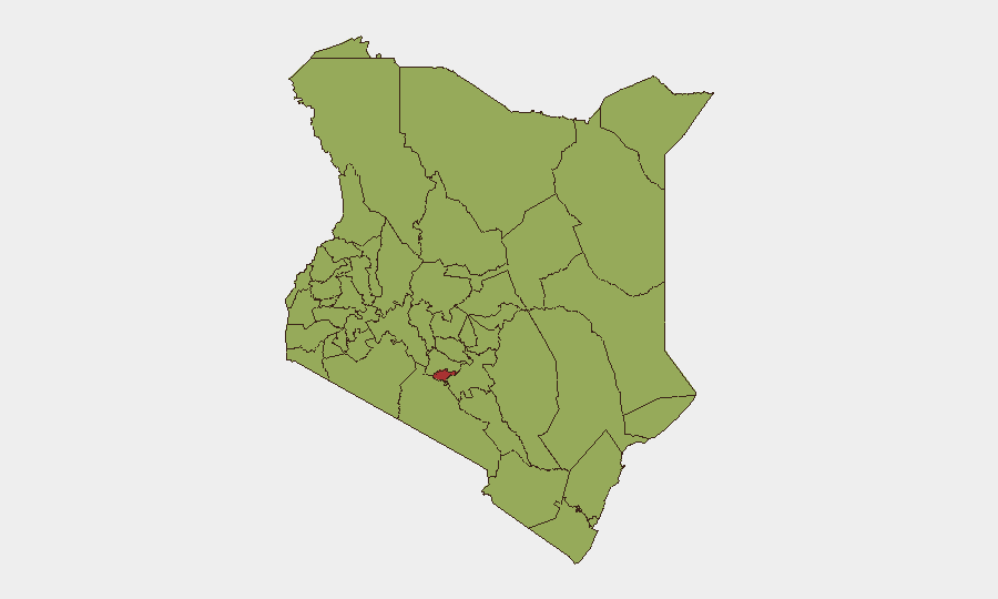
Nairobi County (77.2) dominates the risk ranking, driven by protest mobilization around civic dates (Saba Saba), transport disruption, and ongoing crime pressure. Kajiado, Kwale and the western/rift-valley cluster (Busia, Kakamega, Vihiga, Nandi, Elgeyo-Marakwet, Uasin Gishu, Baringo, Laikipia, Meru) all register moderate-to-elevated composite scores (47.2–49.7), reflecting inter-communal tensions, banditry and cattle-rustling activity. However, Mandera County—though not listed in the top 12—is driving the most acute tactical threat via al-Shabaab operations and should be treated as a highest-priority exclusion zone.
How GeoBit Would Assist
Security teams would deploy AOI Monitoring & Early Warning on Nairobi CBD, Mandera border belt and designated security-disturbed zones to detect protest mobilization, militant activity and roadblock deployment in real-time. Routing & Network Analysis would identify safe alternative transport corridors during the matatu strike and around roadblock clusters. OSINT fusion across Telegram, social media and local news feeds would provide early signals of protest escalation and transport-sector developments before they impact staff movement.
7-Day Outlook
Al-Shabaab is likely to sustain ambush and IED activity in Mandera and Wajir through early August, prompting continued police/military presence and access restrictions. Saba Saba-related demonstrations in Nairobi are expected to persist or intensify, with elevated police response and potential for scattered clashes. Transport disruption will remain a secondary constraint on mobility in urban and inter-city corridors.
Highest-Risk Areas — Ranked
| # | State / Region | Risk |
|---|---|---|
| 1 | Nairobi County | 77.2 |
| 2 | Kajiado County | 49.7 |
| 3 | Kwale | 48.4 |
| 4 | Busia County | 47.2 |
| 5 | Kakamega County | 47.2 |
| 6 | Vihiga County | 47.2 |
| 7 | Nandi County | 47.2 |
| 8 | Elgeyo-Marakwet County | 47.2 |
| 9 | Uasin Gishu County | 47.2 |
| 10 | Baringo | 47.2 |
| 11 | Laikipia County | 47.2 |
| 12 | Meru County | 47.2 |
Sources
Previous Daily Briefs
A new Kenya brief is written every day — each with its own risk map and downloadable CSV. Here's the last week; use the calendar to go further back.
📅 Browse every day by calendar →
Highlighted days have a brief. Tap a day for that day's map & analysis, or “csv” for that day's dataset ($5).
Atlas — our AI intelligence desk — emails them this snapshot personally. Nothing else, no list.