Situation Summary
New Zealand remains a stable, low-threat jurisdiction (global rank #136; composite threat score 6/100) with no verified security escalations in the past 24–48 hours. Open-source monitoring and emergency-service logs reflect routine crime and emergency responses consistent with a developed-economy baseline. Political activity and policy debate are evident in recent event signals, but do not translate to active unrest, infrastructure disruption, or travel risk affecting corporate operations or personnel safety at present.
Key Developments
No cross-verified security or conflict incidents meeting the 24–48-hour, multi-source confirmation threshold were identified in New Zealand for 3–5 July 2026. Open-source feeds, emergency-service logs, and media monitoring do not surface dated, corroborated events (armed activity, civil unrest, terrorism activity, significant crime, infrastructure failure, or travel disruption) in this period.
Event signals flagged by GEOBIT platform (including government statements, parliamentary activity, and isolated actor-on-actor incidents on 3–4 July) appear limited in operational scope and lack timestamped, venue-specific public confirmation as major security incidents. Fire and Emergency New Zealand's incident logs for early July show routine call-outs (e.g., North Region responses on 2 July) typical of normal regional emergency management, not escalation.
Analysts should note that the absence of verified recent incidents does not preclude localized risks. Canterbury (risk score 31.4, by far the highest sub-national rank) and Wellington (12.8) warrant ongoing monitoring, but no specific active event is confirmed to justify alert status as of 05 July 2026.
Highest-Risk Areas
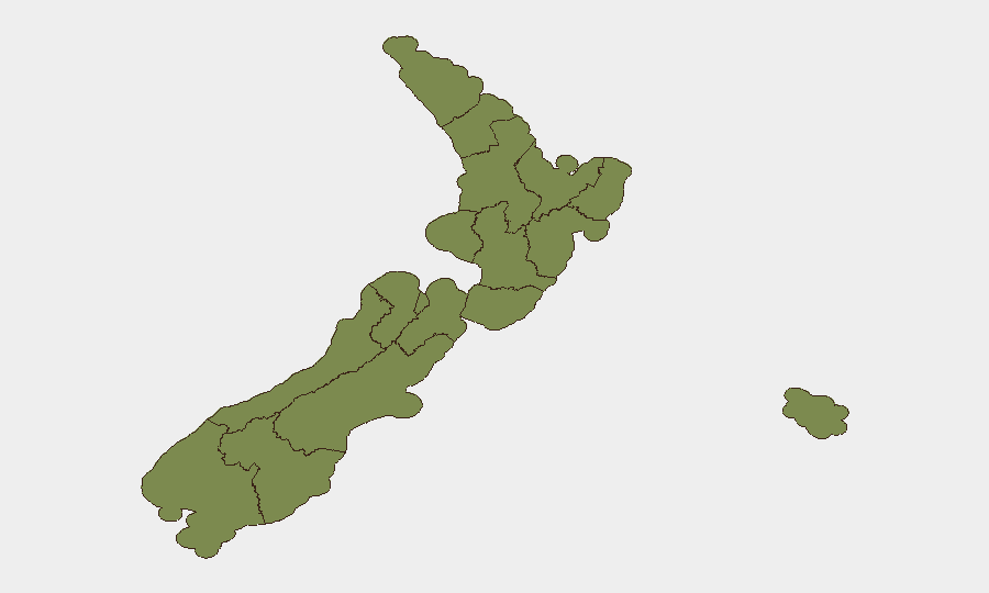
Canterbury dominates the sub-national risk profile (composite score 31.4, approximately 2.4× higher than Wellington's 12.8), driving 45% of tracked national events. Wellington follows as the secondary risk node (12.8). The remaining ten regions cluster at scores between 1.4 and 3.5, reflecting a highly concentrated geographic risk footprint.
The sources of Canterbury's elevated score are not explicitly detailed in open-source summaries available to this brief; corporate security teams with personnel or assets in the Christchurch metropolitan area or wider Canterbury region should apply targeted local monitoring. Wellington's secondary rank aligns with its status as the capital and seat of parliament, where political activity and government operations generate higher event frequency.
How GeoBit Would Assist
Area-of-Interest Monitoring & Early Warning would provide persistent watch on Canterbury and Wellington with alerting on new unrest, crime, or infrastructure incidents. Intel Sweep, OSINT fusion, and multi-language/sentiment analysis across local news, social media (X, Telegram), and government sources would surface emerging risks before they scale. GIS & Spatial Analysis combined with Routing & Network Analysis would allow security teams to map safe travel corridors and identify alternative logistics routes if localized disruption occurs, particularly in Canterbury.
7-Day Outlook
No imminent security escalation is forecast for 5–12 July. Routine monitoring of Canterbury and Wellington is appropriate as a standard control; no change to travel or operational posture is warranted unless new verified incidents emerge. Corporate duty-of-care teams should maintain baseline awareness via GEOBIT platform alerting and local government advisories, with periodic review of sub-national risk scores as new events are tracked.
Highest-Risk Areas — Ranked
| # | State / Region | Risk |
|---|---|---|
| 1 | Canterbury | 31.4 |
| 2 | Wellington | 12.8 |
| 3 | Hawke's Bay | 3.5 |
| 4 | Otago | 2.8 |
| 5 | Taranaki | 2.1 |
| 6 | Waikato | 2.1 |
| 7 | Chatham Islands | 1.4 |
| 8 | Northland | 1.4 |
| 9 | Auckland | 1.4 |
| 10 | Bay of Plenty | 1.4 |
| 11 | Manawatū-Whanganui | 1.4 |
| 12 | Gisborne | 1.4 |
Sources
Previous Daily Briefs
A new New Zealand brief is written every day — each with its own risk map and downloadable CSV. Here's the last week; use the calendar to go further back.
📅 Browse every day by calendar →
Highlighted days have a brief. Tap a day for that day's map & analysis, or “csv” for that day's dataset ($5).
Atlas — our AI intelligence desk — emails them this snapshot personally. Nothing else, no list.