Situation Summary
Oman is experiencing acute maritime and territorial security escalation following Iranian military strikes on commercial shipping and infrastructure in and near Omani waters over July 13–14, 2026. At least three commercial vessels have been struck by missile fire in the Strait of Hormuz and adjacent shipping lanes, with confirmed casualties among international crews. Musandam Governorate and Al Wusta (Duqm) are designated highest-risk zones; U.S. Embassy guidance includes shelter-in-place advisories for certain areas. The trajectory indicates sustained regional military activity with direct impact on Oman's sovereignty, civilian infrastructure, and international maritime traffic.
Key Developments
- Mombasa & Al Bahiyah tankers, Strait of Hormuz southern lane (Omani waters) – July 13, 2026: Two Emirati oil tankers struck by Iranian cruise missiles; one Indian crew member killed, eight wounded (six Indian, two Ukrainian); fires contained. Described by UAE Ministry of Defence as part of deliberate strait escalation.
- Stolt Magnesium tanker, ~13 nm SE of Limah, Musandam Governorate – July 14, 2026: Commercial tanker hit by missile/external explosive device on southbound shipping route off northern Oman coast. UK Maritime Trade Operations (UKMTO) issued maritime warning; investigation ongoing.
- Musandam Governorate drone strikes – July 12–14, 2026: Multiple unmanned aerial vehicle attacks on sites across Musandam acknowledged by Omani state news agency. Government statement confirms implementation of "all necessary measures" to safeguard residents and critical infrastructure.
- Strait of Hormuz shipping corridor – July 13–14, 2026: Security analysis cites U.S. Central Command reporting minimum three commercial vessels attacked within 24-hour period along Oman-side route; assessed as Iranian attempt to deter traffic on southern lane, elevating maritime risk for all transiting vessels.
- International Maritime Organization concern – July 13, 2026 (Monday night): IMO via UN Secretary-General's noon briefing expresses grave concern over "latest attacks on shipping in and around the Strait of Hormuz," confirming at least two seafarer fatalities and multiple injuries aligned with Omani territorial waters incidents.
- Omani government statements – July 14, 2026: Ministry of Defence condemns attacks; public statements signal heightened alert status. Travel advisories updated to reflect acute security escalation, airstrikes, and drone activity in northern zones.
Highest-Risk Areas
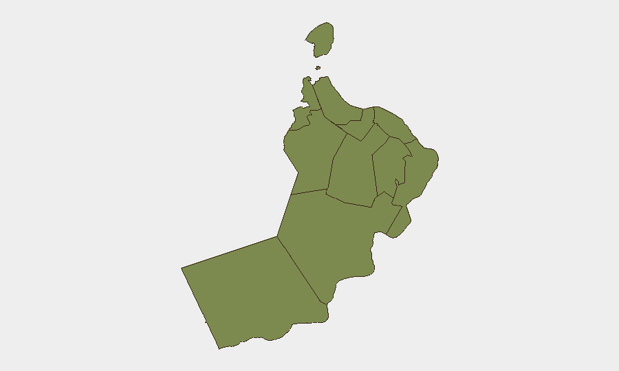
Al Wusta Governorate dominates the sub-national risk ranking (31.5), reflecting its geographic proximity to the central Arabian Sea and confirmed drone activity targeting infrastructure. Musandam Governorate (9.6) is second and represents the immediate flashpoint: northern exclave hosting critical maritime chokepoint traffic, active drone strikes, and missile attacks on shipping within past 48 hours. Ash Sharqiyah South (6.6) and Muscat (5.5) follow at reduced but material risk. All remaining governorates register baseline threat (1.5). The concentration of high-risk scores in Al Wusta and Musandam reflects sustained Iranian military operations targeting both territorial infrastructure and commercial shipping lanes—a pattern likely to persist.
How GeoBit Would Assist
Real-time Maritime & Aviation tracking combined with AOI Monitoring & Early Warning would enable continuous watch on vessel movements, missile launches, and drone activity across the Strait of Hormuz and Omani territorial waters, with alerting on imminent threats. GIS & Spatial Analysis and Satellite & Imagery analysis would map strike patterns, assess infrastructure damage, and support damage assessment and business continuity planning. Multi-language OSINT fusion (X/Twitter, Telegram, official statements) and Network & Actor Analysis would track evolving Iranian intent, Omani government response, and regional military posture shifts to support forward planning.
7-Day Outlook
Iranian military operations against shipping and coastal infrastructure are likely to continue or intensify as regional escalation persists. Maritime traffic through the Strait of Hormuz will remain under sustained threat; insurance, routing, and crew safety protocols should be assumed as non-standard for the foreseeable future. Oman's government is expected to maintain defensive posture and public statements; however, direct Omani military response capability and willingness remain constrained, and the country's role as a transit zone and buffer will continue to expose civilians and assets to collateral risk.
Highest-Risk Areas — Ranked
| # | State / Region | Risk |
|---|---|---|
| 1 | Al Wusta Governorate | 31.5 |
| 2 | Musandam Governorate | 9.6 |
| 3 | Ash Sharqiyah South Governorate | 6.6 |
| 4 | Muscat Governorate | 5.5 |
| 5 | Al Buraymi Governorate | 1.5 |
| 6 | Ad Dhahirah Governorate | 1.5 |
| 7 | Al Batinah North Governorate | 1.5 |
| 8 | Al Batinah South Governorate | 1.5 |
| 9 | Ad Dakhiliyah Governorate | 1.5 |
| 10 | Ash Sharqiyah North Governorate | 1.5 |
| 11 | Dhofar Governorate | 1.5 |
Sources
Previous Daily Briefs
A new Oman brief is written every day — each with its own risk map and downloadable CSV. Here's the last week; use the calendar to go further back.
📅 Browse every day by calendar →
Highlighted days have a brief. Tap a day for that day's map & analysis, or “csv” for that day's dataset ($5).
Atlas — our AI intelligence desk — emails them this snapshot personally. Nothing else, no list.