Situation Summary
Palau remains a stable, low-threat environment with no verified security incidents, civil unrest, infrastructure disruption, or acute travel risk reported in the last 24–48 hours (30–31 July 2026). National security posture is calm across all states; routine law-enforcement and preparedness activities continue ahead of the 55th Pacific Islands Forum. The threat environment shows no trajectory toward deterioration.
Key Developments
No discrete security, conflict, crime, civil-unrest, or infrastructure incidents have been confirmed in Palau during the 24–48 hour window ending 1 August 2026. Live web research across open-source feeds (regional wire services, news, security briefings) turned up only routine administrative and preparedness activities with no disruptive operational events.
Background context (outside current window): The Palau Senate passed cybersecurity governance legislation on 27 July 2026, establishing a Bureau of Cybersecurity and national CISO role—a policy strengthening, not an incident. Security exercises linked to the Pacific Islands Forum were conducted earlier and remain ongoing preparatory activities. A Palau-flagged grain vessel was struck by Russian drones in the Black Sea (late July, Ukraine waters) with two sailors missing—a maritime-registry incident outside Palau territory and outside the 48-hour window.
Highest-Risk Areas
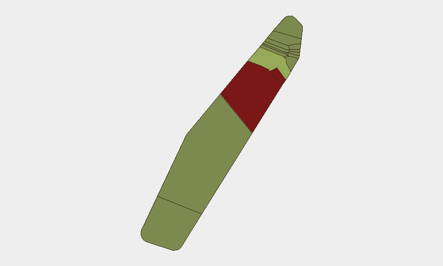
Peleliu (risk 92) and Angaur (risk 88) are flagged as the highest-risk states within Palau's sub-national hierarchy, though this ranking reflects structural and historical risk factors rather than current discrete incidents. Koror (risk 45) ranks third and remains the commercial and administrative hub; Melekeok (risk 35) and Airai (risk 32) follow. Elevated scores in Peleliu and Angaur likely reflect historical conflict legacy, economic fragility, and geographic isolation. All other states score below 30. The ranking serves as a baseline for sustained monitoring and duty-of-care planning, but does not indicate active unrest or travel restrictions.
How GeoBit Would Assist
Corporate security and risk teams operating in Palau can leverage AOI Monitoring & Early Warning to establish persistent, real-time alerts on Peleliu and Angaur for emerging incidents; multi-language web research and OSINT fusion to cross-check local and regional sources for early signals of civil unrest, maritime incidents, or infrastructure disruption; and conflict & military network analysis to track any developments affecting the broader Pacific region that could spill into Palau jurisdiction. Routing & Network Analysis supports contingency planning for personnel in remote or elevated-risk states.
7-Day Outlook
No indicators suggest deterioration in Palau's security environment over the next seven days. The Pacific Islands Forum preparation will continue as a planned event, with security exercises and inter-agency coordination routinely escalating in the lead-up; these are not risk vectors. Seasonal weather patterns and maritime conditions (typhoon season context) remain the primary environmental variable for asset and travel planning rather than security threat.
Data Sources: GeoBit Daily Threat Monitor (31 July 2026), Live Web Research (last 24h), Sub-National Risk Assessment (current), Open-Source Regional Wire Services.
Highest-Risk Areas — Ranked
| # | State / Region | Risk |
|---|---|---|
| 1 | Peleliu | 92 |
| 2 | Angaur | 88 |
| 3 | Koror | 45 |
| 4 | Melekeok | 35 |
| 5 | Airai | 32 |
| 6 | Ngatpang | 28 |
| 7 | Ngeremlengui | 26 |
| 8 | Ngaraard | 25 |
| 9 | Ngardmau | 24 |
| 10 | Aimeliik | 23 |
| 11 | Ngiwal | 22 |
| 12 | Ngchesar | 21 |
Sources
Previous Daily Briefs
A new Palau brief is written every day — each with its own risk map and downloadable CSV. Here's the last week; use the calendar to go further back.
📅 Browse every day by calendar →
Highlighted days have a brief. Tap a day for that day's map & analysis, or “csv” for that day's dataset ($5).
Atlas — our AI intelligence desk — emails them this snapshot personally. Nothing else, no list.