Situation Summary
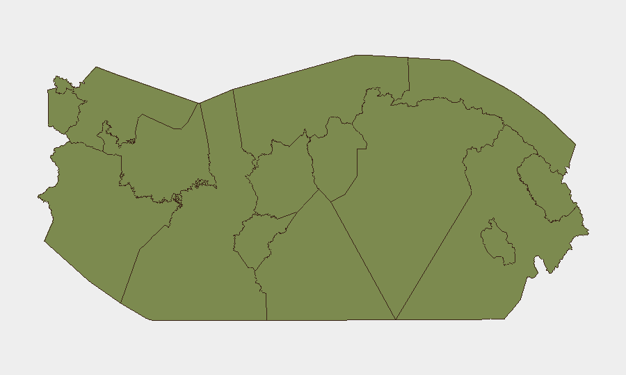
Panama's security environment is characterized by sustained law-enforcement operations targeting trafficking networks and wanted offenders, coupled with heightened coastal interdiction activity and border-zone monitoring in response to Colombian cartel displacement warnings. Panamá Province (risk 31.3) and Coclé (risk 21.3) remain the primary drivers of national risk, reflecting concentrated criminal activity in and around Panama City and transit corridors. The trajectory is one of active state response—intensified police operations and financial surveillance—rather than escalation, though trafficking-network retaliation and continued organized-crime competition in border zones remain material risks.
Key Developments
- Plan Firmeza nationwide police sweep (July 31, 2026): The Policía Nacional arrested 193 individuals in 24 hours across Panama under intensive operations, including 120 wanted persons, 16 caught in flagrante delicto, and offenders for micro- and drug trafficking. Thirty-three search warrants executed; 12 firearms, 7 magazines, and 73 rounds of ammunition seized. 1,143 traffic citations issued nationwide. *Risk implication:* Elevated checkpoint frequency and short-notice raids across major routes and urban centers.
- Maritime drug seizure, Punta Barco (Chame), Panamá Oeste (July 31, 2026): Servicio Nacional Aeronaval seized 786 packages of suspected controlled substance and one artisanal vessel off the coast. *Risk implication:* Intensified naval inspections likely along Panamá Oeste and other coastal transit zones; potential trafficking-network retaliation.
- Clan del Golfo displacement monitoring, national scope (July 31, 2026): Following Colombian warnings, Panama's Minister of Public Security confirmed enhanced surveillance and inter-agency coordination (including the Financial Analysis Unit) to monitor suspected members of the Clan del Golfo entering Panamanian territory and associated money-laundering activity. *Risk implication:* Tighter border controls and financial-sector scrutiny; potential for organized-crime territorial competition.
- Traffic enforcement intensification, national road network (July 31, 2026): As part of Plan Firmeza, traffic units conducted 1,143 summonses across major inter-provincial routes, indicating sustained enforcement operations. *Risk implication:* Expect frequent roadside stops and potential delays on key corridors.
- Curfew and operational focus, Bocas del Toro and Colón (ongoing, confirmed July 31, 2026): Authorities maintain minor curfews in both provinces and continue elevated patrols in response to persistent organized-crime and migrant-related security concerns. *Risk implication:* Movement restrictions and heightened checkpoint activity in these zones.
Highest-Risk Areas
Panamá Province (31.3) and Coclé (21.3) are driving national risk scores, primarily due to trafficking activity, gang competition, and proximity to Panama City's financial and transit infrastructure. Panamá Oeste (21.3) follows, reflecting its coastal role in drug interdiction and migrant transit. Colón, Bocas del Toro, and the Darién border corridor remain persistent secondary hotspots, with organized crime and trafficking networks exploiting remote terrain and limited state presence; curfews and operational disruptions in these areas are ongoing.
How GeoBit Would Assist
Security teams would deploy AOI Monitoring & Early Warning to watch critical transit corridors (Panamá Province highways, Punta Barco coastal zone, Darién border) for emerging trafficking or cartel activity. Network & Actor Analysis and OSINT fusion (X/Twitter, news feeds, financial-sector alerts) would track Clan del Golfo movements and money-laundering flows. Routing & Network Analysis would identify alternative routes during heightened enforcement periods, and conflict & crime search would maintain real-time situational awareness of Plan Firmeza operations and checkpoint deployments.
7-Day Outlook
Plan Firmeza operations and coastal interdiction activity are expected to continue at current tempo through early August. Border-zone monitoring will intensify as Clan del Golfo displacement risk remains elevated. No major escalation is anticipated; risk remains concentrated in Panamá Province and known trafficking corridors, with checkpoints and enforcement activity as the primary near-term operational friction for legitimate transit.
Highest-Risk Areas — Ranked
| # | State / Region | Risk |
|---|---|---|
| 1 | Panamá Province | 31.3 |
| 2 | Coclé | 21.3 |
| 3 | Panamá Oeste | 21.3 |
| 4 | Chiriquí | 7.9 |
| 5 | Guna Yala | 1.3 |
| 6 | Darién | 1.3 |
| 7 | Emberá-Wounaan | 1.3 |
| 8 | Naso Tjër Di | 1.3 |
| 9 | Bocas del Toro | 1.3 |
| 10 | Ngäbe-Buglé | 1.3 |
| 11 | Colón | 1.3 |
| 12 | Veraguas | 1.3 |
Sources
Previous Daily Briefs
A new Panama brief is written every day — each with its own risk map and downloadable CSV. Here's the last week; use the calendar to go further back.
📅 Browse every day by calendar →
Highlighted days have a brief. Tap a day for that day's map & analysis, or “csv” for that day's dataset ($5).
Atlas — our AI intelligence desk — emails them this snapshot personally. Nothing else, no list.