Situation Summary
Papua New Guinea remains a moderate composite threat environment (rank #135 globally, score 2.6) with security risks heavily concentrated in the National Capital District and Morobe Province, driven by crime, tribal violence, and illegal firearms circulation. Recent developments include a prison escape, sorcery-related assault, diplomatic tension over Taiwan relations, and ongoing military exercises with U.S. partners. No acute nationwide escalation is forecast, but localized friction from concurrent military activity, maritime disruption, and law-enforcement operations will persist through mid-to-late July.
Key Developments
- National Capital District (16 July 2026). Papua New Guinea's foreign minister announced closure of Taiwan's Taipei Economic Office; Taiwan rejected the decision and stated its office continues operations. This move signals heightened diplomatic tension aligned with China's "one China" position and carries potential political-risk implications for foreign entities operating in PNG.
- National Capital District (17 July 2026). Papua New Guinea and Taiwan formally reduced diplomatic relations; Taiwan vowed to reassess bilateral engagement. Expect diplomatic messaging and potential policy adjustments affecting foreign-relations posture.
- Baisu Correctional Institution, Western Highlands Province (12 July; reported 16 July 2026). Ten National Court remandees escaped during visiting hours; three were shot dead, five were recaptured and hospitalised under guard, and two remain at large. A major police manhunt is active; internal investigations into the security breach are underway.
- Enga Province (14–15 July; reported 16 July 2026). Police are pursuing suspects in the torture and assault of two elderly women accused of sorcery; the incident was filmed and circulated on social media, aiding suspect identification. Case remains ongoing with active apprehension efforts.
- Port Moresby, Lae (Morobe), Wewak (East Sepik) (13–24 July 2026; ongoing). Joint Exercise "Tamiok Strike 2026" involving PNG Defence Force and U.S. Army Pacific is generating heightened military movements, traffic disruption, and temporary airspace restrictions around bases and training areas. No security incidents reported; short-term operational and travel friction expected.
- PNG waters (coastal areas) (16 July 2026 onwards). Royal Australian Navy ship HMAS Leeuwin deployed to conduct a five-week joint hydrographic survey with PNG Defence Force; activity will increase maritime vessel presence and may disrupt small-craft and commercial traffic in surveyed areas.
- Manus Province waters (13 July 2026). A magnitude 6.4 earthquake approximately 192 km southeast of Lorengau raised short-term concerns over infrastructure integrity and maritime-route safety; no large-scale instability is forecast, but ongoing monitoring for aftershocks and transport impacts continues.
Highest-Risk Areas
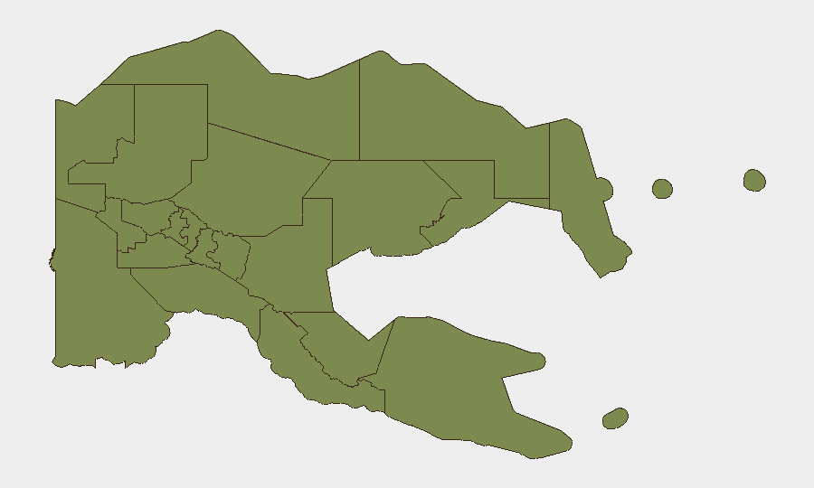
National Capital District (score 31.8) and Morobe Province (score 21.8) drive the majority of PNG's tracked threat events, with crime, organised tribal violence, and illegal firearms circulation as primary drivers. Enga Province (score 11.8) has emerged as a secondary concern due to recent sorcery-related violence and community unrest. All other provinces score below 2.0 and remain comparatively stable; however, security-service capacity constraints nationwide limit enforcement capability and increase incident-response friction.
How GeoBit Would Assist
Security teams should employ AOI Monitoring & Early Warning to track Port Moresby, Lae, and Mt Hagen for police activity, protest signalling, and crowd-movement indicators; Network & Actor Analysis to map prison-related institutional failure and sorcery-violence suspect networks; and Intel Sweep with multi-language OSINT fusion to monitor social-media circulation of violence content and emerging diplomatic rhetoric tied to Taiwan relations. Satellite imagery analysis would support infrastructure-integrity assessment following the Manus earthquake.
7-Day Outlook
The concurrent military exercise, prison-escape manhunt, and diplomatic tension will sustain elevated short-term operational friction and police activity in Port Moresby, Lae, and Western Highlands through late July. No nationwide security deterioration is forecast, but localized disruption from military movements and law-enforcement operations will persist; monitor maritime and airspace advisories and exercise heightened situational awareness in high-risk provinces.
Highest-Risk Areas — Ranked
| # | State / Region | Risk |
|---|---|---|
| 1 | National Capital District | 31.8 |
| 2 | Morobe | 21.8 |
| 3 | Enga | 11.8 |
| 4 | Eastern Highlands | 1.8 |
| 5 | Gulf | 1.8 |
| 6 | Madang | 1.8 |
| 7 | Manus | 1.8 |
| 8 | West New Britain | 1.8 |
| 9 | New Ireland | 1.8 |
| 10 | East New Britain | 1.8 |
| 11 | Central | 1.8 |
| 12 | Oro | 1.8 |
Sources
Previous Daily Briefs
A new Papua New Guinea brief is written every day — each with its own risk map and downloadable CSV. Here's the last week; use the calendar to go further back.
📅 Browse every day by calendar →
Highlighted days have a brief. Tap a day for that day's map & analysis, or “csv” for that day's dataset ($5).
Atlas — our AI intelligence desk — emails them this snapshot personally. Nothing else, no list.