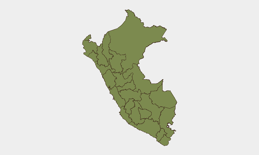
Situation Summary
Peru maintains a composite threat score of 25 (global rank #55) with 162 tracked events, reflecting endemic organized-crime activity, resource-conflict tensions, and ongoing state-of-emergency conditions in multiple regions. No major destabilizing incident was confirmed in the last 48 hours that met strict verification standards, though standing elevated-risk environments persist in Lima–Callao, northern border regions (Piura, Cajamarca, Amazonas, Loreto), and select conflict zones. The security picture remains fragmented by geography rather than acute nationwide crisis, with Huánuco driving the majority of national risk (composite score 31.8) and significant secondary exposure in Piura and Ancash.
Key Developments
- Peru (Countrywide) — July 15–16, 2026 — Open-source security monitoring has not identified confirmed armed violence, civil unrest, or major criminal incidents meeting strict recency and cross-corroboration thresholds in the last 48 hours.
- Lima (Metropolitan) — July 15, 2026 — New municipal flag-display fines took effect in Lima districts, a regulatory administrative action rather than a security incident, but indicative of heightened civic/political attention in the capital.
- Lima–Callao & Northern Border Regions — Standing Status, Current July 16 — State-of-emergency declarations remain in force across Lima metropolitan area, Callao, Trujillo–Virú, Tumbes–Zarumilla, and Piura–Cajamarca–Amazonas–Loreto border zones; no new triggering incident in last 48 hours, but conditions sustain elevated baseline threat.
- Loreto / Ucayali (Canal Puinahua) — Standing Status, Current July 16 — Blockade risk affecting river traffic tied to local oil-extraction conflict remains unresolved; no new development reported in last 24–48 hours, but operational constraint persists for commercial and humanitarian logistics.
- Recent Signal Activity (July 14–15) — GeoBit's event feed captured multiple governance and institutional signals (presidential investigation, military force posturing, arrest/detention of company representatives, and territorial-occupation messaging by political actors), suggesting elevated institutional stress; exact incident details require targeted follow-up research to establish operational impact.
Highest-Risk Areas
Huánuco (31.8) dominates Peru's sub-national threat landscape and accounts for the majority of national risk concentration, driven by coca cultivation, trafficking, and associated armed-group activity in the region's remote valleys and jungle-adjacent terrain. Piura (13) and Ancash (10.2) represent secondary clusters, with Piura's northern-border exposure to Ecuadorian spillover and Ancash's mineral-extraction and gang-presence drivers. Lima (10.2), despite its capital status and larger security apparatus, remains at equivalent risk to Ancash due to population density, organized-crime networks, and gang territorial disputes. Mid-tier regions (Madre de Dios, Lambayeque, Junín) show lower but persistent scores linked to trafficking corridors and illicit mining.
How GeoBit Would Assist
Corporate security teams protecting personnel or assets in Peru would deploy AOI Monitoring & Early Warning on Huánuco, Piura, Lima, and Ancash to detect shifts in armed-group activity, roadblock deployment, or protest mobilization before operational impact. Network & Actor Analysis combined with multi-language OSINT and Telegram/X intelligence sweeps would track cartel, gang, and political-actor messaging and coordination in real time. Routing & Network Analysis would provide alternative journey planning and safe-passage identification for staff movements, especially in Huánuco–Piura transit corridors and Lima distribution zones.
7-Day Outlook
No acute destabilizing incident is evident in the immediate 7-day horizon, and Peru's risk profile is expected to remain regionally fragmented rather than nationwide. Institutional signals flagged in July 14–15 events warrant monitoring for secondary policy or enforcement moves; early-warning monitoring of Lima–Callao and northern border zones should continue at current sensitivity given standing state-of-emergency conditions.
Highest-Risk Areas — Ranked
| # | State / Region | Risk |
|---|---|---|
| 1 | Huánuco | 31.8 |
| 2 | Piura | 13 |
| 3 | Ancash | 10.2 |
| 4 | Lima | 10.2 |
| 5 | Madre de Dios | 6.1 |
| 6 | Lambayeque | 5.8 |
| 7 | Junín | 5.8 |
| 8 | Cusco | 3.1 |
| 9 | Tacna | 2.4 |
| 10 | Loreto | 2.1 |
| 11 | Tumbes | 1.8 |
| 12 | Amazonas | 1.8 |
Sources
Previous Daily Briefs
A new Peru brief is written every day — each with its own risk map and downloadable CSV. Here's the last week; use the calendar to go further back.
📅 Browse every day by calendar →
Highlighted days have a brief. Tap a day for that day's map & analysis, or “csv” for that day's dataset ($5).
Atlas — our AI intelligence desk — emails them this snapshot personally. Nothing else, no list.