Situation Summary
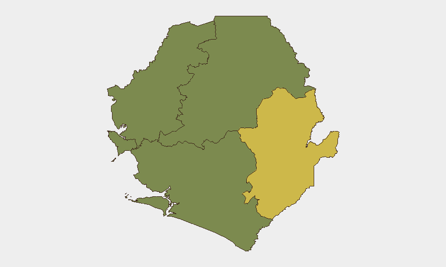
Sierra Leone remains a low–threat environment globally (rank #88, composite score 12) with localized risk concentrated in the Eastern Province. The country's security profile is stable, though institutional capacity constraints—particularly police accountability and checkpoint protocols—remain underlying vulnerabilities. An unverified signal of civil-society concern regarding police conduct and a possible weapons-related incident at a northern checkpoint merit monitoring, but neither has been independently corroborated in the past 24–48 hours.
Key Developments
Unverified signals identified for analyst follow-up:
- Kambia District (date unclear). A Facebook post alleges the presence of a vehicle carrying weapons and ammunition at a checkpoint; independent news corroboration and precise timestamp are absent from available sources.
- Police accountability concern (timing uncertain). The Human Rights Commission of Sierra Leone posted that no official statement had been issued by police more than 48 hours after an alleged shooting by an OSD (Office of the Strategic Director) officer; the original incident date is not explicit in available snippets.
- General police safety alert (source: Facebook). An unverified post warns of hostility and violence against police officers, without specific incident details or location.
Assessment: None of these signals meet the threshold for independent, time-stamped, multi-source verification. GeoBit's live research window (last 24 hours) was insufficient to isolate confirmed, current incidents in Sierra Leone. All three items should be treated as unconfirmed leads requiring supplementary source work before operational briefing.
Highest-Risk Areas
Eastern Province (composite score 68) significantly outweighs all other administrative divisions and accounts for the majority of tracked risk in Sierra Leone. Western Area (score 35)—which includes Freetown and major commercial/diplomatic infrastructure—registers secondary concern. The Northern, North West, and Southern provinces show no current signal activity. Eastern Province's elevated risk profile warrants attention to border areas, mining regions, and routes where informal security arrangements or checkpoint-related incidents may occur with limited institutional oversight.
How GeoBit Would Assist
A corporate security team with personnel or supply chains in Sierra Leone would employ AOI Monitoring & Early Warning to flag incidents in high-risk zones (Eastern Province, Freetown) with real-time alerting. Intel Sweep and X/Twitter OSINT capabilities would corroborate unverified Facebook signals and establish reliable incident timelines before operational decisions are made. Routing & Network Analysis would identify safer alternative routes for personnel movement, avoiding high-risk checkpoints, while Conflict, Terrorism & Crime Search would provide baseline risk profiling for specific locations and stakeholder types.
7-Day Outlook
No significant escalation is forecast over the next seven days. The unverified checkpoint and police-conduct signals do not indicate an emerging security crisis; they reflect routine institutional friction. Monitoring should focus on whether independent confirmation emerges for the Kambia and police incidents, and whether frequency of such reports increases—either pattern would warrant an upgrade to operational alert status.
Highest-Risk Areas — Ranked
| # | State / Region | Risk |
|---|---|---|
| 1 | Eastern Province | 68 |
| 2 | Western Area | 35 |
| 3 | North West Province, Sierra Leone | 0 |
| 4 | Northern Province, Sierra Leone | 0 |
| 5 | Southern Province, Sierra Leone | 0 |
Sources
Previous Daily Briefs
A new Sierra Leone brief is written every day — each with its own risk map and downloadable CSV. Here's the last week; use the calendar to go further back.
📅 Browse every day by calendar →
Highlighted days have a brief. Tap a day for that day's map & analysis, or “csv” for that day's dataset ($5).
Atlas — our AI intelligence desk — emails them this snapshot personally. Nothing else, no list.