Situation Summary
Somalia remains at elevated threat level (#30 globally, composite score 68) driven by persistent Al-Shabaab insurgency, localized armed-group activity, and maritime risks. As of 17 July 2026, 12:00 UTC, no reliably corroborated major kinetic incidents (attacks, clashes, or significant crime) have been confirmed in the last 24–48 hours across multi-source open-source monitoring, suggesting a short-term reporting lull rather than an improvement in underlying risk. Threat concentration is heavily skewed to Mudug region (risk score 31.8), which accounts for the majority of tracked events; Banaadir (Mogadishu) remains secondary but consequential. The security environment remains unpredictable, with capabilities and intent for Al-Shabaab operations intact.
Key Developments
No major new kinetic incidents confirmed in last 24–48 hours (16–17 July 2026).
Multi-source open-source monitoring and specialist assessments have not corroborated location-specific attacks, clashes, or infrastructure incidents in Somalia during this window. This represents a gap in reported activity, not a reduction in underlying threat.
Event signal activity (17–18 July 2026) reflects administrative and diplomatic actions:
- UK disapproval statement regarding Mukalla (17 July)
- Mogadishu federal court arrest/detention action (18 July)
- Prosecutor public statement (18 July)
- Intra-Somali demand (18 July)
None of these constitute new kinetic threats to personnel or assets.
Broader context (preceding week):
Al-Shabaab insurgency and armed-group operations continue at baseline threat level. Military mobilization events and carrier presence were recorded (15–16 July), consistent with ongoing counter-insurgency posture. Earlier in July (10–14), coordinated militant attacks on military installations and IED operations were reported near Mogadishu and Lower Shabelle, but these fall outside the 24–48 hour reporting window.
Highest-Risk Areas
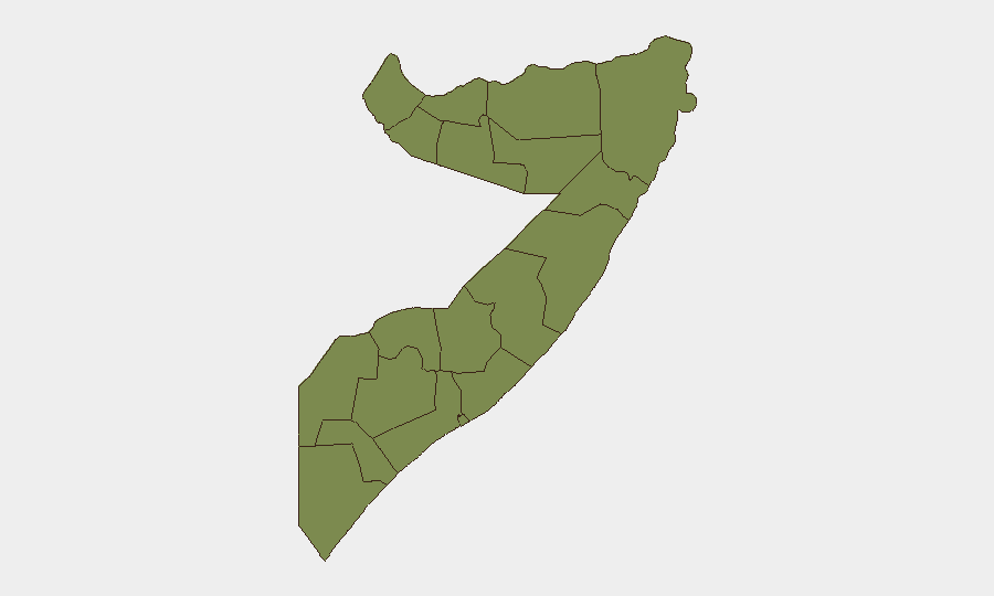
Mudug dominates the risk landscape (31.8 vs. 7.1 for second-ranked Banaadir), indicating Al-Shabaab and armed-group activity is concentrated in central Somalia, particularly around Galkayo and surrounding pastoral/logistical hubs. This concentration reflects both militant presence and state capacity gaps. Banaadir (Mogadishu) carries disproportionate consequence despite lower composite score; capital-based incidents affect diplomatic, commercial, and security operations nationwide. All other ranked states (Awdal, Woqooyi Galbeed, Gedo, Bakool, Bay, Middle Juba, Lower Shabelle, Sahil, Togdheer, Hiiraan) register at 1.8, indicating either stable baseline threat or lower reporting/monitoring coverage. Personnel and asset concentration in Mogadishu and northern ports should not mask the elevated Mudug risk profile for operations in central zones.
How GeoBit Would Assist
AOI Monitoring & Early Warning with persistent watch on Mudug (Galkayo/Balcad), Banaadir (Mogadishu), and port zones would provide 24/7 alerting on kinetic activity, militant mobilization, or security force operations affecting duty-of-care exposure. Intel Sweep, OSINT fusion, and multi-language search across local media, social platforms, and radio SIGINT would enable teams to distinguish genuine tactical threats from administrative signals and identify emerging incidents before they scale. Battle mapping and force-structure tracking would inform route planning and facility security posture by tracking Al-Shabaab and military positions in real time.
7-Day Outlook
No major shift in threat trajectory is anticipated over the next 7 days; Al-Shabaab operational tempo and piracy risk remain consistent with July baseline. Military and diplomatic activity will likely continue; heightened alertness during any announced political or security events (e.g., government announcements, military operations) is warranted. Seasonal maritime risk (monsoon and piracy patterns) should be monitored in parallel with land-based threats.
Highest-Risk Areas — Ranked
| # | State / Region | Risk |
|---|---|---|
| 1 | Mudug | 31.8 |
| 2 | Banaadir | 7.1 |
| 3 | Awdal | 4.1 |
| 4 | Woqooyi Galbeed | 1.8 |
| 5 | Gedo | 1.8 |
| 6 | Bakool | 1.8 |
| 7 | Bay | 1.8 |
| 8 | Middle Juba | 1.8 |
| 9 | Lower Shabelle | 1.8 |
| 10 | Sahil | 1.8 |
| 11 | Togdheer | 1.8 |
| 12 | Hiiraan | 1.8 |
Sources
Previous Daily Briefs
A new Somalia brief is written every day — each with its own risk map and downloadable CSV. Here's the last week; use the calendar to go further back.
📅 Browse every day by calendar →
Highlighted days have a brief. Tap a day for that day's map & analysis, or “csv” for that day's dataset ($5).
Atlas — our AI intelligence desk — emails them this snapshot personally. Nothing else, no list.