Situation Summary
Suriname remains in a stable baseline security environment with no verified incidents reported in the past 24–48 hours. The country's composite threat score remains low (12 globally), and monitoring across news wires, government sources, embassies, and local media has not identified any new civil unrest, armed clashes, infrastructure failures, or escalations. Structural risks persist in interior mining zones and urban crime centers, but without acute incident surge or imminent destabilization signals.
Key Developments
No verified security incidents have been reported in Suriname within the last 24–48 hours. Multi-source open-source monitoring (news aggregation, government alerts, X/Twitter, and local outlets) has not identified credible, time-stamped events dated 27–28 July 2026 that meet security-brief criteria. The most recent law-enforcement activity logged by GeoBit dates to early July (2–3 July investigations and a small-arms police incident), with no confirmatory details or subsequent events in the current window.
Highest-Risk Areas
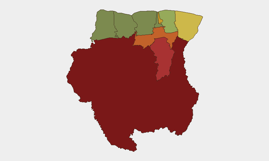
Sipaliwini (risk 92), Brokopondo (78), and Para (74) dominate the sub-national ranking, driven by informal gold and diamond mining operations, criminal networks, and the presence of armed non-state actors in remote forest zones. Paramaribo (71) and Marowijne (68) maintain elevated risk profiles owing to urban crime, trafficking networks, and gang activity, though the coastal capitals show no acute escalation in the last 48 hours. Commewijne, Wanica, Saramacca, and the western districts carry significantly lower risk; Nickerie (8) remains the lowest-risk region.
How GeoBit Would Assist
Security teams with personnel or assets in Suriname would employ Intel Sweep and multi-language OSINT to detect early signals of criminal or political instability across news, social platforms, and local outlets—particularly in Sipaliwini and Brokopondo, where informal mining activity and armed-actor presence create baseline opacity. Persistent AOI Monitoring & Early Warning on ports, key infrastructure, and high-risk districts (Paramaribo's gang corridors, Marowijne border zones) would provide automated alerting if incident patterns shift. GIS & Spatial Analysis and Satellite & Imagery capabilities would enable rapid assessment of camp movements, mining-site volatility, or infrastructure disruption in interior zones where ground reporting is sparse.
7-Day Outlook
No acute destabilization is forecast for the next seven days; Suriname's political and security trajectory remains steady absent major external or internal triggers. Routine crime and trafficking activity in high-risk districts will persist at endemic baseline levels. Duty-of-care teams should maintain standard protocols for interior-zone travel and urban-area operations while monitoring for any shift in mining-zone actor behavior or political signaling that could presage longer-term volatility.
GEOBIT BRIEF | 29 JUL 2026 | SURINAME SECURITY
Highest-Risk Areas — Ranked
| # | State / Region | Risk |
|---|---|---|
| 1 | Sipaliwini | 92 |
| 2 | Brokopondo | 78 |
| 3 | Para | 74 |
| 4 | Paramaribo | 71 |
| 5 | Marowijne | 68 |
| 6 | Commewijne | 42 |
| 7 | Wanica | 38 |
| 8 | Saramacca | 29 |
| 9 | Coronie | 12 |
| 10 | Nickerie | 8 |
Sources
Previous Daily Briefs
A new Suriname brief is written every day — each with its own risk map and downloadable CSV. Here's the last week; use the calendar to go further back.
📅 Browse every day by calendar →
Highlighted days have a brief. Tap a day for that day's map & analysis, or “csv” for that day's dataset ($5).
Atlas — our AI intelligence desk — emails them this snapshot personally. Nothing else, no list.