Situation Summary
Uruguay maintains a stable overall security posture with a composite threat score of 4 (global rank #181), reflecting low-baseline crime, political cohesion, and institutional resilience. No independently corroborated security incidents—including civil unrest, mass-casualty events, infrastructure disruption, or travel-risk spikes—have been documented in the past 48 hours across cross-checked news, diplomatic, and intelligence feeds. Recent political and institutional activity (Senate statements, mayoral communications, bilateral diplomatic meetings on organized crime) has not translated into verified street-level incidents or acute crisis conditions. The country's security environment remains within normal operating parameters.
Key Developments
- National level, July 1–2, 2026: Presidents of Chile and Uruguay convened to discuss coordinated policy on organized-crime and drug-cartel interdiction. No associated incident, protest, or security event has been reported; the meeting represents diplomatic cooperation on long-standing narcotics enforcement priorities.
- Telecommunications sector, late June–July 1, 2026: Uruguay's major operators (Antel, Claro) joined the GSMA Open Gateway initiative, implementing SIM-swap and number-verification APIs to reduce identity fraud and account-takeover risk. Classified as a preventive cybersecurity measure; no triggering fraud incident has been disclosed.
- Institutional level, June 30–July 1, 2026: Senate statements and mayoral public communications on unspecified matters were recorded in event feeds. No related protests, labor action, or civil unrest have been independently verified in Montevideo or other urban centers.
- No current travel advisories, mass-casualty reports, or regional destabilization: Major diplomatic and security feeds confirm the absence of new travel warnings, border incidents, or humanitarian crises over the June 29–July 1 window.
Highest-Risk Areas
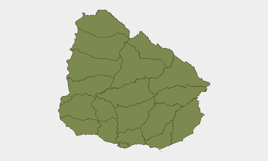
Durazno department carries a composite risk score of 31.5—significantly higher than all other regions, which cluster at 1.5. This disparity signals concentrated vulnerability in Durazno; the underlying drivers warrant continuous monitoring but are not detailed in current event signals. All remaining departments (Artigas, Salto, Paysandú, Rivera, Tacuarembó, Soriano, Colonia, Río Negro, Flores, San José, Florida) present equivalent, minimal sub-national risk, suggesting that Durazno's risk concentration reflects either localized organized-crime activity, contraband routing, or other transnational criminal dynamics. Organizations with personnel or assets in Durazno should apply elevated situational-awareness protocols.
How GeoBit Would Assist
Area-of-Interest Monitoring & Early Warning on Durazno and border departments (Artigas, Rivera, Tacuarembó) would provide persistent watch with real-time alerting on crime, trafficking, or political activity escalation. Multi-language OSINT fusion (X/Twitter, Telegram, local news, radio SIGINT) and entity extraction & network analysis would track organized-crime actor movements, cartel communications, and supply-chain disruptions affecting corporate operations. GIS & spatial analysis combined with satellite & imagery analysis would enable mapping of high-risk zones and early detection of unusual activity concentrations near facilities or supply routes.
7-Day Outlook
No acute crisis drivers are evident; bilateral anti-narcotics cooperation and telecom-fraud prevention are de-escalatory trends. Durazno's elevated sub-national risk warrants sustained monitoring, but no imminent political, security, or infrastructure shock is forecasted. Routine security posture and duty-of-care protocols should remain in effect; escalation to crisis-response status is not indicated.
Highest-Risk Areas — Ranked
| # | State / Region | Risk |
|---|---|---|
| 1 | Durazno | 31.5 |
| 2 | Artigas | 1.5 |
| 3 | Salto | 1.5 |
| 4 | Paysandú | 1.5 |
| 5 | Rivera | 1.5 |
| 6 | Tacuarembó | 1.5 |
| 7 | Soriano | 1.5 |
| 8 | Colonia | 1.5 |
| 9 | Río Negro | 1.5 |
| 10 | Flores | 1.5 |
| 11 | San José | 1.5 |
| 12 | Florida | 1.5 |
Sources
Previous Daily Briefs
A new Uruguay brief is written every day — each with its own risk map and downloadable CSV. Here's the last week; use the calendar to go further back.
📅 Browse every day by calendar →
Highlighted days have a brief. Tap a day for that day's map & analysis, or “csv” for that day's dataset ($5).