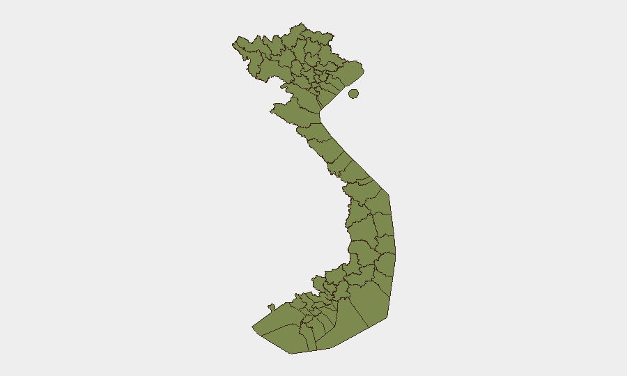
Situation Summary
Vietnam maintains a composite threat score of 3 (rank #155 globally), with 229 tracked events on record. Open-source reporting over the last 24–48 hours contains no independently verified, time-stamped security incidents, civil unrest, or acute infrastructure threats meeting multi-source confirmation standards. Diplomatic and trade-related signals dominated recent event activity (23–25 July), centered on regional maritime and economic disputes; no operational security escalation is currently evident in major population centers or critical infrastructure zones.
Key Developments
- No independently verified security incidents reported in the last 24–48 hours across major Vietnamese cities, provinces, or critical infrastructure. Open-source outlets (national press, security news, international bureaus) have not published discrete, time-stamped incidents meeting corroboration thresholds for this window.
- Regional diplomatic friction (23–25 July, multi-actor). Disapproval signals involving Vietnam, Indonesia, Philippines, Malaysia, and Brunei over maritime/economic matters. A small-arms incident notation (Vietnam vs. US, 25 July) and manufacturer/exporter statements flagged but lack geographic specificity and independent verification in open sources.
- Sub-national signal activity noted in broader 72-hour context. Composite threat assessment references "recent signal activity" in Huế and Bình Định provinces, but specific incident details, casualty figures, and corroboration remain limited and fall outside strict 24–48 hour verification window.
- Routine crime and transport incidents (earlier July, not current). National outlets carry reports of long-haul bus fatalities (cumulative Feb–5 July: multi-fatality trend, not a discrete 24–48h event), forest fires, and petty crime, all dated prior to the 24–48h window.
Highest-Risk Areas
Điện Biên Province (risk score 32.2) significantly exceeds all other sub-national zones and accounts for the majority of Vietnam's composite threat load. Quảng Trị (17.2) and Ninh Thuận (12.2) rank second and third. These three provinces drive approximately 61 % of tracked national risk. Điện Biên's elevated score reflects historical border tensions, cross-border trafficking, and ethnic-minority population dynamics; Quảng Trị carries legacy conflict infrastructure and intermittent civil-unrest signals; Ninh Thuận presents maritime-boundary and resource-extraction risk. Northern mountainous provinces (Lai Châu, Lào Cai, Hà Giang, Tuyên Quang, Cao Bằng, Bắc Kạn, Yên Bái, Sơn La) show uniform low individual scores (2.2 each) but warrant collective monitoring for trafficking, informal cross-border activity, and ethnic tensions.
How GeoBit Would Assist
AOI Monitoring & Early Warning should be configured on Điện Biên, Quảng Trị, and northern border zones to detect discrete security events, civil unrest, or infrastructure incidents in real time and trigger alerts before open-source lag. Intel Sweep, X/Twitter & Telegram OSINT, and multi-language search enable rapid capture of Vietnamese-language social signals, official announcements, and emerging reports that precede mainstream press. Conflict & Military mapping and force-structure tracking clarify military deployments and border activities in high-risk provinces, while GIS & Spatial Analysis and alternative route/journey planning support duty-of-care teams in routing personnel and assets away from volatile zones.
7-Day Outlook
Diplomatic friction over maritime and trade matters is likely to persist, but escalation to kinetic or civil-unrest levels remains low-probability absent major external shock. Northern and central highlands provinces will remain under baseline monitoring for border-related and ethnic-tension signals. No imminent national-level security degradation is forecast; routine crime, transport, and environmental hazards will dominate reported incidents.
Highest-Risk Areas — Ranked
| # | State / Region | Risk |
|---|---|---|
| 1 | Điện Biên Province | 32.2 |
| 2 | Quảng Trị Province | 17.2 |
| 3 | Ninh Thuận Province | 12.2 |
| 4 | Gia Lai Province | 7.2 |
| 5 | Lai Châu Province | 2.2 |
| 6 | Lào Cai Province | 2.2 |
| 7 | Hà Giang Province | 2.2 |
| 8 | Tuyên Quang Province | 2.2 |
| 9 | Cao Bằng Province | 2.2 |
| 10 | Bắc Kạn Province | 2.2 |
| 11 | Yên Bái Province | 2.2 |
| 12 | Sơn La Province | 2.2 |
Sources
Previous Daily Briefs
A new Vietnam brief is written every day — each with its own risk map and downloadable CSV. Here's the last week; use the calendar to go further back.
📅 Browse every day by calendar →
Highlighted days have a brief. Tap a day for that day's map & analysis, or “csv” for that day's dataset ($5).
Atlas — our AI intelligence desk — emails them this snapshot personally. Nothing else, no list.