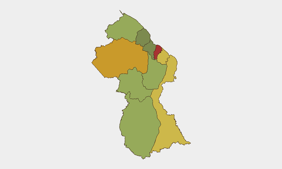
Sub-national composite risk — darker = higher. Source: GeoBit.
⬇ Guyana dataset (CSV) — events, per-region risk, cyber & sources
Situation Summary
Guyana is ranked #126 on the GeoBit threat index (score 14). Live brief generation is temporarily degraded; event data follows.
Recent Events
- 2026-10-06 · Arrests · Police arrested a 33-year-old miner after discovering a 9mm pistol and 11 live rounds concealed beneath a vehicle mat; no link to another in
- 2026-10-06 · Violence against civilians · Two unidentified men on an XR motorcycle robbed a 19-year-old of two gold-colored chains; the pillion rider displayed a handgun, and when th
- 2026-10-07 · Violence against civilians · Andika Ferrier, 43, former Ministry of Home Affairs employee, was charged with assault causing actual bodily harm over an alleged assault on
- 2026-10-05 · Violence against civilians · Romel Toney, 28, of Kiruni, was killed during an altercation on Saturday night; further details on other participants or cause of death not
- 2026-10-08 · Violence against civilians · An unidentified person in another vehicle allegedly fired at a 35-year-old businessman and contractor; police found damage consistent with a
- 2026-10-10 · Violence against civilians · Three masked, armed men allegedly robbed a 57-year-old businessman at his property, taking more than G$10 million in cash.
Highest-Risk Areas — Ranked
| # | State / Region | Risk |
|---|---|---|
| 1 | Demerara-Mahaica | 78 |
| 2 | Cuyuni-Mazaruni | 72 |
| 3 | Mahaica-Berbice | 65 |
| 4 | East Berbice-Corentyne | 62 |
| 5 | Upper Demerara-Berbice | 58 |
| 6 | Potaro-Siparuni | 48 |
| 7 | Barima-Waini | 45 |
| 8 | Upper Takutu-Upper Essequibo | 42 |
| 9 | Pomeroon-Supenaam | 38 |
| 10 | Essequibo Islands | 35 |
Sources
Previous Weekly Briefs
A new Guyana brief is written every Monday, covering the week — each with its own risk map and downloadable CSV. Use the calendar to go further back.
- October 12, 2026
- October 5, 2026
- September 28, 2026
- September 21, 2026
- September 14, 2026
- September 7, 2026
- September 1, 2026
📅 Browse past briefs by calendar →
Highlighted days have a brief. Tap a day for that day's map & analysis, or “csv” for that day's dataset ($5).
See Guyana live.
GeoBit maps Guyana — every region, event, and risk layer — on demand.
Request a live demo →Share this intelligence
Atlas — our AI intelligence desk — emails them this snapshot personally. Nothing else, no list.
Automated by GeoBit AI from publicly reported events and open-source research. Context only; not a risk advisory. Recognized by Deloitte · NVIDIA Inception · Geospatial World Forum.