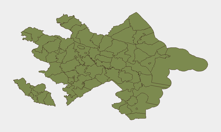
Situation Summary
Azerbaijan remains a low-to-moderate global security concern (rank #105, composite score 9) with 76 tracked events over the assessment period. The threat landscape is heavily concentrated in the Shusha District (risk score 31.5), a post-conflict zone where infrastructure recovery and border management remain active. No major new security incidents, civil unrest, or infrastructure disruptions were detected in open-source reporting during the last 24–48 hours (13–14 July 2026); the security environment appears stable relative to recent historical patterns, though persistent vulnerabilities in contested and border-adjacent areas warrant continued monitoring.
Key Developments
Open-source research did not identify widely reported, time-stamped security, conflict, crime, or civil-unrest incidents occurring specifically in Azerbaijan on 13–14 July 2026 that meet corroboration and recency thresholds.
Note on detected event signals: GeoBit's platform flagged several event indicators (public statements, media-related arrests/detentions, and industry–population friction) dated 13–14 July 2026, but associated media reporting either lacked sufficient detail, clear timestamps, or independent corroboration to assess operational impact on travel, operations, or asset security within the reporting period. This gap reflects either: (a) events still emerging into public reporting, (b) localized incidents not yet covered by major international or regional news outlets, or (c) data gaps in real-time open-source availability.
Recommendation: Security teams should cross-check GeoBit's event-signal database directly for underlying source documents, timestamps, and actor identities; rely on local fixers, NGO networks, or regional media (Caucasian Knot, JAMnews, local news agencies) for same-day incident confirmation in Azerbaijan.
Highest-Risk Areas
Shusha District dominates the risk profile (31.5) as the primary driver of Azerbaijan's national score. This reflects ongoing post-2020 conflict reconstruction, border proximity to Armenia, infrastructure vulnerabilities, and mine-clearance operations in civilian areas. Baku City (16.5) carries elevated risk associated with political messaging, media restrictions, and occasional labor/industry friction—visible in recent event signals—but remains substantially safer than Shusha. Ujar and Sumqayit districts (6.5 each) show secondary elevation, likely linked to broader northern border dynamics and industrial activity. All remaining regions score below 2.0 and do not present acute regional risk clusters at present.
Operational implication: Personnel or assets in Shusha should operate under heightened protocols for unexploded ordnance (UXO), restricted-zone access, and curfew compliance. Baku operations benefit from urban infrastructure and security services but should maintain awareness of periodic regulatory tightening and media/speech sensitivities.
How GeoBit Would Assist
Security teams would employ Area-of-Interest (AOI) Monitoring & Early Warning on Shusha, Baku, and border districts to detect emerging incidents, protest mobilization, or infrastructure disruptions in near-real time. Multi-language OSINT sweep and X/Twitter & Telegram OSINT capabilities enable same-day incident confirmation and sentiment tracking across Azerbaijani, Russian, and Turkish language channels. GIS & Spatial Analysis and Routing & Network Analysis support alternative travel planning and perimeter mapping in high-risk zones, while Conflict & Military force-structure tracking informs awareness of any military activity changes in border regions.
7-Day Outlook
No acute escalation is forecast over the next seven days based on available intelligence. Shusha and northern border regions will continue to warrant standard elevated-caution postures for organizations with operations there. Monitoring should remain attentive to any fresh media-related arrests, industry labor actions, or cross-border incidents that could signal deterioration; the absence of major events in the last 48 hours does not rule out localized friction emerging later in the week.
Highest-Risk Areas — Ranked
| # | State / Region | Risk |
|---|---|---|
| 1 | Shusha District | 31.5 |
| 2 | Baku City | 16.5 |
| 3 | Ujar District | 6.5 |
| 4 | Sumqayit | 6.5 |
| 5 | Sadarak District | 1.5 |
| 6 | Qazakh District | 1.5 |
| 7 | Sharur District | 1.5 |
| 8 | Yevlakh District | 1.5 |
| 9 | Kangarli District | 1.5 |
| 10 | Nakhchivan Autonomous Republic | 1.5 |
| 11 | Aghstafa District | 1.5 |
| 12 | Tovuz District | 1.5 |
Previous Daily Briefs
A new Azerbaijan brief is written every day — each with its own risk map and downloadable CSV. Here's the last week; use the calendar to go further back.
📅 Browse every day by calendar →
Highlighted days have a brief. Tap a day for that day's map & analysis, or “csv” for that day's dataset ($5).
Atlas — our AI intelligence desk — emails them this snapshot personally. Nothing else, no list.