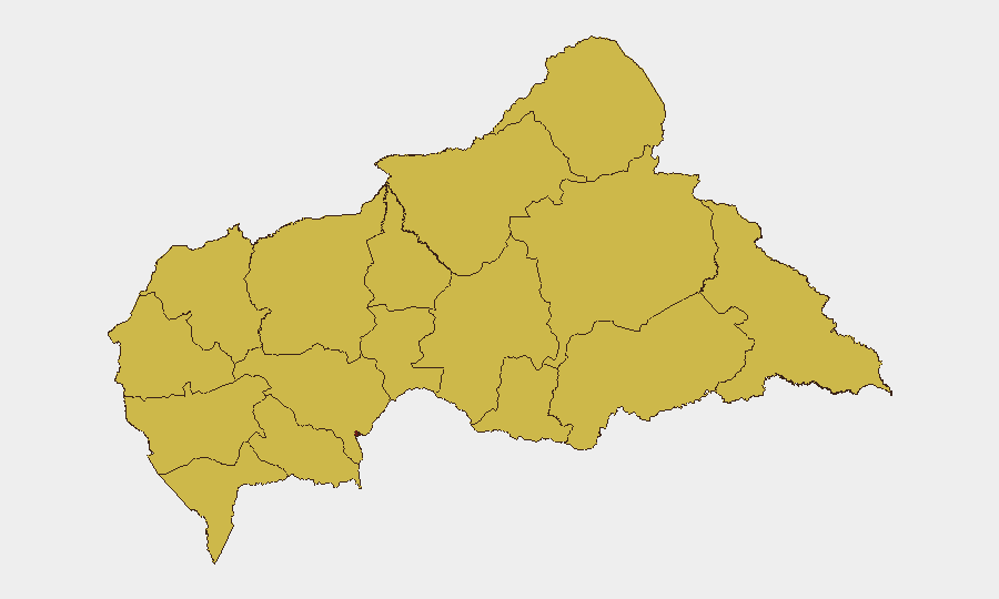
Situation Summary
Central African Republic remains the 22nd-highest-threat country globally, with a composite threat score of 96 across 68 tracked events. Bangui dominates risk exposure at 97.5, while twelve prefectures register elevated and uniform mid-range scores (67.5), indicating widespread geographic distribution of instability rather than isolated hotspots. Recent signals point to cross-border military activity, financial-sector dysfunction, and procedural tensions within the justice system, though the capital continues to concentrate both opportunity and threat.
Key Developments
- Bangui / Bozizé Trial – 2026-06-24: Defence counsel in the Special Criminal Court raised procedural irregularities and requested case delay, signalling potential disruption to a high-profile accountability process.
- Bangui / Ministry Threat to European Actors – 2026-06-25: A ministry-level threat issued against unnamed European actors; scope, cause, and target designation remain unclear pending clarification.
- Cross-Border Military Activity – 2026-06-23: Reciprocal military engagements reported between Congolese and rebel forces, with potential spillover implications for eastern CAR prefectures (Haut-Mbomou, Mbomou).
- Central Bank / Financial Sector Friction – 2026-06-23 to 2026-06-24: Senate-level administrative sanctions against the Central Bank, followed by Central Bank rejection of a banking partner and subsequent investigation; pattern suggests liquidity, governance, or sanctions-compliance crisis.
- Vakaga / Cross-Border Incursions (UN Situational Context): UN briefings reference continued Rapid Support Forces activity in Vakaga Prefecture causing civilian displacement and abuses, though specific incident dates within the last 48 hours are not yet timestamped in available sources.
Highest-Risk Areas
Bangui's isolation at 97.5 reflects capital-city concentration of political, financial, and judicial institutions, where recent threats, court delays, and banking dysfunction create compounded risk for corporate operations and personnel. The uniform 67.5 score across all other prefectures indicates endemic insecurity rather than variable stability—a pattern consistent with persistent armed activity, cross-border incursions, and weak state control outside the capital. Vakaga, Haute-Kotto, and the eastern tier (Haut-Mbomou, Mbomou) merit particular attention due to reported RSF and Congolese military movements; Bangui-bound supply routes and expatriate transit corridors through these zones warrant continuous assessment.
How GeoBit Would Assist
Corporate security teams should employ Intel Sweep and OSINT fusion to track the Ministry threat trajectory, Central Bank liquidity crisis, and trial proceedings in real time. AOI Monitoring & Early Warning with persistent watch on Bangui (political/financial triggers) and eastern prefectures (military/cross-border activity) will provide 12–72-hour alert capability before escalation reaches personnel or supply chains. Routing & Network Analysis can model alternative transit and supply corridors away from high-risk border zones, while Conflict & Military force-structure tracking clarifies Congolese and non-state actor positioning.
7-Day Outlook
The convergence of judicial delay, financial-sector stress, and renewed cross-border military activity suggests elevated but not acute crisis risk through early July. Watch for Central Bank policy announcements (capital controls, currency actions) and further Ministry statements clarifying the European-actor threat; neither has yet crossed into operational disruption. If Bangui-Kinshasa cross-border activity intensifies or Central Bank dysfunction triggers cash-flow constraints, corporate operations and expatriate mobility could face material friction within 5–10 days.
Highest-Risk Areas — Ranked
| # | State / Region | Risk |
|---|---|---|
| 1 | Bangui | 97.5 |
| 2 | Bamingui-Bangoran | 67.5 |
| 3 | Vakaga | 67.5 |
| 4 | Haute-Kotto | 67.5 |
| 5 | Haut-Mbomou | 67.5 |
| 6 | Mbomou | 67.5 |
| 7 | Nana-Mambéré | 67.5 |
| 8 | Ouham-Pendé | 67.5 |
| 9 | Mambéré-Kadéï | 67.5 |
| 10 | Sangha-Mbaéré | 67.5 |
| 11 | Ouham | 67.5 |
| 12 | Nana-Grébizi | 67.5 |
Sources
Previous Daily Briefs
A new Central African Republic brief is written every day — each with its own risk map and downloadable CSV. Here's the last week; use the calendar to go further back.
📅 Browse every day by calendar →
Highlighted days have a brief. Tap a day for that day's map & analysis, or “csv” for that day's dataset ($5).