Situation Summary
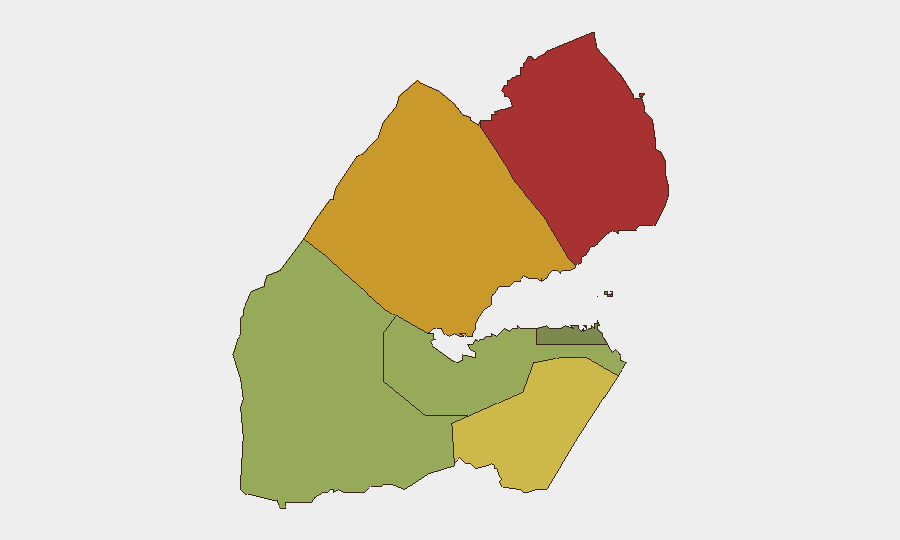
Djibouti remains operationally calm with no credible, corroborated security incidents, civil unrest, armed activity, or infrastructure disruption reported in the last 24–48 hours. The overall threat composite score of 18 reflects a low national baseline, though significant regional variance exists—northern and western regions (Obock, Tadjourah, Ali Sabieh) carry substantially elevated risk profiles compared to the capital and southern areas. The current trajectory is stable absent new triggering events.
Key Developments
No discrete security, crime, civil unrest, armed, or terror incidents meeting the 24–48 hour reporting window have been corroborated. Open-source monitoring, regional security feeds, and embassy reporting confirm the absence of new incidents in this timeframe. Older policy activity (e.g., a regional task force convened July 27; maritime diplomacy messaging July 30) falls outside the acute incident window and represents diplomatic rather than security developments.
Highest-Risk Areas
Obock (risk 78) and Tadjourah (risk 72) in the north drive the country's aggregate threat profile, reflecting chronic exposure to Yemen-spillover dynamics, irregular migration flows, and historically fragmented governance in border zones. Ali Sabieh (65) in the west mirrors these patterns—remote terrain, porous borders, and limited state capacity create conditions for trafficking, smuggling, and potential militant transit. The capital region of Djibouti (35) and southern zones remain substantially lower-risk, indicating that threats cluster in peripheral, poorly-monitored frontier areas rather than urban centers or key infrastructure nodes.
How GeoBit Would Assist
Security teams operating in or responsible for Djibouti should employ AOI (Area-of-Interest) Monitoring & Early Warning on the three highest-risk regions (Obock, Tadjourah, Ali Sabieh) to detect emerging civil unrest, armed activity, or cross-border incidents with automated alerting; OSINT fusion and multi-language search (including Somali, Arabic, and French sources) to surface localized reporting missed by English-language feeds; and GIS & Spatial Analysis to map personnel/asset locations against the sub-national risk ranking and plan alternative routing or movement protocols. Maritime & Aviation tracking should cover the Bab el-Mandeb corridor and regional ports (Doraleh) given Djibouti's strategic chokepoint role and recent geopolitical messaging around Red Sea transit.
7-Day Outlook
No acute escalation is anticipated in the next 7 days given the current stable baseline and absence of triggering incidents or announced events. However, the persistent elevated risk in northern and western regions remains structural; security teams should maintain baseline monitoring posture and assume that any deterioration in Yemen, Somalia, or Red Sea maritime conditions could transmit risk into Obock and Tadjourah within hours. Duty-of-care protocols should remain calibrated to regional rather than national threat levels.
Next update: 2026-08-06, 0600 UTC (or on incident trigger).
Highest-Risk Areas — Ranked
| # | State / Region | Risk |
|---|---|---|
| 1 | Obock | 78 |
| 2 | Tadjourah | 72 |
| 3 | Ali Sabieh | 65 |
| 4 | Arta | 48 |
| 5 | Dikhil | 42 |
| 6 | Djibouti | 35 |
Sources
Previous Daily Briefs
A new Djibouti brief is written every day — each with its own risk map and downloadable CSV. Here's the last week; use the calendar to go further back.
📅 Browse every day by calendar →
Highlighted days have a brief. Tap a day for that day's map & analysis, or “csv” for that day's dataset ($5).
Atlas — our AI intelligence desk — emails them this snapshot personally. Nothing else, no list.