Situation Summary
Ethiopia remains at the centre of a protracted civil conflict with competing armed groups, government forces, and militia controlling or contesting territory across at least nine regions, driving a composite threat ranking of #9 globally. Displacement, sexual violence, mass arrests, and drone strikes continue across northern and central zones, though no major verified conflict incidents have been publicly reported in the last 24 hours. Health threats—including Marburg virus disease and malaria—compound insecurity in already fragile areas, and recent wildfires have added environmental pressure to multiple regions. The security posture is deteriorating unevenly; some localities experience acute flashpoint risk while others face slower-burn displacement and humanitarian stress.
Key Developments
- No major verified conflict or crisis news for Ethiopia in the past 24 hours (per GeoBit event feeds as of 2026-07-06). Routine signals of territory occupation, unconventional violence, and military-civilian incidents have been logged but lack specific time-stamped confirmation within the 24–48-hour window.
- Marburg virus disease and malaria continue to circulate in Ethiopia (recent reports, no new confirmed cases cited as of 2026-07-06); health authorities are monitoring spread in conflict-affected and remote areas.
- Wildfires reported in multiple zones (2026, specific dates not confirmed): active incidents tracked in Central Ethiopia Regional State and cross-border Ethio-Sudan border regions; smoke, displacement, and resource depletion pose secondary risks to populations and supply chains.
- EHRCO human rights statement (published 2026-07-02, incidents 2026-06-18 to 2026-06-29): Government forces accused of killings, sexual violence, mass arrests, and looting across Zayse Woreda, South Ethiopia Regional State; underscores pattern of abuses that may drive future escalation and displacement.
- UK public statements on Ethiopia (logged 2026-07-06, content not specified): diplomatic signals regarding villages and humanitarian concerns indicate international attention to specific localities; nature and urgency of statements not confirmed.
Highest-Risk Areas
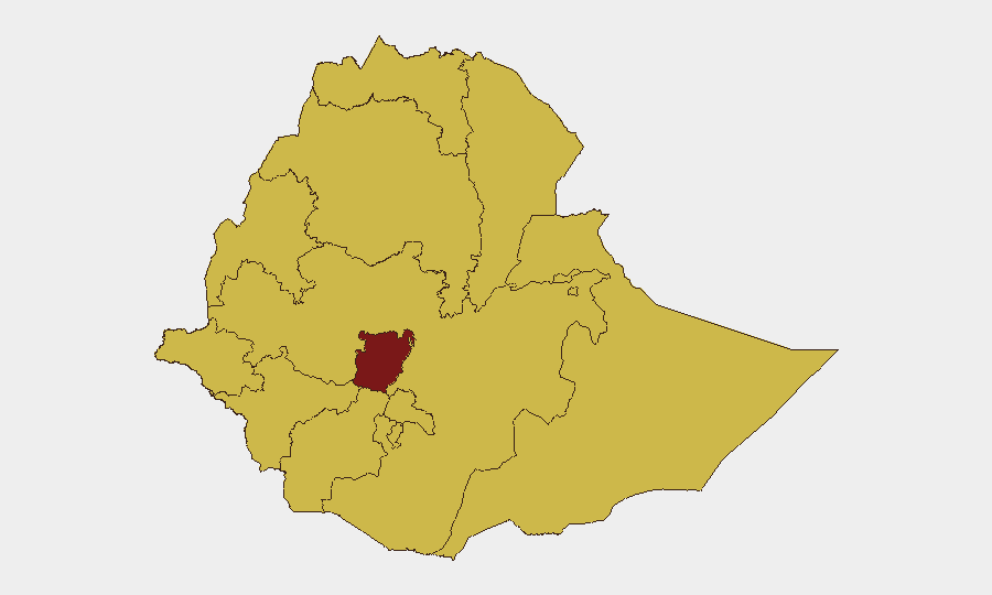
Central Ethiopia Regional State (risk 100) dominates the threat matrix and stands apart from the 11 other high-risk regions at risk level 70; wildfire activity, military operations, and population density compound civil-conflict drivers. Tigray, Amhara, Afar, and Benishangul-Gumuz regions remain critically unstable due to ongoing militia and government force contestation, internal displacement, and limited humanitarian access. Addis Ababa and Oromia Region—despite being ranked #9 and #11 respectively—retain significant risk owing to their economic and strategic importance and proximity to or inclusion of contested zones. The near-uniform risk elevation across all major regions (70–100) reflects the breadth of the conflict and suggests that no zone is reliably secure for high-risk corporate operations.
How GeoBit Would Assist
Security and risk teams would employ AOI Monitoring & Early Warning to track Central Ethiopia Regional State, Tigray, and Amhara in real time, with persistent satellite and OSINT feeds triggering alerts on force movements, displacement flows, and health outbreaks before traditional media confirmation. Intel Sweep, multi-language OSINT, and network analysis would build current actor profiles (militia, government units, opposition groups) and track their stated and inferred intentions. GIS & Spatial Analysis and Routing & Network Analysis would enable alternative-route planning and situational awareness for staff and supply chains, while Humanitarian & NGO data and Environmental & Health monitoring would flag secondary risks (malaria, wildfires) that compound primary security threats.
7-Day Outlook
No immediate escalation is signaled for the next 7 days, but the absence of reported incidents should not be read as de-escalation; conflict in fragmented zones often operates below global media thresholds. Health threats and environmental stress (wildfires, disease) are likely to persist and may drive secondary displacement. Organizations should maintain heightened readiness for rapid-onset events in Central Ethiopia Regional State and the northern regions, given historical volatility and the scale of recent documented abuses.
Highest-Risk Areas — Ranked
| # | State / Region | Risk |
|---|---|---|
| 1 | Central Ethiopia Regional State | 100 |
| 2 | Tigray | 70 |
| 3 | Amhara Region | 70 |
| 4 | Afar Region | 70 |
| 5 | Benishangul-Gumuz Region | 70 |
| 6 | Somali Region | 70 |
| 7 | Gambela Region | 70 |
| 8 | South West Ethiopia Peoples | 70 |
| 9 | Addis Ababa | 70 |
| 10 | South Ethiopia Regional State | 70 |
| 11 | Oromia Region | 70 |
| 12 | Sidama | 70 |
Sources
Previous Daily Briefs
A new Ethiopia brief is written every day — each with its own risk map and downloadable CSV. Here's the last week; use the calendar to go further back.
📅 Browse every day by calendar →
Highlighted days have a brief. Tap a day for that day's map & analysis, or “csv” for that day's dataset ($5).
Atlas — our AI intelligence desk — emails them this snapshot personally. Nothing else, no list.