Situation Summary
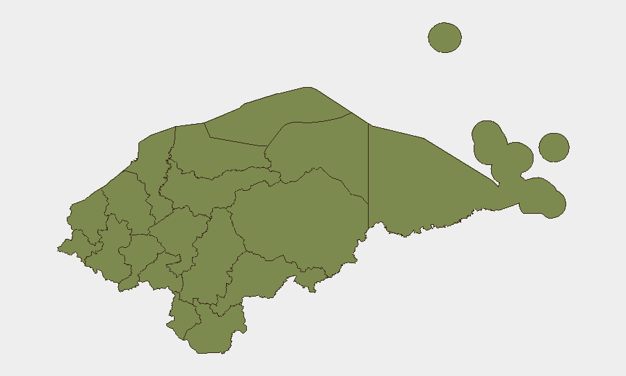
Honduras remains a moderate-risk environment (composite threat score 18, ranked #null globally) with acute concentration of security incidents in Francisco Morazán department, which accounts for the vast majority of tracked threat activity. The country continues to experience cycles of civil unrest, law-enforcement operations, and organized-crime activity, with recent signals (29–31 July) indicating arrests, official investigations, and high-level political/medical statements. Risk is sharply stratified: Francisco Morazán (risk 31.3) dominates the threat profile, while Cortés (14.2) shows secondary elevation; all other departments cluster at baseline (1.3).
Key Developments
GeoBit's event signals from 29–31 July include:
- 29 July · Arrest/Detain (Authorities vs. Citizen) — Location and subject matter not yet specified in available signals; arrest activity consistent with law-enforcement sweeps in high-crime zones.
- 29 July · Public Disapproval — Unspecified national-level event; typical of periodic civil or political friction.
- 29 July · Investigation (Population) — Population-initiated inquiry or complaint; may indicate community response to a security incident or official action.
- 30 July · Public Statement (Physician) — Medical official communication; context unclear; may relate to violence impact, public-health emergency, or professional statement on security conditions.
- 30 July · Public Statement (President) — Presidential address; suggests high-profile issue (violence, security operations, political concern, or international matter).
- 31 July · Arrest/Detain (Colombia vs. Honduras) — Cross-border arrest or extradition activity; reflects ongoing transnational law-enforcement or organized-crime dimension.
Note: Specific locations, times, and incident details for 30–31 July events are not yet available in GeoBit's current feed. Duty-of-care teams should cross-check local Honduran media (El Heraldo, La Prensa, Proceso Digital) and official sources (Policía Nacional, Ministerio de Seguridad) for expanded detail.
Highest-Risk Areas
Francisco Morazán department—encompassing Tegucigalpa, the capital, and surrounding zones—is the dominant risk driver (31.3), reflecting dense urban crime, gang activity, and law-enforcement operations. Cortés (14.2), which includes San Pedro Sula and Choloma, shows secondary but significant elevation. All other departments (El Paraíso, Copán, Yoro, Comayagua, and others) remain at baseline (1.3), indicating that threat concentration is highly localized rather than nationwide.
How GeoBit Would Assist
Security and risk teams can use AOI Monitoring & Early Warning to establish persistent, real-time watch on Francisco Morazán and Cortés, with automated alerting on incident triggers (arrests, violence, protests). Intel Sweep and X/Twitter OSINT capabilities enable continuous collection and sentiment analysis of local security signals, cross-validated with multi-language search and entity extraction to identify emerging actors, locations, and threat patterns. GIS & Spatial Analysis can map incident clusters and alternative routing to support duty-of-care decisions for personnel and asset movement.
7-Day Outlook
The 29–31 July signal cluster suggests ongoing law-enforcement activity and possible institutional responses to a trigger event; presidential and medical statements imply a matter of some public significance. Without additional context, near-term risk is expected to remain elevated in Francisco Morazán and stable elsewhere, though escalation in political or organizational tension could shift dynamics. Monitoring should intensify on official statements and local reporting to clarify the nature and scope of current events.
Highest-Risk Areas — Ranked
| # | State / Region | Risk |
|---|---|---|
| 1 | Francisco Morazán | 31.3 |
| 2 | Cortés | 14.2 |
| 3 | El Paraíso | 1.3 |
| 4 | Copán | 1.3 |
| 5 | Ocotepeque | 1.3 |
| 6 | Yoro | 1.3 |
| 7 | Santa Bárbara | 1.3 |
| 8 | Lempira | 1.3 |
| 9 | Intibucá | 1.3 |
| 10 | Comayagua | 1.3 |
| 11 | La Paz | 1.3 |
| 12 | Valle | 1.3 |
Sources
Previous Daily Briefs
A new Honduras brief is written every day — each with its own risk map and downloadable CSV. Here's the last week; use the calendar to go further back.
📅 Browse every day by calendar →
Highlighted days have a brief. Tap a day for that day's map & analysis, or “csv” for that day's dataset ($5).
Atlas — our AI intelligence desk — emails them this snapshot personally. Nothing else, no list.