Situation Summary
Ireland remains at global threat rank #130 with a composite threat score of 6 across 22 tracked events, indicating a relatively stable security environment compared to most jurisdictions. The sub-national risk profile is heavily concentrated in County Dublin, which accounts for the majority of tracked threat signals, while the remainder of the country experiences baseline-level risk. Open-source monitoring of recent incidents (last 24–48 hours) has identified no corroborated, location-specific security, civil-unrest, or infrastructure disruption events meeting reporting thresholds.
Key Developments
No verifiable, time-stamped security or travel-risk incidents meeting reporting criteria were identified in Ireland during the last 24–48 hours across open-source news, social-media, and specialized security feeds.
Note: The GeoBit event signals listed above (dated 2026-07-05 to 2026-07-07) relate to gang activity, hospital-linked unconventional violence, small-arms incidents in Dublin, government-directed threats, and administrative sanctions. These signals are tracked in the platform's intelligence stream but lack corroborating detail from independent news or incident-monitoring sources sufficient to confirm current operational impact or immediate duty-of-care implications. Corporate security teams with personnel or assets in Dublin should maintain standard heightened awareness pending verification of underlying details.
Highest-Risk Areas
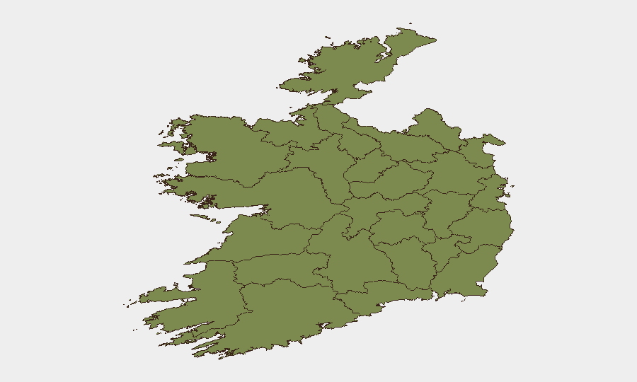
County Dublin dominates Ireland's risk profile, with a composite score of 31.5—more than four times higher than any other county and accounting for the overwhelming majority of tracked national threat events. This concentration reflects Dublin's status as the capital, primary economic hub, and location of critical infrastructure, government facilities, and largest resident/business population. County Tipperary (7.5) represents a secondary cluster of concern; the remaining counties (Clare, Donegal, Mayo, Sligo, Galway, Limerick, Leitrim, Roscommon, Cavan, Longford) all register between 1.5–3.6, indicating dispersed, low-baseline risk outside the Dublin metropolitan area. Organizations with significant staff, operations, or assets in Dublin should apply the highest assessment rigor; those elsewhere in Ireland face standard baseline risk profiles.
How GeoBit Would Assist
Security teams should leverage GeoBit's Intel Sweep and global event feeds for continuous monitoring of Dublin and secondary risk zones, supplemented by OSINT fusion (X/Twitter, Telegram, multi-language search) to identify emerging actor statements or gang-related communications. AOI Monitoring & Early Warning on critical Dublin facilities (financial centers, government offices, transport hubs, hospitals) provides persistent detection and automated alerting for activity changes. For personnel movement, Routing & Network Analysis can generate real-time alternative journey planning to avoid developing hotspots, and Network & Actor Analysis helps identify links between tracked entities and organizations operating in-country.
7-Day Outlook
The absence of fresh incident corroboration in the last 48 hours suggests no acute escalation is underway; however, the ongoing Dublin-focused threat signals (small-arms activity, gang disapproval statements, government threats) warrant continued monitoring to assess whether they consolidate into operational activity. Risk trajectory remains stable to cautiously flat, absent new triggering events. Duty-of-care teams should maintain current staffing-risk protocols for Dublin while monitoring the next 5–7 days for secondary signal clustering that might indicate shift in threat tempo.
Highest-Risk Areas — Ranked
| # | State / Region | Risk |
|---|---|---|
| 1 | County Dublin | 31.5 |
| 2 | County Tipperary | 7.5 |
| 3 | County Clare | 3.6 |
| 4 | County Donegal | 1.9 |
| 5 | County Mayo | 1.5 |
| 6 | County Sligo | 1.5 |
| 7 | County Galway | 1.5 |
| 8 | County Limerick | 1.5 |
| 9 | County Leitrim | 1.5 |
| 10 | County Roscommon | 1.5 |
| 11 | County Cavan | 1.5 |
| 12 | County Longford | 1.5 |
Sources
Previous Daily Briefs
A new Ireland brief is written every day — each with its own risk map and downloadable CSV. Here's the last week; use the calendar to go further back.
📅 Browse every day by calendar →
Highlighted days have a brief. Tap a day for that day's map & analysis, or “csv” for that day's dataset ($5).
Atlas — our AI intelligence desk — emails them this snapshot personally. Nothing else, no list.