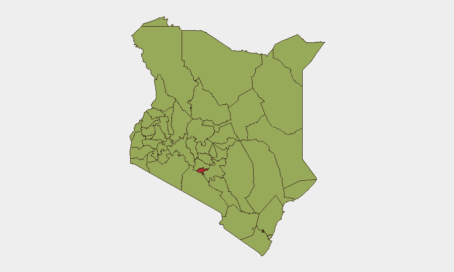
Situation Summary
Kenya remains at moderate global risk (rank #24, composite score 68) with 57 tracked threat events. Nairobi County dominates the risk profile at 77.3, driven by urban crime, political tension, and organized activity, while northeastern border counties face persistent al-Shabaab operational presence. A confirmed attack in Mandera County on 2026-07-29 and multiple recent "occupy territory" signals across the country suggest elevated militant and territorial activity in the last 48 hours.
Key Developments
- Mandera County / Lafey-Wantey Dam corridor (2026-07-29): Five Kenyan security personnel killed in a suspected al-Shabaab ambush; follow-on IED strike on reinforcement vehicle. Cross-sourced by Reuters, Al Jazeera, and AFP affiliates.
- Territory occupation signals (2026-08-01, multiple Kenya locations): Three distinct "occupy territory" events logged against Kenya and/or broader Africa region within the last 24 hours, suggesting coordinated or cascading territorial incursions or militia activity. Geographic specificity pending corroboration.
- Kenya-Tanzania investigation engagement (2026-08-01): Bilateral investigative action initiated, indicating potential transnational incident or dispute. Scope and outcome unknown; monitors required.
- Recent threat and investigation activity (2026-07-30 – 2026-08-01): Three separate investigation triggers and one threat signal logged in Kenya over 48 hours, with authorities issuing public statements. Pattern suggests active incident response or emerging security event.
- Power outage (2026-07-29): Nationwide power disruption recorded, creating secondary risk for communications loss, infrastructure vulnerability, and operational disruption to security and emergency services.
Highest-Risk Areas
Nairobi County is the dominant driver of Kenya's risk profile (77.3), reflecting concentrated urban crime, protester activity, and organized criminal presence in the capital and surrounding metropolitan zone. All remaining high-risk counties (Kajiado through Meru) cluster at 47–49.8, indicating a second tier of consistent but lower-intensity risk: these include border regions (Kajiado, Kwale, Busia) vulnerable to smuggling and cross-border militant activity, and western/rift-valley counties (Kakamega, Uasin Gishu, Elgeyo-Marakwet, Baringo, Laikipia) with histories of communal violence, land disputes, and political flashpoints. The Mandera attack underscores that northeastern border counties remain primary zones for al-Shabaab operations.
How GeoBit Would Assist
Intel Sweep and OSINT fusion capabilities enable continuous monitoring of Kenya's threat ecosystem—tracking al-Shabaab operational tempo, militia movements, and criminal networks across English, Swahili, and regional media. AOI Monitoring & Early Warning with persistent satellite and SIGINT watch on Mandera, Nairobi, and Rift Valley counties can detect force movements, vehicle staging, and IED emplacement before attacks mature. Routing & Network Analysis allows security and logistics teams to model safe transit corridors, avoid high-risk counties and known ambush sites, and identify alternative supply chains in real time.
7-Day Outlook
Al-Shabaab activity in Mandera and unconfirmed territorial occupation events suggest potential for further cross-border infiltration and asymmetric attacks on security forces and infrastructure over the next 7 days. Nairobi County instability may escalate if political or protest triggers emerge. Power infrastructure vulnerabilities and communications disruption will compound response times. Heightened vigilance and real-time intelligence fusion are warranted through early August.
Highest-Risk Areas — Ranked
| # | State / Region | Risk |
|---|---|---|
| 1 | Nairobi County | 77.3 |
| 2 | Kajiado County | 49.8 |
| 3 | Kwale | 48.2 |
| 4 | Busia County | 47.3 |
| 5 | Kakamega County | 47.3 |
| 6 | Vihiga County | 47.3 |
| 7 | Nandi County | 47.3 |
| 8 | Elgeyo-Marakwet County | 47.3 |
| 9 | Uasin Gishu County | 47.3 |
| 10 | Baringo | 47.3 |
| 11 | Laikipia County | 47.3 |
| 12 | Meru County | 47.3 |
Sources
Previous Daily Briefs
A new Kenya brief is written every day — each with its own risk map and downloadable CSV. Here's the last week; use the calendar to go further back.
📅 Browse every day by calendar →
Highlighted days have a brief. Tap a day for that day's map & analysis, or “csv” for that day's dataset ($5).
Atlas — our AI intelligence desk — emails them this snapshot personally. Nothing else, no list.