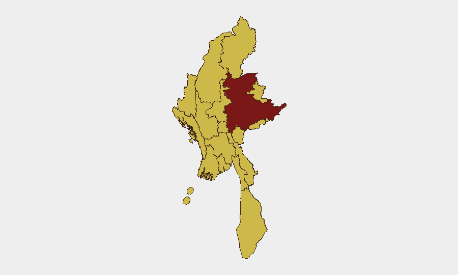
Situation Summary
Myanmar remains in active civil war following the February 2021 coup, with composite threat score of 100 placing it #10 globally. Multiple armed groups—principally the Myanmar Armed Forces (Tatmadaw), People's Defence Force (PDF), and ethnic armed organizations (EAOs)—are engaged in conventional and unconventional operations across nearly all regions. Recent signals (21 June) indicate intensifying military clashes, government-led unconventional violence, cross-border engagement with Malaysia, and deteriorating ethnic-group relations, suggesting the conflict trajectory remains volatile and broadening geographically.
Key Developments
- 21 June | Conventional Military Operations. Insurgent groups reported engaging Tatmadaw forces; no specific location confirmed in available 24-48h reporting.
- 21 June | Unconventional Violence. Government forces conducted operations classified as unconventional violence; specific location and casualty figures not yet available in open sources.
- 21 June | Cross-Border Incident. Malaysia-Myanmar military engagement reported; geographic scope and context require further corroboration.
- 21 June | Ethnic Relations Deterioration. Two signals of "Reduce Relations" between ethnic groups and Myanmar state; operational context remains unclear from available 24-48h data.
- 21 June | Government Statement. Myanmar authorities issued public statements regarding insurgency; rhetorical posture suggests defensive framing.
- Recent | Hydrometeorological Hazard. Flooding reported in Myanmar (Insecurity Insight reference: event ID 1103937); location and impact scope pending confirmation.
*Note: Open-source 24-48h incident-level reporting from Myanmar remains limited in granularity and multi-source corroboration. Corporate security teams should supplement with fee-based regional intelligence feeds and local media monitoring for real-time tactical situational awareness.*
Highest-Risk Areas
Shan State (risk 100) remains the primary conflict epicenter, hosting the largest concentration of active armed groups, PDF cells, and Tatmadaw garrisons. Nine additional regions—including Tanintharyi, Chin, Sagaing, Kachin, Wa State, Magway, Mandalay, Rakhine, and Ayeyarwady—all register risk score 70, indicating that large-scale violence is no longer confined to border regions but now endemic across the country. Yangon, Naypyitaw, and secondary urban centers (risk 70) are increasingly exposed to unconventional attacks, IED activity, and supply-chain disruption. The breadth of high-risk territory reflects the junta's loss of territorial control and the PDF-EAO alliance's expanding operational reach.
How GeoBit Would Assist
Corporate security and duty-of-care teams should deploy AOI Monitoring & Early Warning (persistent watch on offices, warehouses, travel corridors, and personnel locations) with automated alerting tied to OSINT fusion (X/Twitter, Telegram, local news aggregators) to detect imminent threats 12–48 hours ahead of major incidents. Routing & Network Analysis capabilities enable real-time alternative-route planning around active conflict zones, roadblocks, and curfews. Battle Mapping and force structure tracking provide granular understanding of armed-group positions and Tatmadaw deployment, informing evacuation decisions and travel-risk scoring for specific locations and time windows.
7-Day Outlook
Conflict intensity is expected to remain elevated, with PDF-led offensives and Tatmadaw counteroperations likely to continue across Shan, Sagaing, and Mandalay regions. Cross-border incidents (as signaled 21 June with Malaysia) may increase if regional actors perceive power vacuums or refugee crises. Flooding and monsoon season complications will further degrade infrastructure and increase displacement, compounding security and humanitarian access challenges.
Highest-Risk Areas — Ranked
| # | State / Region | Risk |
|---|---|---|
| 1 | Shan State | 100 |
| 2 | Tanintharyi Region | 70 |
| 3 | Chin | 70 |
| 4 | Sagaing Region | 70 |
| 5 | Kachin State | 70 |
| 6 | Wa State (Northern Region) | 70 |
| 7 | Magway | 70 |
| 8 | Mandalay | 70 |
| 9 | Rakhine | 70 |
| 10 | Ayeyarwady | 70 |
| 11 | Yangon | 70 |
| 12 | Naypyitaw Union Territory | 70 |
Sources
Previous Daily Briefs
A new Myanmar brief is written every day — each with its own risk map and downloadable CSV. Here's the last week; use the calendar to go further back.
📅 Browse every day by calendar →
Highlighted days have a brief. Tap a day for that day's map & analysis, or “csv” for that day's dataset ($5).