Situation Summary
Oman faces acute, externally-driven security risk stemming from escalating Iran–US military confrontation in and around the Strait of Hormuz and Gulf of Oman, rather than internal instability or crime. Over the past 72 hours, Iranian cruise-missile and drone strikes on commercial shipping in Omani waters have killed at least one crew member and wounded multiple others; simultaneous US airstrikes against Iranian coastal infrastructure have raised the risk of miscalculation and collateral damage affecting Omani territory and maritime traffic. Domestic political and civil stability remain unaffected, but maritime transit, coastal populations in Musandam and Al Wusta (Duqm), and air operations face materially elevated threat levels.
Key Developments
- US airstrikes, Strait of Hormuz – night of 16–17 July 2026
The United States conducted its sixth consecutive night of strikes against Iranian bridges, ports, and infrastructure at Bandar-e Khamir and Chabahar, immediately adjacent to Omani waters; heightens risk of spillover into Omani territorial waters and navigation corridors.
- Tanker missile strike near Limah, Musandam – 14 July 2026
UK Maritime Trade Operations (UKMTO) reported a commercial tanker struck by a missile 13 nautical miles southeast of Limah while outbound; investigation ongoing and incident linked to Iran–US escalation.
- US Embassy Muscat travel advisory reiteration – 16 July 2026
Embassy re-issued guidance advising US citizens to avoid Duqm and Musandam, with shelter-in-place or commercial departure recommended; reflects sustained elevated risk posture in these coastal zones.
- Ongoing maritime casualties from Iranian strikes – 13–14 July 2026 (now under active monitoring)
At least three commercial vessels (*Mombasa*, *Al Bahiyah*, and GFS Galaxy) struck by Iranian cruise missiles or projectiles in Omani waters; one Indian crew member killed, multiple Ukrainian and Indian crew wounded; fires contained but incidents driving route restrictions and insurance adjustments.
- Oman summons Iran's ambassador over drone strikes – following 12–13 July incidents
Omani government formally protested Iranian unmanned aerial vehicle (UAV) strikes on sites in Musandam and Al Wusta (Duqm); diplomatic tension remains active.
Highest-Risk Areas
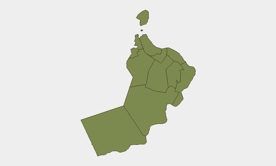
Al Wusta Governorate (composite risk 31.8) and Musandam Governorate (risk 9.0) dominate the threat profile and are separated from baseline risk by an order of magnitude. Both regions face elevated exposure due to geographic proximity to the Iran–US military confrontation zone and critical maritime chokepoints; Musandam overlooks the Strait of Hormuz, while Al Wusta (Duqm) has become a secondary strike target for Iranian drones and a transit zone for vessels routing around the Strait. All other governorates score 1.8–5.2 and reflect low baseline domestic risk; Muscat's low score (1.8) confirms no internal civil or political instability despite being the capital.
How GeoBit Would Assist
Security teams should use Persistent AOI Monitoring & Early Warning to track Musandam and Al Wusta for fresh military activity, missile impacts, or airspace disruptions in real time. Maritime & Aviation Tracking combined with Routing & Network Analysis will identify safe transit corridors and rerouting options for personnel and cargo moving through or near Omani waters and ports. OSINT Fusion (X/Twitter, Telegram, multi-language sources, and entity extraction) will aggregate Iranian, US, and Omani official statements and incident reports to detect warning signs of further escalation or de-escalation.
7-Day Outlook
The Iran–US military exchange is likely to continue at current or elevated intensity; Iranian retaliatory strikes on shipping are expected if US airstrikes persist. Omani waters will remain a contested transit zone, and coastal infrastructure in Musandam and Duqm will face ongoing drone and missile risk. No near-term diplomatic breakthrough is signaled in current statements, and corporate presence or supply-chain operations in these zones should remain under heightened duty-of-care review.
Highest-Risk Areas — Ranked
| # | State / Region | Risk |
|---|---|---|
| 1 | Al Wusta Governorate | 31.8 |
| 2 | Musandam Governorate | 9 |
| 3 | Ash Sharqiyah South Governorate | 5.2 |
| 4 | Muscat Governorate | 1.8 |
| 5 | Al Buraymi Governorate | 1.8 |
| 6 | Ad Dhahirah Governorate | 1.8 |
| 7 | Al Batinah North Governorate | 1.8 |
| 8 | Al Batinah South Governorate | 1.8 |
| 9 | Ad Dakhiliyah Governorate | 1.8 |
| 10 | Ash Sharqiyah North Governorate | 1.8 |
| 11 | Dhofar Governorate | 1.8 |
Sources
Previous Daily Briefs
A new Oman brief is written every day — each with its own risk map and downloadable CSV. Here's the last week; use the calendar to go further back.
📅 Browse every day by calendar →
Highlighted days have a brief. Tap a day for that day's map & analysis, or “csv” for that day's dataset ($5).
Atlas — our AI intelligence desk — emails them this snapshot personally. Nothing else, no list.